Betolaza / Betellogaha / Betolatza
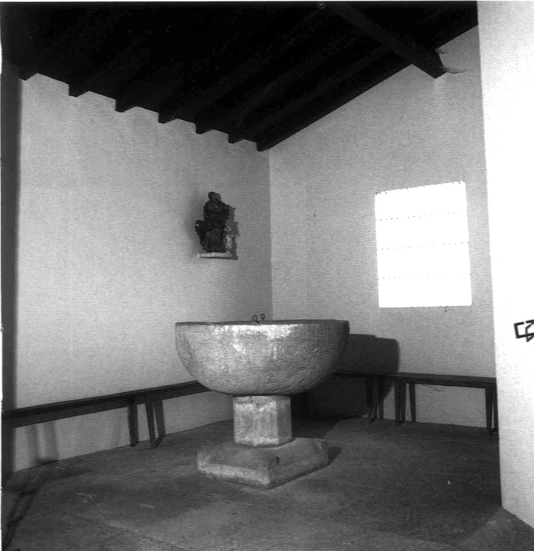
Image copyright © Eusko Ikaskuntza, 2026
CC-BY-NC-ND-4.0
Results: 2 records
view of font in context
Copyright Statement: Image copyright © Eusko Ikaskuntza, 2026
Image Source: digital image of a [1960s?] B&W photograph probably by López de Guereñu in Eusko Ikaskuntza [supplied to BSI by Francisco Guinea w/o source]
Copyright Instructions: CC-BY-NC-ND-4.0
view of church exterior - south view
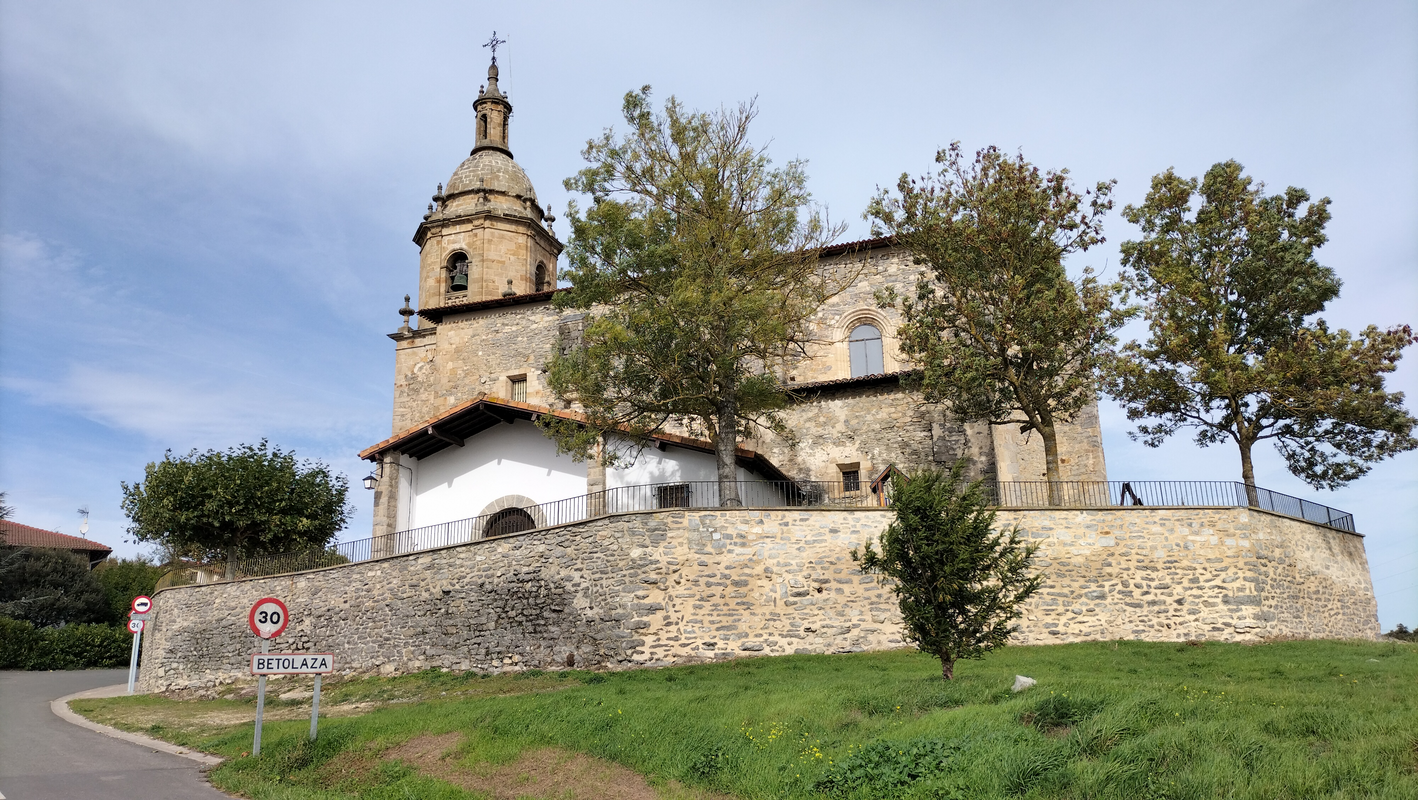
Scene Description: "Betolaza (Araba) Jasokundearen eliza"
Copyright Statement: Image copyright © Ibai1984, 2024
Image Source: digital photograph 20 October 2024 by Ibai1984
Copyright Instructions: CC-BY-SA-4.0
INFORMATION
Font ID: 26252OTP
Object Type: Baptismal Font1
Workshop/Group/Artisan: [cf. FontNotes]
Church / Chapel Name: Jasokundeko Andre Maria eliza / Iglesia de Nuestra Señora de la Asunción
Font Location in Church: Inside
Church Patron Saint(s): The Assumption of St. Mary
Church Notes: medieval church restored 1964
Church Address: Nagusia Kalea, 2, 01510 Betolaza, Araba, Spain
Site Location: Alava / Araba, País Vasco / Euskadi, Spain, Europe
Directions to Site: Located off the A-4401, in the municipality of Arrazua-Ubarrundia, 12 km N of Vitoria-Gasteiz
Ecclesiastic Region: Diócesis de Vitoria
Historical Region: Cuadrilla de Estribaciones del Gorbea / Gorbeialdeako Kuadrilla
Town/City Wikipedia: https://es.wikipedia.org/wiki/Betolaza
Font Notes:
Click to view
Baptismal font of stone listed in the Enciclopedia del románico [https://www.romanicodigital.com/sites/default/files/pdfs/files/alava_BETOLAZA.pdf] [accessed 23 March 2026]: "La pila bautismal situada en la iglesia de Nuestra Señora de la Asunción de Betolaza es, como la mayoría de las pilas bautismales alavesas, de copa semicircular, lisa y bien labrada, que se apoya en un pie octogonal y una base cuadrada con los ángulos realzados, a modo de garras."
Credit and Acknowledgements: We are grateful to the Fundación Santa María la Real [www.romanicodigital.com] for their permission to reproduce content from the Enciclopedia del románico
COORDINATES
UTM: 30T 527230 4754053
Latitude & Longitude (Decimal): 42.938627, -2.66625
Latitude & Longitude (DMS): 42° 56′ 19.06″ N, 2° 39′ 58.5″ W
MEDIUM AND MEASUREMENTS
Material: stone, limestone ?
Font Shape: hemispheric (mounted)
Basin Interior Shape: round
Basin Exterior Shape: round
Drainage Notes: no lining
REFERENCES
- Fundación Santa María la Real, Enciclopedia del románico, Fundación Santa María la Real, 2020+. URL: www.romanicodigital.com.