Herquegies / Erchersies / Heithisies / Herquesies / Jerkisies

Image copyright © KIK-IRPA, Brussels (Belgium), 2026
CC-BY-4.0
Results: 2 records
view of font and cover
Scene Description: [cf. FontNotes]
Copyright Statement: Image copyright © KIK-IRPA, Brussels (Belgium), 2026
Image Source: digital image of a 1977 B&W photograph [cliché M261735] by IRPA https://balat.kikirpa.be/object/10066872
Copyright Instructions: CC-BY-4.0
view of church exterior in context - north view
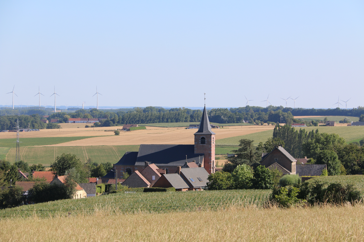
Copyright Statement: Image copyright © FrDr, 2022
Image Source: digital photograph 7 August 2022 by FrDr
Copyright Instructions: CC-BY-SA-4.0
INFORMATION
Font ID: 26079LEE
Object Type: Baptismal Font1
Font Century and Period/Style: 17th century (?), [composite font]
Church / Chapel Name: Eglise Sainte-Anne de Herquegies
Church Patron Saint(s): St. Anne
Church Notes: original church, probably medieval (12thC?) replaced in 1774
Church Address: Pl. d'Herquegies 11, 7911 Frasnes-lez-Anvaing, Belgium
Site Location: Hainaut / Henegouwen, Wallonie / Wallonne, Belgium, Europe
Directions to Site: Located off (W) the N60, in the municipality and 5 km SW of Frasnes-lez-Anvaing, about 20 km E of Tournai
Ecclesiastic Region: Diocèse de Tournai / Bisdom Doornik
Additional Comments: composite font [cf. FontNotes] -- disappeared font? (the one from the medieval church here)
Town/City Wikipedia: https://fr.wikipedia.org/wiki/Herquegies
Font Notes:
Click to view
The baptismal font is listed and illustrated in BALaT KIK-IRPA [https://balat.kikirpa.be/object/10066872] [accessed 27 January 2026] as made of sandstone probably in the 16th century: "cuve octogonale prob. [1501-1600], en grès [...] hauteur: 102 cm".
A communication to BSI from Pol Herman (e-mail of 30 December 2025) informs: "1108 : Erchersies; 1190 : Heithisies; 13th century: Jerkisies; 1360 : Herquesies. It is not known when the chapter of Notre-Dame at Tournai acquired the land of Herquegies. It may date back to the early days of the establishment of the bishopric (6th century). On historical maps, the village is shown as an “enclave of Tournai” within the County of Hainaut. 1108: Pope Paschal confirmed the possession of the tithe of Herquegies along with the entire village. Little information exists about the history of the village and its church. The patronage of the place of worship was with the chapter of Cambrai, but the chapter of Tournai was the civil “lord” of Herquegies. The current church was built in 1774 and replaced an older building. Baptisms were already taking place long before the current church was built. Baptismal records from 1656 onwards. Unusual, probably composite, 16th century baptismal font. The base is in Mosan style, the column in Hainaut-style, the basin reminds me of gothic Mosan basins, but in this case is lacking the four heads. https://balat.kikirpa.be/object/10066872".
A communication to BSI from Pol Herman (e-mail of 30 December 2025) informs: "1108 : Erchersies; 1190 : Heithisies; 13th century: Jerkisies; 1360 : Herquesies. It is not known when the chapter of Notre-Dame at Tournai acquired the land of Herquegies. It may date back to the early days of the establishment of the bishopric (6th century). On historical maps, the village is shown as an “enclave of Tournai” within the County of Hainaut. 1108: Pope Paschal confirmed the possession of the tithe of Herquegies along with the entire village. Little information exists about the history of the village and its church. The patronage of the place of worship was with the chapter of Cambrai, but the chapter of Tournai was the civil “lord” of Herquegies. The current church was built in 1774 and replaced an older building. Baptisms were already taking place long before the current church was built. Baptismal records from 1656 onwards. Unusual, probably composite, 16th century baptismal font. The base is in Mosan style, the column in Hainaut-style, the basin reminds me of gothic Mosan basins, but in this case is lacking the four heads. https://balat.kikirpa.be/object/10066872".
Credit and Acknowledgements: We are grateful to Pol Herman for bringing this font to our attention and for his help in documenting it
COORDINATES
UTM: 31U 540075 5609205
Latitude & Longitude (Decimal): 50.633333, 3.566667
Latitude & Longitude (DMS): 50° 38′ 0″ N, 3° 34′ 0″ E
MEDIUM AND MEASUREMENTS
Material: stone, sandstone
Font Shape: octagonal (mounted)
Basin Interior Shape: round
Basin Exterior Shape: octagonal
Font Height (less Plinth): 102 cm*
Notes on Measurements: * [cf. FontNotes]
LID INFORMATION
Date: modern?
Material: metal
Notes: flat and round, with cross finial
REFERENCES
- KIK-IRPA, BALaT KIK-IRPA, 2024. URL: https://balat.kikirpa.be/.