Roloux / Roleuz / / Rolluoz / Roulloux / Roloux-sous-Fexhe
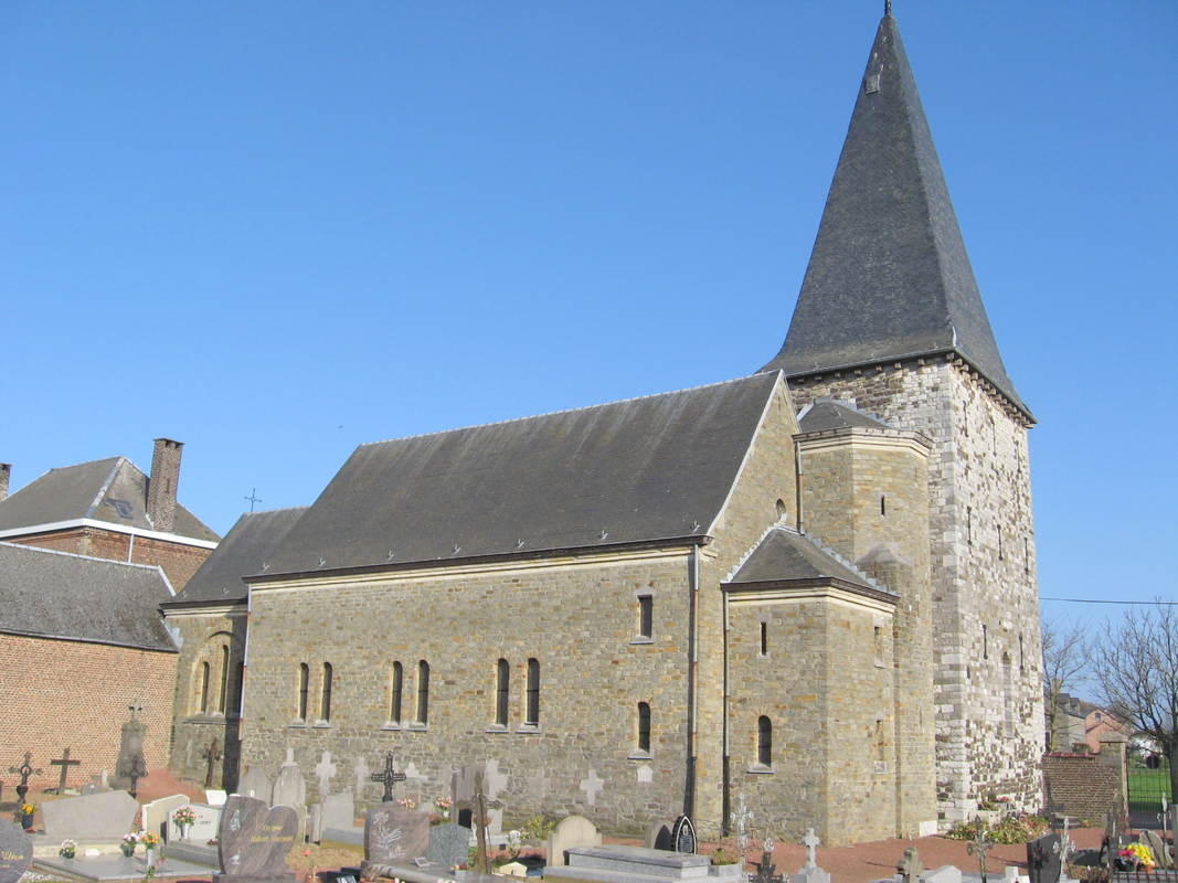
Image copyright © Sonuwe, 2010
GFDL
Results: 3 records
view of church exterior - northwest view
Scene Description: Church of Saint John the Baptiser in Roloux, Fexhe-le-Haut-Clocher, Liège, Belgium / Johannes de Doperkerk in Roloux / Eglise Saint-Jean-Baptiste à Roloux
Copyright Statement: Image copyright © Sonuwe, 2010
Image Source: digital photograph 18 April 2010 by Sonuwe
Copyright Instructions: GFDL
view of stoup
![[cf. FontNotes]](/static-50478a99ec6f36a15d6234548c59f63da52304e5/compressed/1260124003_compressed.png)
Scene Description: [cf. FontNotes]
Copyright Statement: Image copyright © KIK-IRPA, Brussels (Belgium), 2026
Image Source: digital image of a 1972 B&W photograph [cliché M099298] by Serge Pluymers
Copyright Instructions: CC-BY-4.0
view of font and cover in context
![the modern font in this church [cf. FontNotes]](/static-50478a99ec6f36a15d6234548c59f63da52304e5/others/permission_not_available.jpg)
Scene Description: the modern font in this church [cf. FontNotes]
Image Source: source not available
Copyright Instructions: PERMISSION NOT AVAILABLE -- IMAGE NOT FOR PUBLIC USE
INFORMATION
Font ID: 26071RSD
Object Type: Stoup
Font Century and Period/Style: 17th century (?)
Workshop/Group/Artisan: Mosan type?
Church / Chapel Name: Eglise Saint-Jean-Baptiste à Roloux
Font Location in Church: Inside
Church Patron Saint(s): St. John the Baptist
Church Address: Rue de l'Eglise 34, 4347 Fexhe-le-Haut-Clocher, Belgium
Site Location: Liège, Wallonie / Wallonne, Belgium, Europe
Directions to Site: Roloux is located in the municipality of Fexhe-le-Haut-Clocher, about 5 km WNW of Liège airport
Ecclesiastic Region: Diocèse de Liège / Bistum Lüttich
Additional Comments: disappeared font? (the one from the ca. 1100 medieval church here)
Font Notes:
Click to view
A holy-water stoup of stone dated to the 17th century i s listed and illustrated in BALaT KIRK-IRPA [https://balat.kikirpa.be/object/10019597] [accessed 24 January 2026]: "bénitier [...] pierre [...] Date: 1601 - 165 [...] hauteur: 86 cm."
A communication to BSI from Pol Herman (e-mail of 29 December 2025) informs: "11e s : Roleuz. 1101 : Rolluz, 1107 : Rolluoz; Roloux-sous-Fexhe, Rolloux, Roulloux. It is difficult to pinpoint the origins of the village of Roloux, but it is already mentioned in a 10th-century charter (cartulary of Stavelot Abbey). The sanctuary was formerly known as the chapel of the lords of Roloux. The Romanesque building was erected around 1100, constructed of sandstone, limestone, and tufa rubble, and consisted of only one nave. The massive and robust tower is a reminder that in the Middle Ages, places of worship in small rural lordships served as refuges for the population in case of attack. In 1289, the chapel of Roloux was part of the parish of Fexhe-le-Haut-Clocher. 1558 : ecclesia sive capella. It was still a chapel in 1668. The Concordat made the church of Roloux an annex chapel of Jeneffe. In the 19th century, Roloux regained its status as a parish church. The church was enlarged in 1924. Baptisms had to be administered in the church Fexhe until the end of the Ancien Régime. The unusual baptismal font therefore dates from the 19th century at the earliest? Mosan-style stoup of unknow stone. 1601-1650. https://balat.kikirpa.be/object/10019597"
A communication to BSI from Pol Herman (e-mail of 29 December 2025) informs: "11e s : Roleuz. 1101 : Rolluz, 1107 : Rolluoz; Roloux-sous-Fexhe, Rolloux, Roulloux. It is difficult to pinpoint the origins of the village of Roloux, but it is already mentioned in a 10th-century charter (cartulary of Stavelot Abbey). The sanctuary was formerly known as the chapel of the lords of Roloux. The Romanesque building was erected around 1100, constructed of sandstone, limestone, and tufa rubble, and consisted of only one nave. The massive and robust tower is a reminder that in the Middle Ages, places of worship in small rural lordships served as refuges for the population in case of attack. In 1289, the chapel of Roloux was part of the parish of Fexhe-le-Haut-Clocher. 1558 : ecclesia sive capella. It was still a chapel in 1668. The Concordat made the church of Roloux an annex chapel of Jeneffe. In the 19th century, Roloux regained its status as a parish church. The church was enlarged in 1924. Baptisms had to be administered in the church Fexhe until the end of the Ancien Régime. The unusual baptismal font therefore dates from the 19th century at the earliest? Mosan-style stoup of unknow stone. 1601-1650. https://balat.kikirpa.be/object/10019597"
Credit and Acknowledgements: We are grateful to Pol Herman for his help documenting this stoup
COORDINATES
Latitude & Longitude (Decimal): 50.648889, 5.396111
Latitude & Longitude (DMS): 50° 38′ 56″ N, 5° 23′ 46″ E
MEDIUM AND MEASUREMENTS
Material: stone, limestone ?
Font Shape: hemispheric (mounted)
Basin Interior Shape: round
Basin Exterior Shape: round
Font Height (less Plinth): 86 cm*
Notes on Measurements: * [cf. FontNotes]
REFERENCES
- KIK-IRPA, BALaT KIK-IRPA, 2024. URL: https://balat.kikirpa.be/.