Brorup / Brørup
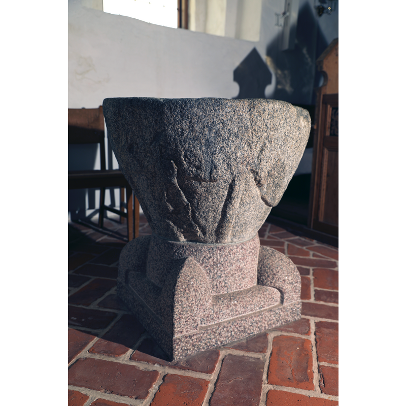
Image copyright © Baptisteria Sacra Index, 2024
CC-BY-NC-ND-4.0
Results: 24 records
view of font
Copyright Statement: Image copyright © Baptisteria Sacra Index, 2024
Image Source: digital photograph taken 16 May 2023 by BSI
Copyright Instructions: CC-BY-NC-ND-4.0
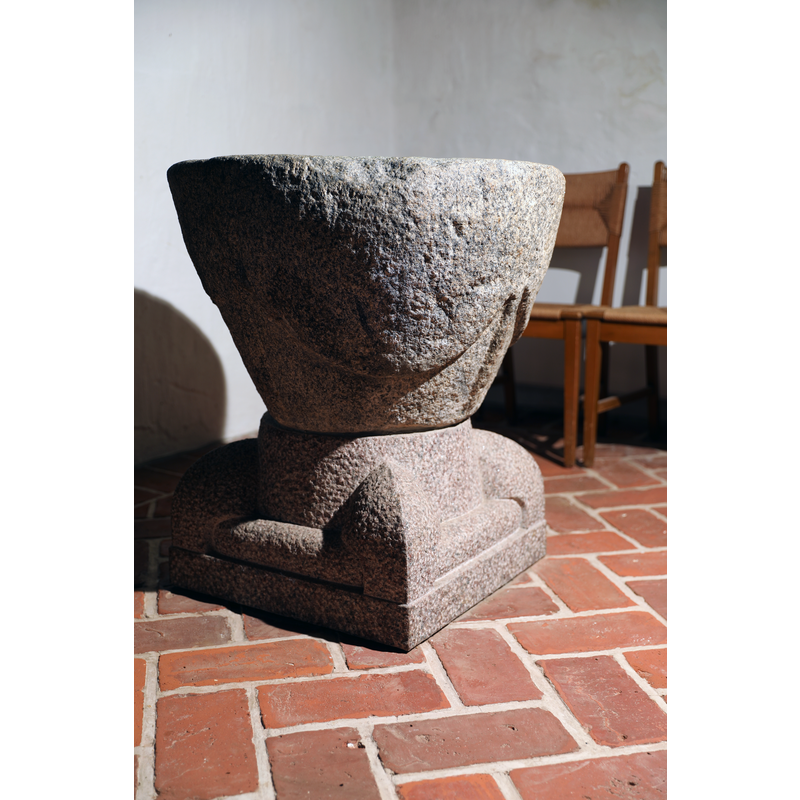
view of font
Copyright Statement: Image copyright © Baptisteria Sacra Index, 2024
Image Source: digital photograph taken 16 May 2023 by BSI
Copyright Instructions: CC-BY-NC-ND-4.0
view of font
Copyright Statement: Image copyright © Baptisteria Sacra Index, 2024
Image Source: digital photograph taken 16 May 2023 by BSI
Copyright Instructions: CC-BY-NC-ND-4.0
view of font
Copyright Statement: Image copyright © Baptisteria Sacra Index, 2024
Image Source: digital photograph taken 16 May 2023 by BSI
Copyright Instructions: CC-BY-NC-ND-4.0
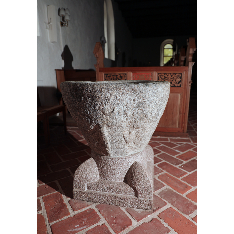
view of font
Copyright Statement: Image copyright © Baptisteria Sacra Index, 2024
Image Source: digital photograph taken 16 May 2023 by BSI
Copyright Instructions: CC-BY-NC-ND-4.0
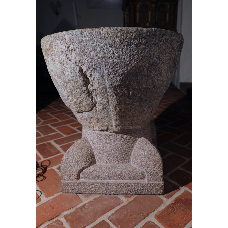
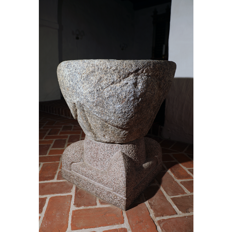
view of font - east side
Copyright Statement: Image copyright © Baptisteria Sacra Index, 2024
Image Source: digital photograph taken 16 May 2023 by BSI
Copyright Instructions: CC-BY-NC-ND-4.0
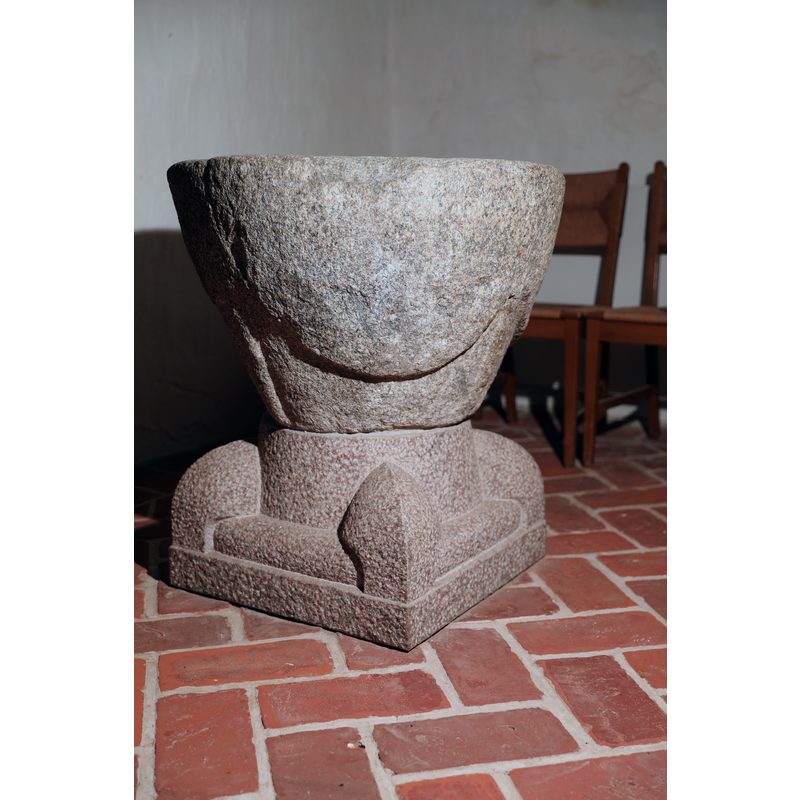
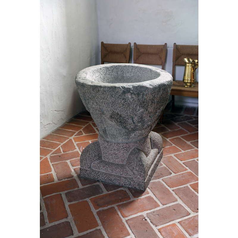
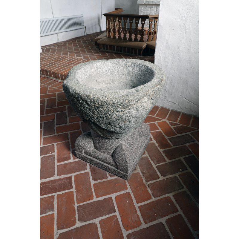
view of font
Copyright Statement: Image copyright © Baptisteria Sacra Index, 2024
Image Source: digital photograph taken 16 May 2023 by BSI
Copyright Instructions: CC-BY-NC-ND-4.0
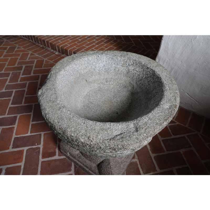
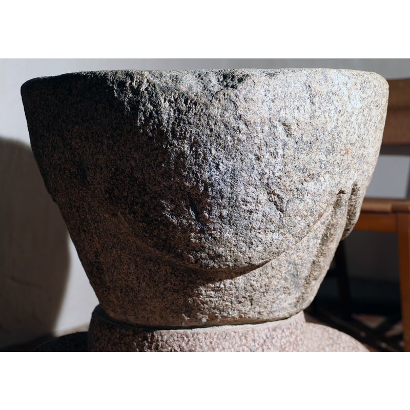
view of basin - upper view
Copyright Statement: Image copyright © Baptisteria Sacra Index, 2024
Image Source: digital photograph taken 16 May 2023 by BSI
Copyright Instructions: CC-BY-NC-ND-4.0
view of basin - detail
Copyright Statement: Image copyright © Baptisteria Sacra Index, 2024
Image Source: digital photograph taken 16 May 2023 by BSI
Copyright Instructions: CC-BY-NC-ND-4.0
view of basin - detail
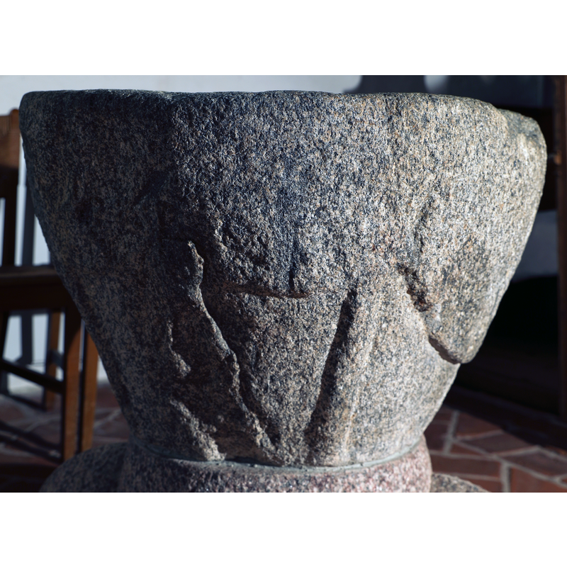
Scene Description: decoration and damage?
Copyright Statement: Image copyright © Baptisteria Sacra Index, 2024
Image Source: digital photograph taken 16 May 2023 by BSI
Copyright Instructions: CC-BY-NC-ND-4.0
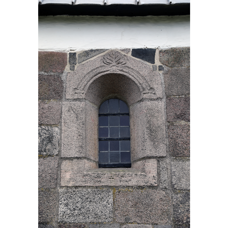
view of church exterior - window
Copyright Statement: Image copyright © Baptisteria Sacra Index, 2024
Image Source: digital photograph taken 16 May 2023 by BSI
Copyright Instructions: CC-BY-NC-ND-4.0
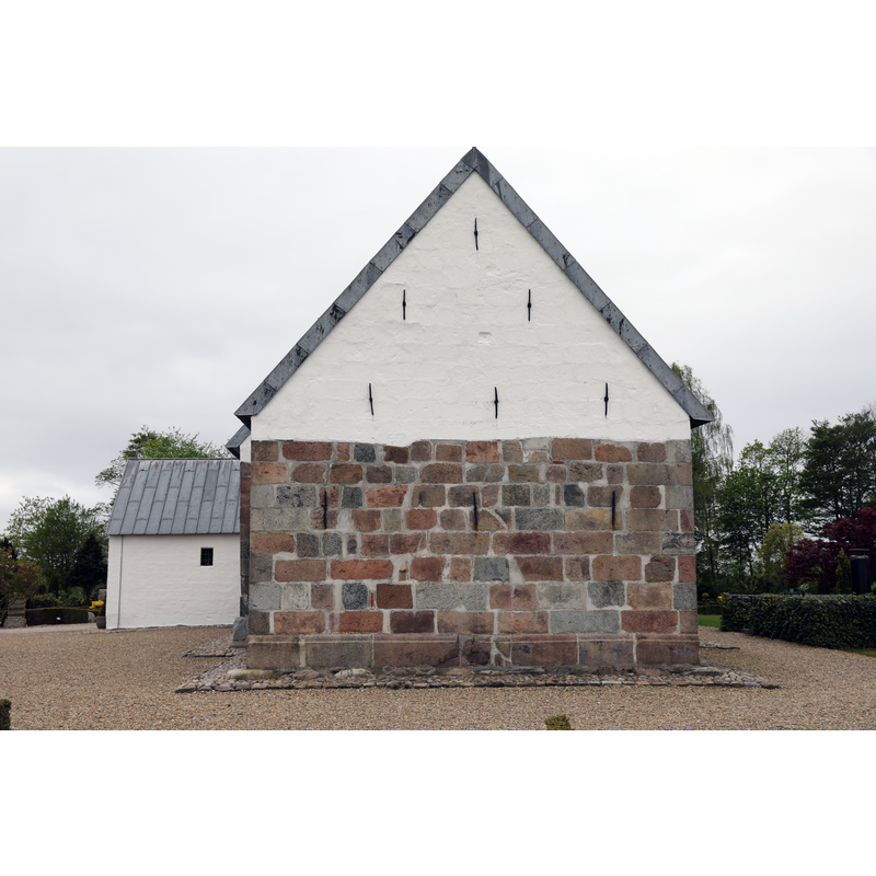
view of church exterior - east end
Copyright Statement: Image copyright © Baptisteria Sacra Index, 2024
Image Source: digital photograph taken 16 May 2023 by BSI
Copyright Instructions: CC-BY-NC-ND-4.0
view of church exterior - bell tower
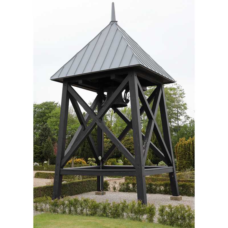
Copyright Statement: Image copyright © Baptisteria Sacra Index, 2024
Image Source: digital photograph taken 16 May 2023 by BSI
Copyright Instructions: CC-BY-NC-ND-4.0
view of church exterior - southeast end
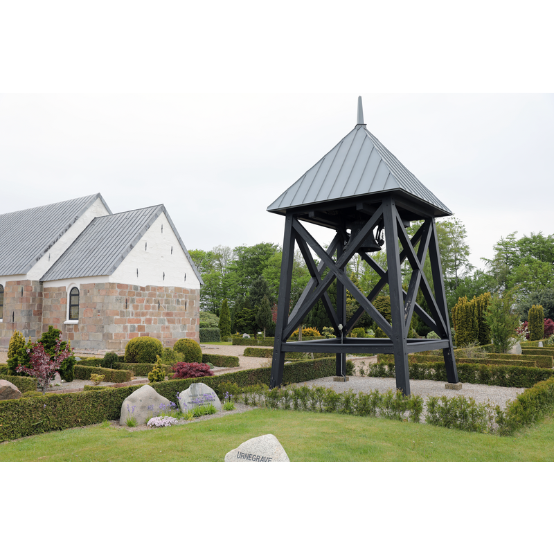
Copyright Statement: Image copyright © Baptisteria Sacra Index, 2024
Image Source: digital photograph taken 16 May 2023 by BSI
Copyright Instructions: CC-BY-NC-ND-4.0
view of church exterior - southeast view
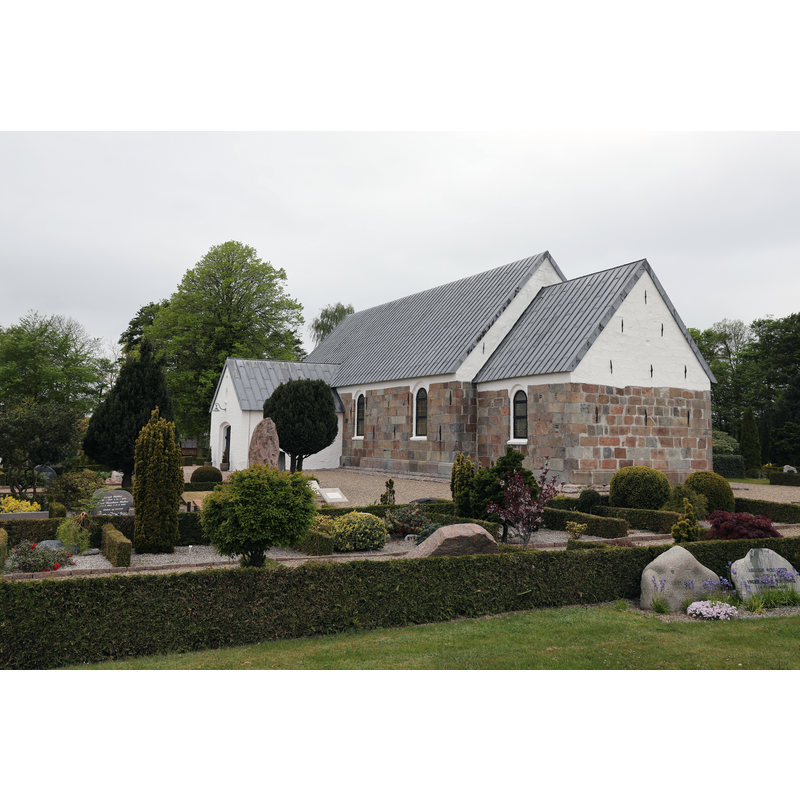
Copyright Statement: Image copyright © Baptisteria Sacra Index, 2024
Image Source: digital photograph taken 16 May 2023 by BSI
Copyright Instructions: CC-BY-NC-ND-4.0
view of font in context - southwest side
Copyright Statement: Image copyright © Baptisteria Sacra Index, 2024
Image Source: digital photograph taken 16 May 2023 by BSI
Copyright Instructions: CC-BY-NC-ND-4.0
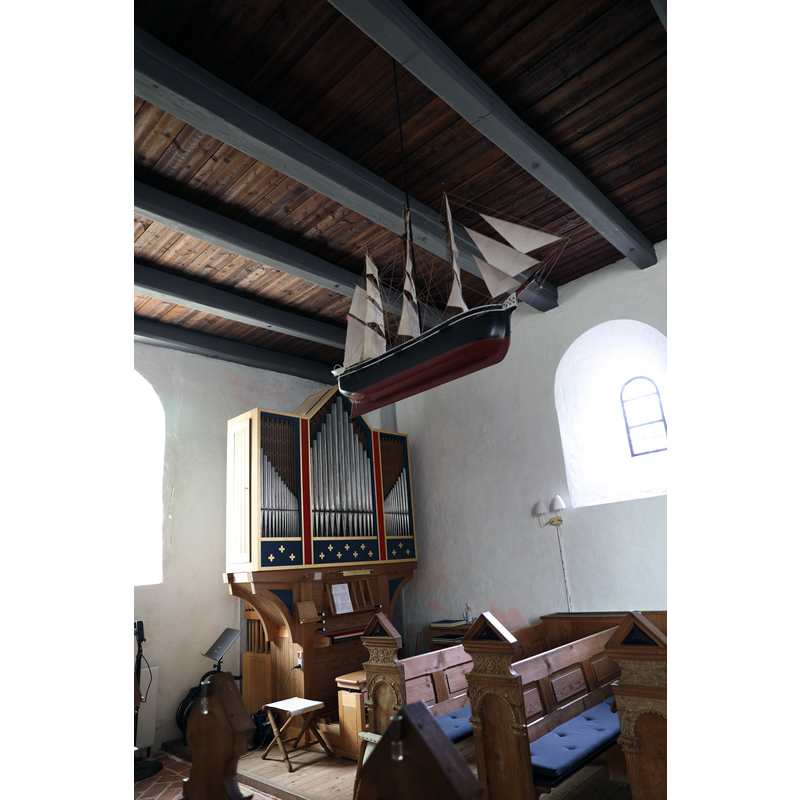
view of church interior - looking northwest
Copyright Statement: Image copyright © Baptisteria Sacra Index, 2024
Image Source: digital photograph taken 16 May 2023 by BSI
Copyright Instructions: CC-BY-NC-ND-4.0
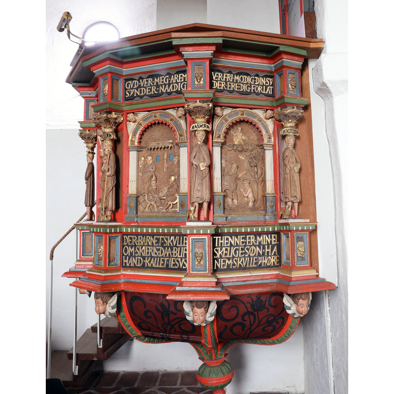
view of church interior - pulpit
Copyright Statement: Image copyright © Baptisteria Sacra Index, 2024
Image Source: digital photograph taken 16 May 2023 by BSI
Copyright Instructions: CC-BY-NC-ND-4.0
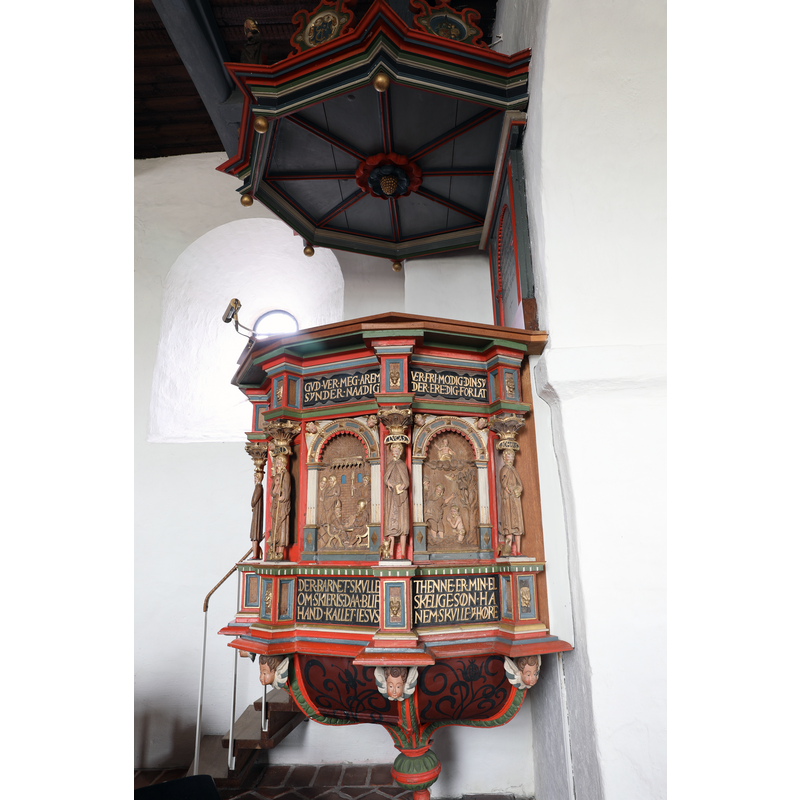
view of church interior - pulpit and sounding board / canopy
Copyright Statement: Image copyright © Baptisteria Sacra Index, 2024
Image Source: digital photograph taken 16 May 2023 by BSI
Copyright Instructions: CC-BY-NC-ND-4.0
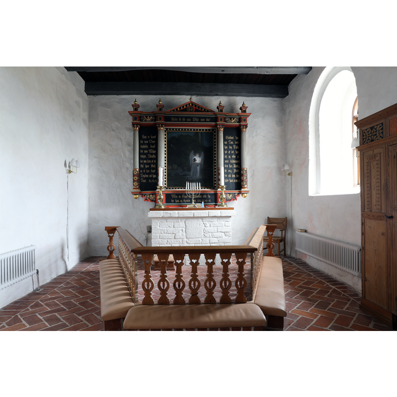
view of church interior - chancel and east end
Copyright Statement: Image copyright © Baptisteria Sacra Index, 2024
Image Source: digital photograph taken 16 May 2023 by BSI
Copyright Instructions: CC-BY-NC-ND-4.0
information
Copyright Statement: Image copyright © Baptisteria Sacra Index, 2025
Image Source: Field notes taken on site by BSI
Copyright Instructions: CC-BY-NC-ND-4.0
view of font base
![the remains of the damaged origibal base [cf. FontNotes]](/static-50478a99ec6f36a15d6234548c59f63da52304e5/compressed/1241203051_compressed.png)
Scene Description: the remains of the damaged origibal base [cf. FontNotes]
Copyright Statement: Image copyright © Baptisteria Sacra Index, 2024
Image Source: digital photograph taken 16 May 2023 by BSI
Copyright Instructions: CC-BY-NC-ND-4.0
view of font base
![the remains of the damaged origibal base [cf. FontNotes]](/static-50478a99ec6f36a15d6234548c59f63da52304e5/compressed/1241203050_compressed.png)
Scene Description: the remains of the damaged origibal base [cf. FontNotes]
Copyright Statement: Image copyright © Baptisteria Sacra Index, 2024
Image Source: digital photograph taken 16 May 2023 by BSI
Copyright Instructions: CC-BY-NC-ND-4.0
view of font base
![the remains of the damaged origibal base [cf. FontNotes]](/static-50478a99ec6f36a15d6234548c59f63da52304e5/compressed/1241203049_compressed.png)
Scene Description: the remains of the damaged origibal base [cf. FontNotes]
Copyright Statement: Image copyright © Baptisteria Sacra Index, 2024
Image Source: digital photograph taken 16 May 2023 by BSI
Copyright Instructions: CC-BY-NC-ND-4.0
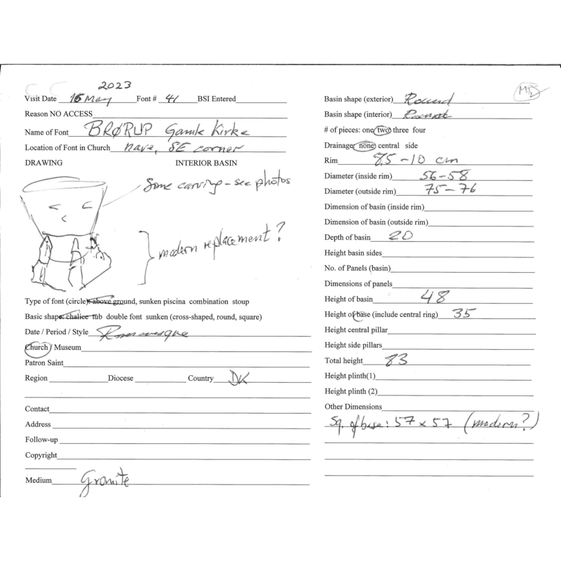
INFORMATION
Font ID: 25743BRO
Object Type: Baptismal Font1
Date Visited: 2023-05-16
Font Date: n.d.
Font Century and Period/Style: 14th century (?) [basin only], Gothic [basin only]
Workshop/Group/Artisan: vestjydske type [Mackeprang]
Church / Chapel Name: Brørup Gamle Kirke
Font Location in Church: Inside the church, in the SE area of the nave
Church Address: Adserbølvej 1, 6650 Brørup, Denmark
Site Location: Syddanmark, Denmark, Europe
Directions to Site: The old church is located off (N) road 191 [aka Sbjergvej], S of the E20, 3 km NW of Brørup, in the municipality and 10 km W of Vejen, 26 km NE of Ribe, 43 km km E of Esbjerg
Ecclesiastic Region: Ribe Stift
Additional Comments: altered font (the base is modern replacement; the old base reported in the churchyard in 1988)
Font Notes:
Click to view
Listed and illustrated in Danmarks Kirker [http://danmarkskirker.natmus.dk/uploads/tx_tcchurchsearch/Ribe_2705-2734.pdf] [accessed 3 December 2024] as a baptismal font of the "vestjydske type" noted in Mackeprang (1941), made of granite; the much damaged base was replaced in 1955, the old one relegated to the churchyard, near the armory entranceway; the altered font was installed in the southeast corner of the nave at the time; the font had been painted but the paint is no longer on it [NB: Mackeprang does not list this font but others of the type]. On-site notes: the basin is roughly bucket shaped and has some decoration on the sides; partly damaged? the base appears to be a mocern replacement.
COORDINATES
UTM: 32U 499337 6150596
Latitude & Longitude (Decimal): 55.50146, 8.9895
Latitude & Longitude (DMS): 55° 30′ 5.26″ N, 8° 59′ 22.2″ E
MEDIUM AND MEASUREMENTS
Material: stone, granite
Font Shape: bucket-shaped, mounted
Basin Interior Shape: round
Basin Exterior Shape: round
Drainage System: no drainage system
Drainage Notes: no lining
Rim Thickness: 8.5-10 cm**
Diameter (inside rim): 56-58 cm**
Diameter (includes rim): 77 cm* / 75-76 cm**
Basin Depth: 20 cm**
Basin Total Height: 48 cm**
Height of Base: 42 cm* [old base in churchyard] / 35 cm**
Font Height (less Plinth): 83 cm**
Font Height (with Plinth): 118 cm*
Square Base Dimensions: 57 x 57 cm** [modern base]
Notes on Measurements: * Danmarks Kirker [height measurement includes the replacement base]
REFERENCES
- Danmarks Kirker, Nationalmuseet i København. URL: http://danmarkskirker.natmus.dk.