Altwies / Altwiese / Altwis
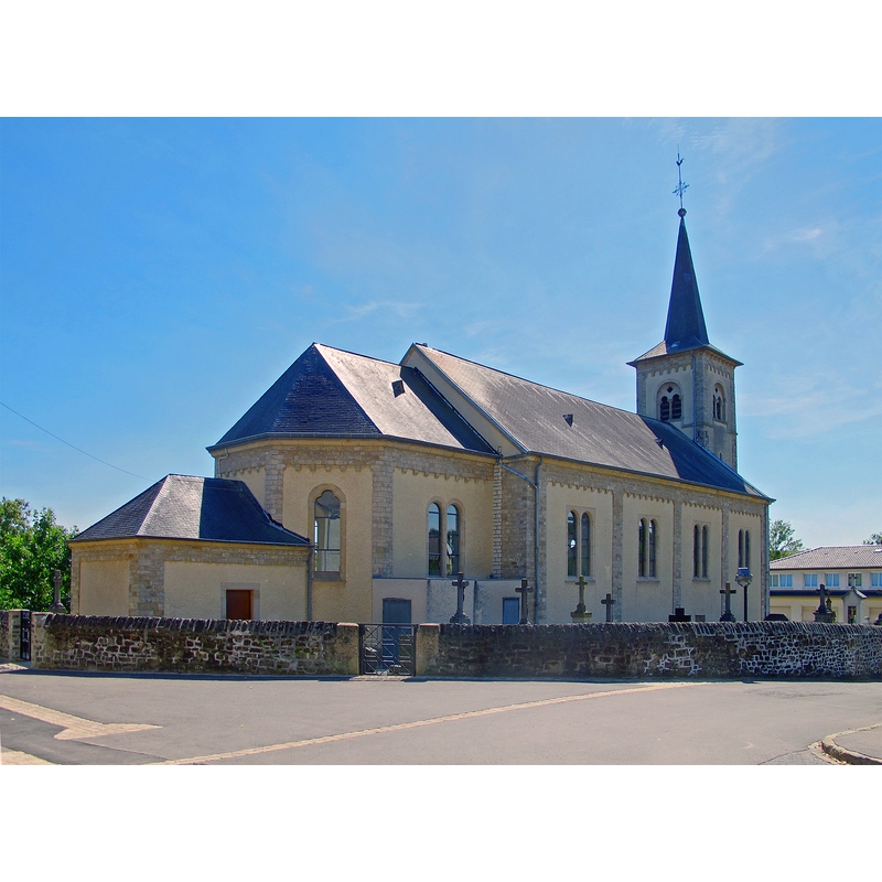
Image copyright © MMFE, 2013
CC-BY-SA-3.0
Results: 3 records
view of church exterior - northeast view
Scene Description: Source caption: "Church of Altwies, Luxembourg"
Copyright Statement: Image copyright © MMFE, 2013
Image Source: digital photograph 15 August 2012 by MMFE [https://commons.wikimedia.org/wiki/File:Kirche_Altwies_02.jpg] [accessed 16 Augsut 2024]
Copyright Instructions: CC-BY-SA-3.0
view of church exterior - southwest view
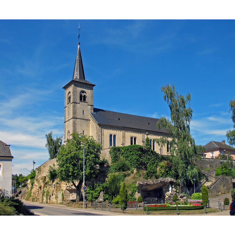
Scene Description: Source caption: "Church of Altwies, Luxembourg"
Copyright Statement: Image copyright © MMFE, 2013
Image Source: digital photograph 15 August 2012 by MMFE [https://commons.wikimedia.org/wiki/File:Kirche_Altwies_01.jpg] [accessed 16 Augsut 2024]
Copyright Instructions: CC-BY-SA-3.0
information
![[cf. FontNotes]](/static-50478a99ec6f36a15d6234548c59f63da52304e5/compressed/0240816003_compressed.png)
Scene Description: [cf. FontNotes]
Copyright Statement: Image copyright © [in the public domain]
Image Source: digital image of a text [source N/A] provided by Pol Herman
Copyright Instructions: Assumed PD
INFORMATION
Font ID: 25657ALT
Object Type: Baptismal Font1
Font Date: [1685?]
Font Century and Period/Style: 17th century(late?)
Church / Chapel Name: Église paroissiale Saint-Benoît, Altwies
Font Location in Church: Inside the church
Church Patron Saint(s): St. Benedict [aka Benet]
Church Notes: present church consecrated June 1875
Church Address: 4 Rue de l'Église, 5671 Altwies Mondorf-les-Bains, Luxembourg
Site Location: Remich, Luxembourg, Europe
Directions to Site: Located off (N) road 16, S of the A12, 2 km NW of Mondorf-les-Bains, just N of the French border
Ecclesiastic Region: Archdiocese of Luxembourg
Font Notes:
Click to view
The baptismal font in this church is visible in a YouTube video [Eglise/Kirche/Church L-#ALTWIES] [accessed 16 August 2024]: it consists of a roughly cylindrical basin with a hemispherical underbowl, raised on a round pedestal base; the upper rim of the basin has a flat moulding; the underbowl is decorated with ribs all around, and there is a an inscribed date. 1685, on the side of the basin. The font cover is round, shell-shaped, hinged towards the back.
A communication to BSI from Pol Herman (e-mail of 7 July 2024) raises the issue that the date on the font was altered ["The font was altered. Maybe the inscribed date was changed, as suggested by the article?"] and that the date on it may reflect the restoration date of 1685. PH provides a reference to an article by Joh. Engling, Die ältesten Taufsteine im apostolischen Vikariate Luxemburg, in the Publications de la Société pour la Recherche et la Conservation des Monuments Historiques dans le Grand-Duché de Luxembourg », année 1858, another reference to Der alte Taufstein in der Kirche zu Altwies [cf. ImagesArea] and the YouTube video mentioned above.
A communication to BSI from Pol Herman (e-mail of 7 July 2024) raises the issue that the date on the font was altered ["The font was altered. Maybe the inscribed date was changed, as suggested by the article?"] and that the date on it may reflect the restoration date of 1685. PH provides a reference to an article by Joh. Engling, Die ältesten Taufsteine im apostolischen Vikariate Luxemburg, in the Publications de la Société pour la Recherche et la Conservation des Monuments Historiques dans le Grand-Duché de Luxembourg », année 1858, another reference to Der alte Taufstein in der Kirche zu Altwies [cf. ImagesArea] and the YouTube video mentioned above.
Credit and Acknowledgements: We are grateful to Pol Herman for his help in documenting this font
COORDINATES
UTM: 32U 301457 5487875
Latitude & Longitude (Decimal): 49.51096, 6.25721
Latitude & Longitude (DMS): 49° 30′ 39.46″ N, 6° 15′ 25.96″ E