Burst / Burste
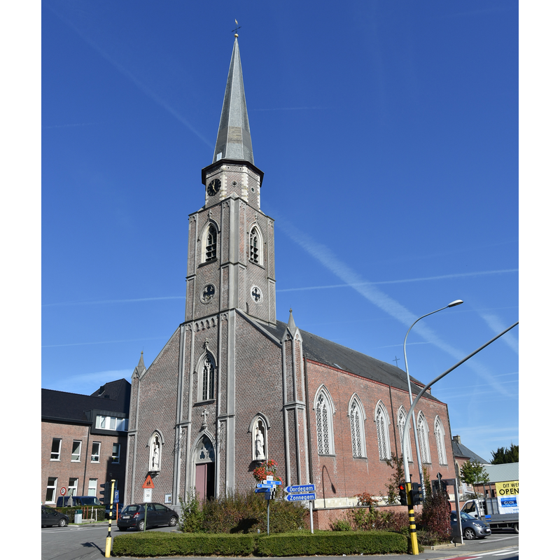
Image copyright © Paul Hermans, 2018
CC-BY-SA-4.0
Results: 4 records
view of church exterior - southwest view
Scene Description: Source caption: "Sint-Martinuskerk (Burst)"
Copyright Statement: Image copyright © Paul Hermans, 2018
Image Source: digital photograph 5 October 2018 by Paul Hermans [https://commons.wikimedia.org/wiki/File:Sint-Martinuskerk_(Burst)_5-10-2018_12-24-34.jpg] [accessed 27 June 2024]
Copyright Instructions: CC-BY-SA-4.0
view of font and cover in context
![the modern font [cf. FontNotes]](/static-50478a99ec6f36a15d6234548c59f63da52304e5/compressed/1240627011_compressed.png)
Scene Description: the modern font [cf. FontNotes]
Copyright Statement: Image copyright © Paul Hermans, 2018
Image Source: edited detail of a digital photograph 5 October 2018 by Paul Hermans [https://commons.wikimedia.org/wiki/File:Sint-Martinuskerk_(Burst)_koor_5-10-2018.jpg] [accessed 27 June 2024]
Copyright Instructions: CC-BY-SA-4.0
view of church interior - chancel and east end
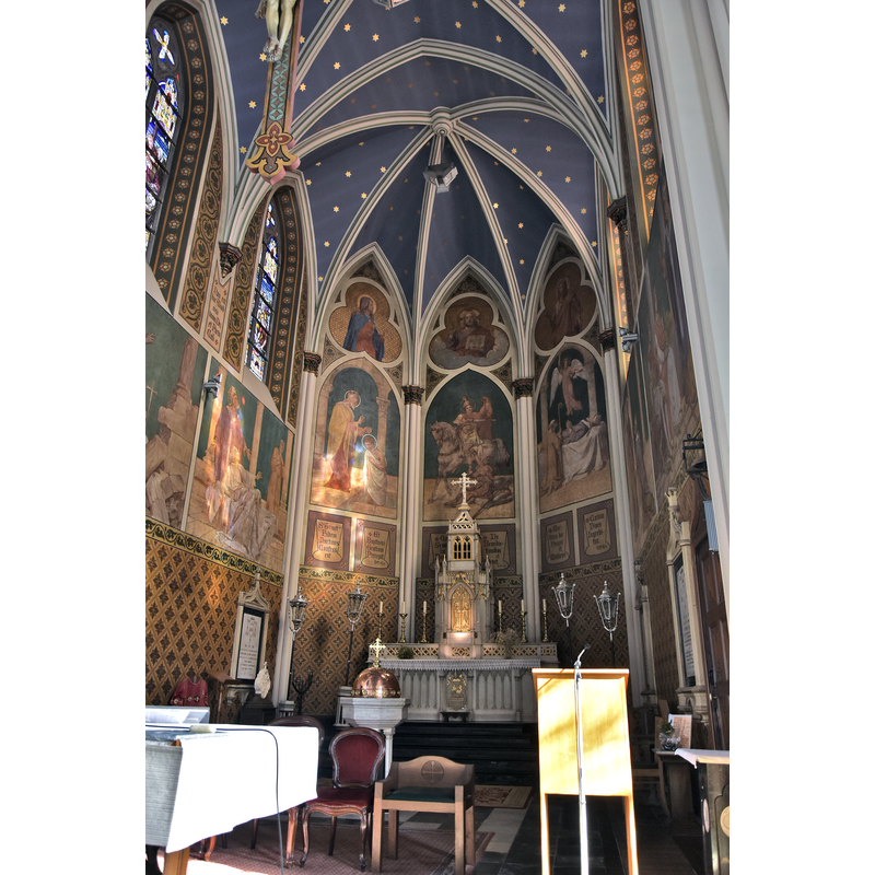
Scene Description: Source caption: "Sint-Martinuskerk (Burst) koor"
Copyright Statement: Image copyright © Paul Hermans, 2018
Image Source: digital photograph 5 October 2018 by Paul Hermans [https://commons.wikimedia.org/wiki/File:Sint-Martinuskerk_(Burst)_koor_5-10-2018.jpg] [accessed 27 June 2024]
Copyright Instructions: CC-BY-SA-4.0
view of church interior - looking east
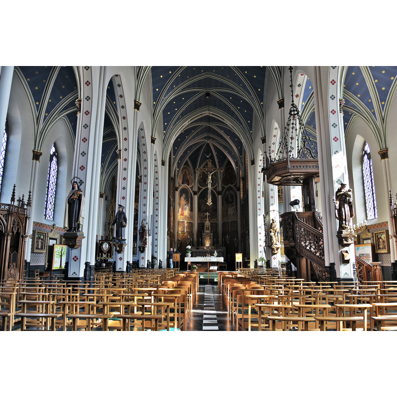
Scene Description: Source caption: "Sint-Martinuskerk (Burst) schip"
Copyright Statement: Image copyright © Paul Hermans, 2018
Image Source: digital photograph 5 October 2018 by Paul Hermans [https://commons.wikimedia.org/wiki/File:Sint-Martinuskerk_(Burst)_schip_5-10-2018.jpg] [accessed 27 June 2024]
Copyright Instructions: CC-BY-SA-4.0
INFORMATION
Font ID: 25587BUR
Object Type: Baptismal Font1?
Font Date: n.d.
Font Century and Period/Style: 12th - 17th century, Medieval - Early Modern
Church / Chapel Name: Römisch-katholische Sint-Martinuskerk, Burst
Font Location in Church: [disappeared]
Church Patron Saint(s): St. Martin of Tours
Church Address: Burst, 9420 Erpe-Mere, Belgium
Site Location: Oost-Vlaanderen / Flandre Est, Vlaanderen / Flandres, Belgium, Europe
Directions to Site: Located off road N46, in the municipality and 3 km SW of Erpe-Mere, about 25 km SE of Ghent
Ecclesiastic Region: Bistum Ghent
Additional Comments: disappeared font? (the font(s) from the earlier church here, from the 12thC to the one said to have been installed in 1601)
Font Notes:
Click to view
No font listed in BALaT KIK-IRPA entry for this church. A communication to BSI from Pol Herman (e-mail of 25 June 2024) informs: "The village of Burst is mentioned for the first time in 1042 as Burste. In a charter of the Saint Martin’s abbey of Gent, it is described as “Bursitia juxta fluviolum Burste”. This river must be the present Molenbeek (Mill Brook). The church of Burst is mentioned for the first time in 1117. I was a property of the abbey of Vorst. The church was badly damaged during the Iconoclastic Fury by the Calvinists in 1580/1582. A new baptismal font was installed in 1601. The old church was demolished in 1852, at which time a new font was installed. There is no trace of older fonts." The modern font and its cover are located in the chancel of the present church.
Credit and Acknowledgements: We are grateful to Pol Herman for bringing this church and fonts to our attention
COORDINATES
UTM: 31U 564719 5640628
Latitude & Longitude (Decimal): 50.913667, 3.920628
Latitude & Longitude (DMS): 50° 54′ 49.2″ N, 3° 55′ 14.26″ E