Kenton nr. Exminster / Chentone
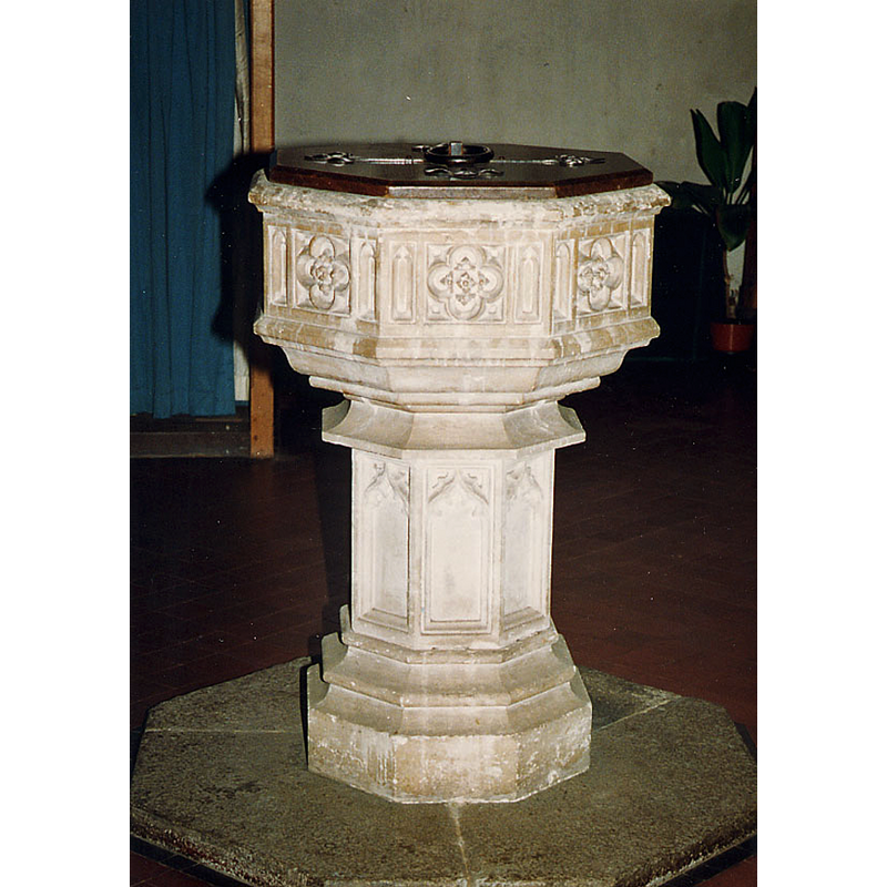
Image copyright © John Salmon, 2010
CC-BY-SA-2.5
Results: 3 records
ciew of font and cover
Scene Description: Source caption: "All Saints, Kenton, Devon - Font" -- the mid-19thC font
Copyright Statement: Image copyright © John Salmon, 2010
Image Source: digital photograph 27 February 2010 by John Salmon [https://www.geograph.org.uk/photo/1727701] [accessed 1 June 2024]
Copyright Instructions: CC-BY-SA-2.5
view of church exterior - northeast view
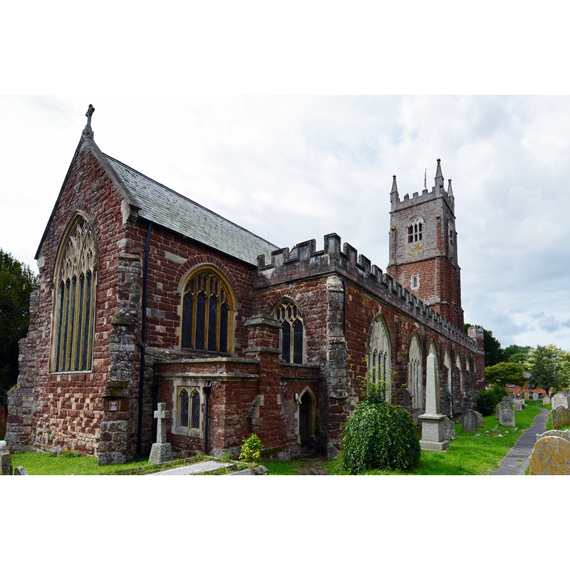
Scene Description: Source caption: "Kenton: All Saints Church"
Copyright Statement: Image copyright © Michael Garlick, 2015
Image Source: digital photograph 16 August 2015 by Michael Garlick [https://www.geograph.org.uk/photo/4626090] [accessed 1 June 2024]
Copyright Instructions: CC-BY-SA-2.5
view of church interior - looking east
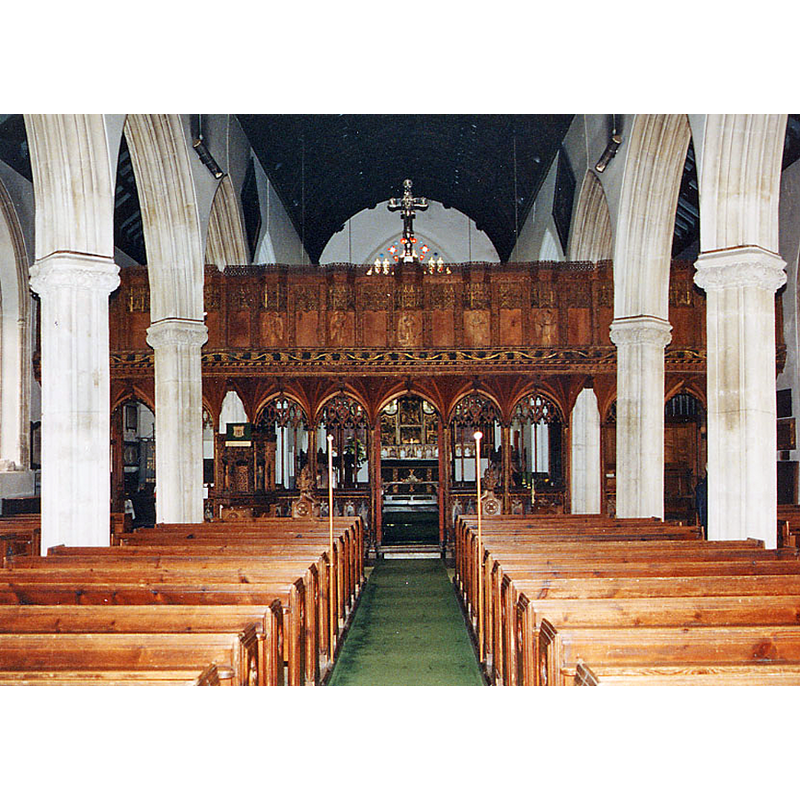
Scene Description: Source caption: "All Saints, Kenton, Devon - East end"
Copyright Statement: Image copyright © John Salmon, 2010
Image Source: digital photograph 27 February 2010 by John Salmon [https://www.geograph.org.uk/photo/1727691] [accessed 1 June 2024]
Copyright Instructions: CC-BY-SA-2.5
INFORMATION
Font ID: 25530KEN
Object Type: Baptismal Font1?
Font Date: n.d.
Font Century and Period/Style: 14th century, Medieval
Church / Chapel Name: Parish Church of All Saints
Font Location in Church: [disappeared]
Church Patron Saint(s): All Saints
Church Address: All Saints Church, 8 Church St, Kenton, Exeter EX6 8LU, United Kingdom -- Tel.: +44 1392 824283
Site Location: Devon, South West, England, United Kingdom
Directions to Site: Located off road A379, 5 km S of Exminster, on the W side of the Exe estuary
Ecclesiastic Region: Diocese of Exeter
Historical Region: Hundred of Exminster [in Domesday]
Additional Comments: disappeared font? (the one from the medieval church here)
Font Notes:
Click to view
There is an entry for this Kenton [variant spelling] in the Dommesday survey [https://opendomesday.org/place/SX9583/kenton/] [accessed 1 June 2024]; it mentions neither priest nor church in it. The entry for this church in Historic England [Listing NGR: SX9579483310] nores: "Parish church. Cresswell and Pevsner date the building c. 1360-70 [...] Octagonal carved font of 1844".
COORDINATES
UTM: 30U 466406 5609915
Latitude & Longitude (Decimal): 50.640132, -3.475096
Latitude & Longitude (DMS): 50° 38′ 24.47″ N, 3° 28′ 30.35″ W