Mortroux No. 2
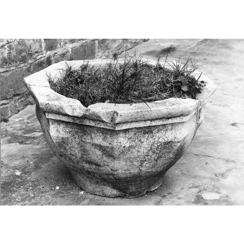
Image copyright © [in the public domain]
CC-BY-4.0
Results: 1 records
view of basin
Scene Description: showinh it being used as planter in 1972
Copyright Statement: Image copyright © [in the public domain]
Image Source: digital image of a 1972 B&W photograph [cliché M083461] by Serge Pluymers, IRPA [https://balat.kikirpa.be/object/10111405] [accessed 10 February 2024]
Copyright Instructions: CC-BY-4.0
INFORMATION
Font ID: 25323MOR
Object Type: Stoup?
Font Date: ca. 1591 - 1610?
Font Century and Period/Style: 16th - 17th century, Late Gothic
Church / Chapel Name: Église paroissiale Sainte-Lucie
Font Location in Church: Outside the church
Church Patron Saint(s): St. Lucy [aka Lucia?
Church Notes: original wooden church re-built in stone 11thC; defensive tower added 12thC; current nave from 1782
Church Address: Rue Sainte Lucie 7, Mortroux, 4607 Dalhem, Belgium
Site Location: Liège, Wallonie / Wallonne, Belgium, Europe
Directions to Site: Located off (E) the N627, just E of Dalhem, E of the E25 and the Meuse river, 18-20 km NE of Liège
Ecclesiastic Region: Diocèse de Liège
Additional Comments: disused stoup / re-purposed stoup (serving as planter) / damaged stoup
Font Notes:
Click to view
A damaged octagonal basin is listed and illustrated in BALaT KIK-IRPA [https://balat.kikirpa.be/object/10111405] [accessed 10 February 2024]: "bénitier, objet[fragment] [...] pierre [...] Date: 1591 - 1610". The basin upper sides are decorated with a torus-scotia combination, otherwise plain. The source does not give any further information on it, but it shows outdoors and obviously used as a planter at the time, 1972. [NB: although the source describes it as a holy-water stoup ["bénitier"] the damages to the upper rim suggest that they were caused by cover anchorings, which strongly indicate this was a font, not a stoup].
COORDINATES
Latitude & Longitude (Decimal): 50.710833, 5.753131
Latitude & Longitude (DMS): 50° 42′ 39″ N, 5° 45′ 11.27″ E
MEDIUM AND MEASUREMENTS
Material: stone
Font Shape: octagonal, unmounted
Basin Interior Shape: round
Basin Exterior Shape: octagonal