Peer
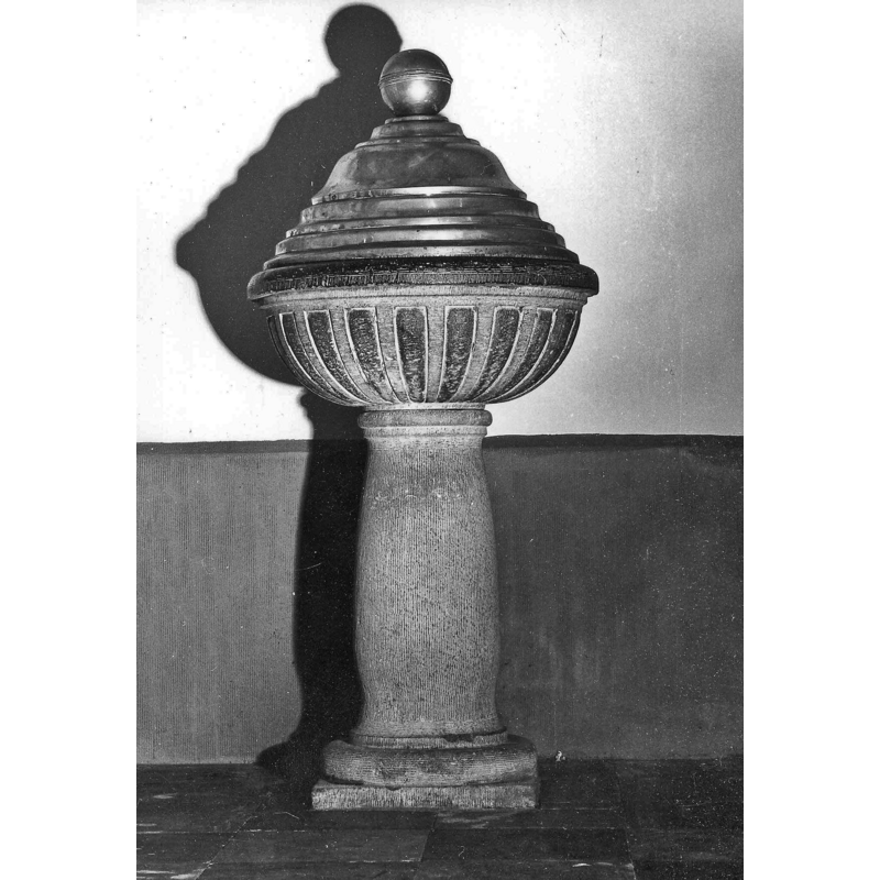
Image copyright © KIK-IRPA, Brussels (Belgium), 2024
CC-BY-4.0
Results: 4 records
view of font and cover
Copyright Statement: Image copyright © KIK-IRPA, Brussels (Belgium), 2024
Image Source: digital image of a 1975 B&W photograph [cliché M230356] in BALaT KIK-IRPA [https://balat.kikirpa.be/object/71769] [accessed 9 February 2024]
Copyright Instructions: CC-BY-4.0
view of church exterior - south view
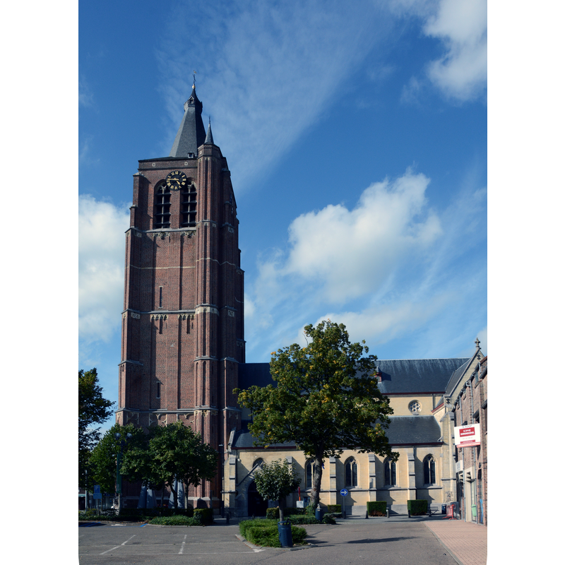
Scene Description: Source caption: "Sint-Trudokerk, Peer van Armand Preud'hommeplein"
Copyright Statement: Image copyright © Funkyxian, 2017
Image Source: edited detail of a digital photograph 10 September 2017 by Funkyxian [https://commons.wikimedia.org/wiki/File:Sint-Trudokerk,_Peer_van_Armand_Preud'hommeplein.jpg] [accessed 9 February 2024]
Copyright Instructions: CC-BY-SA-4.0
view of church interior - looking east
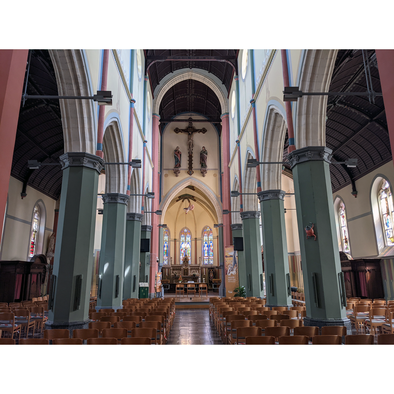
Scene Description: Source caption: "Sint-Trudokerk (Peer) kerkschip"
Copyright Statement: Image copyright © Paul Hermans, 2021
Image Source: digital photograph 4 August 2021 by Paul Hermans [https://commons.wikimedia.org/wiki/File:Sint-Trudokerk_(Peer)_kerkschip_4-08-2021_15-01-06.jpg] [accessed 9 February 2024]
Copyright Instructions: CC-BY-SA-4.0
view of font and cover

Image Source: digital photograph [source N/A] provided by Pol Herman
Copyright Instructions: PERMISSION NOT AVAILABLE – IMAGE NOT FOR PUBLIC USE
INFORMATION
Font ID: 25320PEE
Object Type: Baptismal Font1
Font Date: n.d.
Font Century and Period/Style: 17th century/ 19th century
Church / Chapel Name: Sint-Trudokerk in Peer / Decanale parochiekerk Sint-Trudo
Font Location in Church: [cf. FontNotes]
Church Patron Saint(s): St. Trudo
Church Notes: possible wooden church ca. 950; re-built 11thC in stone, and ca. 1170; tower added between 1392 and 1422; set on fire by in 1572 Austrian troops and in by the Spanish in 1599; restored 19th and 19thC; renovated 1895-1897
Church Address: Sint Trudo Kerk, 3990 Peer, Belgium
Site Location: Limburg, Vlaanderen / Flandres, Belgium, Europe
Directions to Site: Located off the N738, S of the N73, 8 km W of Bree, 30 km S of Eindhoven, 30 km N of Hasselt
Ecclesiastic Region: Bistum Hasselt
Additional Comments: disappeared font? (the one from the medieval church here)
Font Notes:
Click to view
Baptismal font listed and illustrated in BALaT KIK-IRPA [https://balat.kikirpa.be/object/71769] [accessed 9 February 2024]: "doopvont [...] hardsteen [...] Date: 1841 - 1860 [...] hoogte: 160 cm" [NB: the height includes that of the font cover]. The entry for this church in the Inventaris Onroerend Erfgoed [https://inventaris.onroerenderfgoed.be/erfgoedobjecten/80653] [accessed 9 February 2024] mentions a baptismal font made of granite in the mid-19th century, topped with a font cover made of brass in the 17th century; it notes that the font was earlier in the baptistery but has been in the chancel since 1984 ["Granieten doopvont uit het midden van de 19de eeuw met geelkoperen deksel uit de 17de eeuw, voorheen in de doopkapel, sinds 1984 in het koor"]. The entry in Erfgoedplus.be [https://www.erfgoedplus.be/details/KF.objecten.1622] [accessed 9 February 2024] however, gives the date range for the font as "1675 - 1699". The font consists of a roughly hemispherical basin of dark partly polisjed limestone, a pronounced moulding at the upper rim, the underbowl patterned with flat ribs; it is raised on a round baluster-shaped pedestal base of lighter stone, with mouldings at each end. The dome-shaped font cover is graded on the sides and has a large orb-and-cross finial.
A communication to BSI from Pol Herman (e-mail of 17 September 2023) remarks on the disagreement on the dating in the sources, and adds: "Erfgoedplus 1675-1699 seems stylistically correct and would fit the church history, KIK-IRPA 1841-1860 probably wrong".
A communication to BSI from Pol Herman (e-mail of 17 September 2023) remarks on the disagreement on the dating in the sources, and adds: "Erfgoedplus 1675-1699 seems stylistically correct and would fit the church history, KIK-IRPA 1841-1860 probably wrong".
Credit and Acknowledgements: We are gratefult to Pol Herman for bringing this font to our attention and for his help in documenting it
COORDINATES
UTM: 31U 671481 5667447
Latitude & Longitude (Decimal): 51.132781, 5.450969
Latitude & Longitude (DMS): 51° 7′ 58.01″ N, 5° 27′ 3.49″ E
MEDIUM AND MEASUREMENTS
Material: stone
Font Shape: hemispheric, mounted
Basin Exterior Shape: round
LID INFORMATION
Date: 17th century?
Material: metal, brass
Apparatus: no
Notes: [cf. FontNotes]