Dampierre-sur-Blevy / Dampierre-sur-Blévy
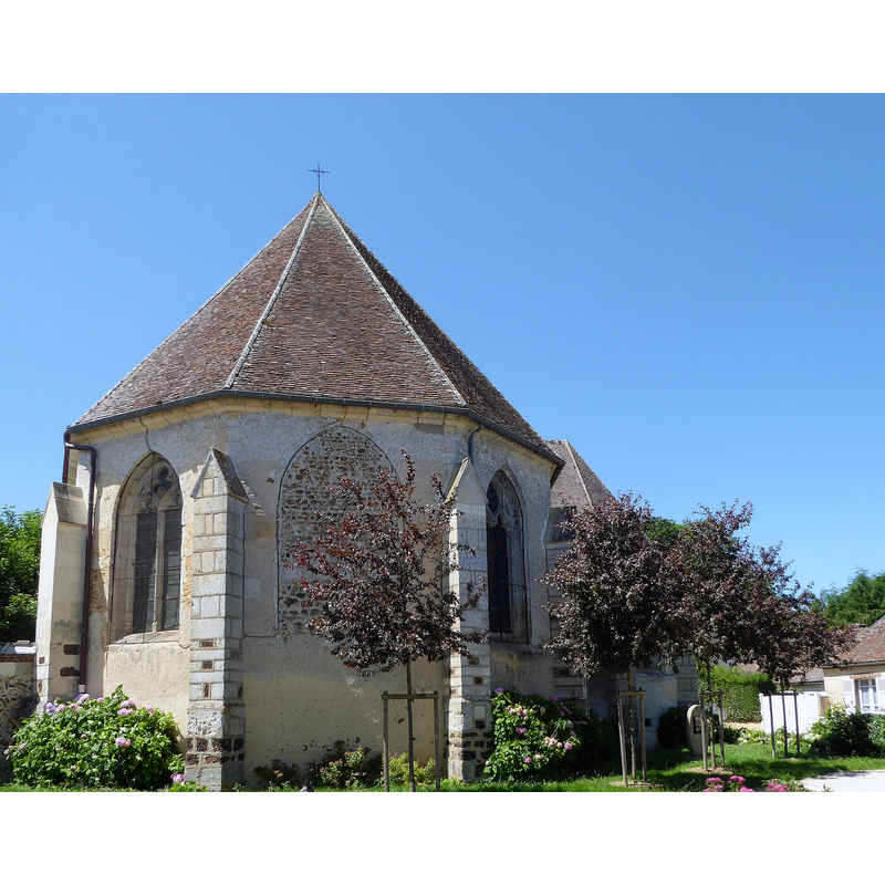
Image copyright © Le Passant, 2021
CC-BY-SA-4.0
Results: 2 records
view of church exterior - northeast view
Scene Description: Source caption: "Chevet église Saint-Pierre de Dampierre-sur-Blévy, Maillebois, Eure-et-Loir, France."
Copyright Statement: Image copyright © Le Passant, 2021
Image Source: edited detail of a digital photograph 18 July 2021 by Le Passant [https://commons.wikimedia.org/wiki/File:Chevet_église_Saint-Pierre_de_Dampierre-sur-Blévy_Maillebois_Eure-et-Loir_France.jpg] [accessed 8 January 2024]
Copyright Instructions: CC-BY-SA-4.0
view of church exterior - southwest view
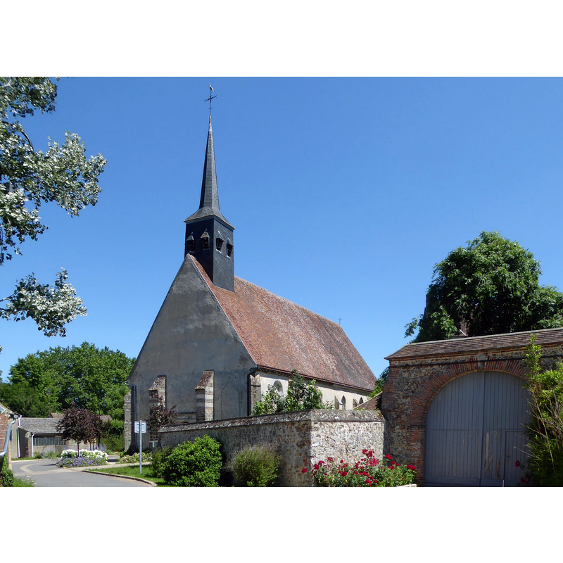
Scene Description: Source caption: "Église Saint-Pierre de Dampierre-sur-Blévy, Maillebois, Eure-et-Loir, France."
Copyright Statement: Image copyright © Le Passant, 2021
Image Source: edited detail of a digital photograph 18 July 2021 by Le Passant [https://commons.wikimedia.org/wiki/File:Église_Saint-Pierre_de_Dampierre-sur-Blévy_Maillebois_Eure-et-Loir_France.jpg] [accessed 8 January 2024]
Copyright Instructions: CC-BY-SA-4.0
INFORMATION
Font ID: 25241DAM
Object Type: Baptismal Font1?
Font Date: n.d.
Font Century and Period/Style: 12th century, Romanesque
Church / Chapel Name: Église Saint-Pierre de Dampierre-sur-Blévy
Font Location in Church: [cf. FontNotes]
Church Patron Saint(s): St. Peter
Church Notes: 12th-15thC church
Church Address: 7 Pl. de l'Église Dampierre, 28170 Maillebois, France
Site Location: Eure-et-Loir, Centre-Val de Loire, France, Europe
Directions to Site: Located off the D20-D146 crossroads, in the municipality ond 2-3 km W of Maillebois, about 20 km WSW of Dreux
Ecclesiastic Region: Diocèse de Chartres
Historical Region: Le Thymerais
Additional Comments: disappeared font? (the one from the 12thC church here)
Font Notes:
Click to view
[NB: we have no information on the baptismal font of the 12th-century church here].
COORDINATES
UTM: 31U 361852 5387784
Latitude & Longitude (Decimal): 48.627855, 1.125136
Latitude & Longitude (DMS): 48° 37′ 40.28″ N, 1° 7′ 30.49″ E