Dampierre / Gargilesse-Dampierre
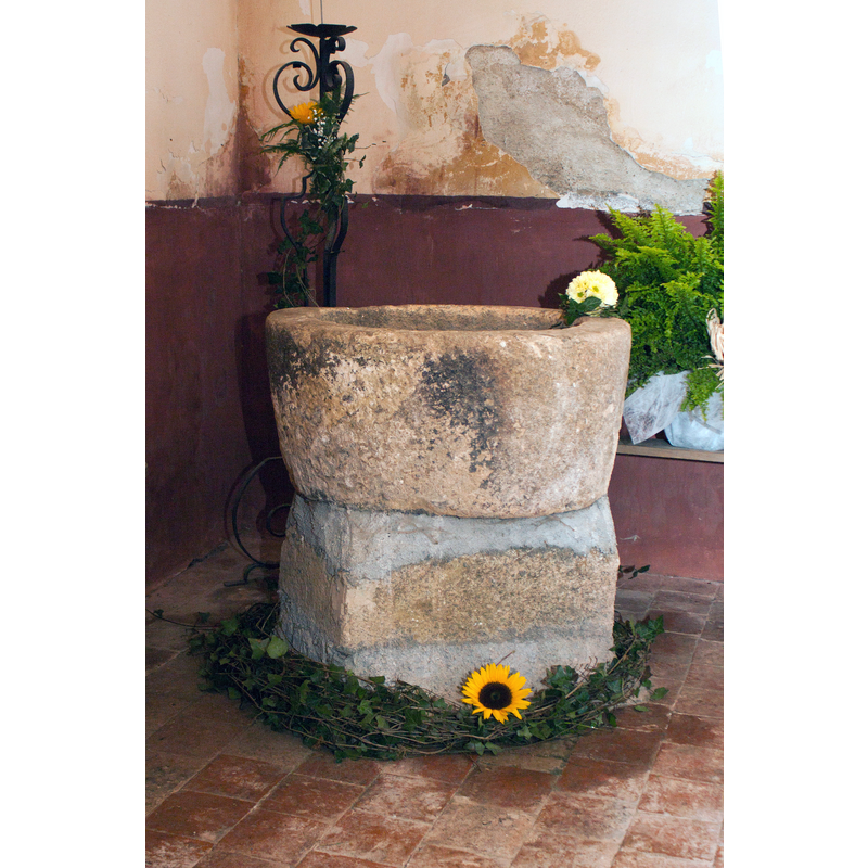
Image copyright © Daniel Villafriuela, 2012
CC-BY-SA-3.0
Results: 3 records
view of font
Scene Description: Source caption: "Église de Dampierre-Fonts Baptismaux"
Copyright Statement: Image copyright © Daniel Villafriuela, 2012
Image Source: digital photograph 29 April 2012 by Daniel Villafriuela [https://commons.wikimedia.org/wiki/File:Église_de_Dampierre-Fonts_Baptismaux-20120428.jpg] [accessed 7 January 2024]
Copyright Instructions: CC-BY-SA-3.0
view of church exterior - southwest view
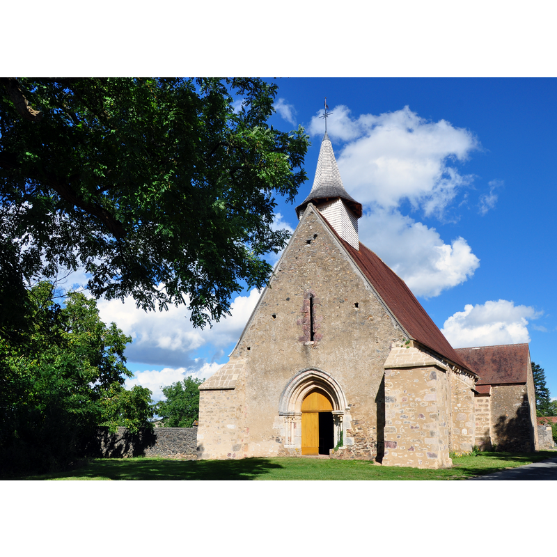
Scene Description: Source caption: "Eglise de Dampierre - Gargilesse-Dampierre (Indre)"
Copyright Statement: Image copyright © Jean Faucheux, 2010
Image Source: edited detail od a digital photograph 9 September 2010 by Jean Faucheux [https://commons.wikimedia.org/wiki/File:Eglise_Dampierre.JPG] [accessed 7 January 2024]
Copyright Instructions: CC-BY-SA-3.0
view of church interior - looking east
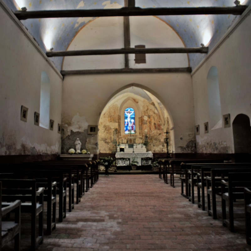
Scene Description: Source caption: "Église de Dampierre-Nef"
Copyright Statement: Image copyright © Daniel Villafriuela, 2012
Image Source: digital photograph 29 April 2012 by Daniel Villafriuela [https://commons.wikimedia.org/wiki/File:Église_de_Dampierre-Nef-20120428.jpg] [accessed 7 January 2024]
Copyright Instructions: CC-BY-SA-3.0
INFORMATION
Font ID: 25237DAM
Object Type: Baptismal Font1
Font Date: n.d.
Font Century and Period/Style: 12th - 13th century [altered?], Romanesque [altered]
Church / Chapel Name: Église Saint-Pierre de Dampierre en Gargilesse-Dampierre
Font Location in Church: Inside the church
Church Patron Saint(s): St. Peter
Church Notes: 12thC church; modified 13thC and later -- listed in Mérimée [ref.: PA00097353]: "Eglise [...] Murs de la nef du 12e siècle. Façade ouest avec bon portail du 13e siècle. Choeur du 13e siècle avec voûte du 15e siècle"
Church Address: 36190 Gargilesse-Dampierre, France
Site Location: Indre, Centre-Val de Loire, France, Europe
Directions to Site: Located off the D91-D918 crossroads, 3 km WSW of Pommiers, 10-12 km SE of Argenton-sur-Creuse, about 70 km SW of Bourges
Ecclesiastic Region: Diocèse de Bourges
Historical Region: Centre
Additional Comments: composite? / altered?
Font Notes:
Click to view
The font in this church is an odd looking object that may have been cobbled togethers from unrelated parts: the plain tub-shaped basin has been mounted on a squarish block with lots of modern(?) cement on it, No cover present.
COORDINATES
UTM: 31T 394481 5151556
Latitude & Longitude (Decimal): 46.5093, 1.62459
Latitude & Longitude (DMS): 46° 30′ 33.48″ N, 1° 37′ 28.52″ E
MEDIUM AND MEASUREMENTS
Material: stone
Font Shape: tub-shaped, mounted