Rulles / Rill / Rûle / Ruris
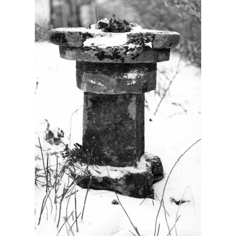
Image copyright © KIK-IRPA, Brussels (Belgium), 2023
Reproduced in accordance with KIK-IRPA guidelines
Results: 3 records
view of font in context
Scene Description: 19thC font? [cf. FontNotes]
Copyright Statement: Image copyright © KIK-IRPA, Brussels (Belgium), 2023
Image Source: digital image of a 1971 B&W photograph by Raoul Dekermel, in KIK-IRPA [https://balat.kikirpa.be/object/10059771] [accessed 1 October 2023]
Copyright Instructions: Reproduced in accordance with KIK-IRPA guidelines
view of church exterior - southwest view
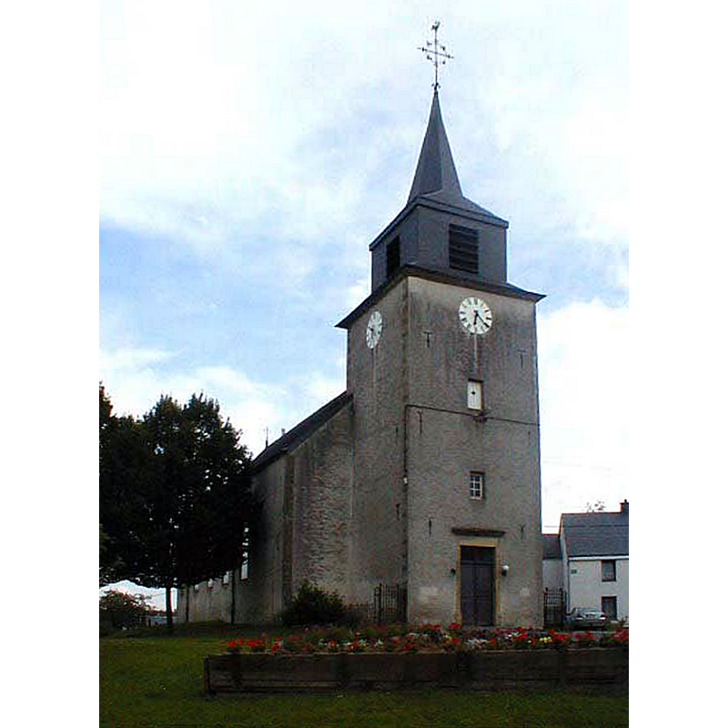
Scene Description: Source caption: "Eglijhe di Rûle" -- the 19thC church
Copyright Statement: Image copyright © L. Mahin, 2007
Image Source: digital photograph 25 July 2007 by L. Mahin [https://commons.wikimedia.org/wiki/File:Eglijhe_Ruule.jpg] [accessed 1 October 2023]
Copyright Instructions: GFDL / CC-BY-SA-3.0-migrated
view of font
![the Rulles font as it lay abandoned in the vicarage garden? [cf. FontNotes]](/static-50478a99ec6f36a15d6234548c59f63da52304e5/others/permission_not_available.jpg)
Scene Description: the Rulles font as it lay abandoned in the vicarage garden? [cf. FontNotes]
Image Source: digital image of an undated B&W photograph from an unknown source, provided by Pol Herman
Copyright Instructions: PERMISSION NOT AVAILABLE – IMAGE NOT FOR PUBLIC USE
INFORMATION
Font ID: 24961RUL
Object Type: Baptismal Font1?
Church / Chapel Name: Église paroissiale Saint-Maximin
Font Location in Church: [cf. FontNotes]
Church Patron Saint(s): St. Maximus
Church Notes: original church probably ca. 1000; old church demolished 1819; re-built in a new site in 1819; tower added 1848-1851
Church Address: Rue Maurice Grévisse 46, 6724 Habay, Belgium
Site Location: Luxembourg / Luxemburg, Wallonie / Wallonne, Belgium, Europe
Directions to Site: Located off (S) N897, W of highway E25, in the municipality and 6 km W of Habay, about 25 km WNW of Arlon
Ecclesiastic Region: Diocèse de Namur
Additional Comments: disappeared font? (the one from the medieval church here)
Font Notes:
Click to view
Fernand Doucet's Rulles-Marbehan et les alentours au cours du temps [https://docplayer.fr/222088420-Fernand-doucet-restranscrit-par-jacques-nicolas-a-partir-du-document-original-dedie-a-m-maurice-grevisse-rulles-marbehan.html] [accessed 1 October 2023] mentions a discarded font in the vicarage garden: "quant aux vieux fonts baptismaux, relégués comme antiquité dans le jardin du presbytère et dont le pied est également gothique, leur origine parait aussi très reculée [...] Les anciens fonts baptismaux relégués au fond du verger du presbytère de Rulles du temps de M. le Conrotte Ver, témoin de l ancienneté de la paroisse de Rulles Marbehan"; presumably this would have taken place ca. 1819, when the old church was demolished and a new one built on a new site. A 19th-century baptismal font in Rulles is listed and illustrated in BALaT KIK-IRPA [https://balat.kikirpa.be/object/10059771] [accessed 1 October 2023]: "fonts baptismaux [...] 1801-1900 [...] pierre [...] hauteur: 72 cm [...] jardin du presbytère". [NB: we have no information on the font of the medieval church here].
Credit and Acknowledgements: We are grateful to Pol Herman for bringing this font to our attention and for his help in documenting it
COORDINATES
UTM: 31U 684408 5510425
Latitude & Longitude (Decimal): 49.718056, 5.558333
Latitude & Longitude (DMS): 49° 43′ 5″ N, 5° 33′ 30″ E