Saint-Lambert-et-Mont-de-Jeux
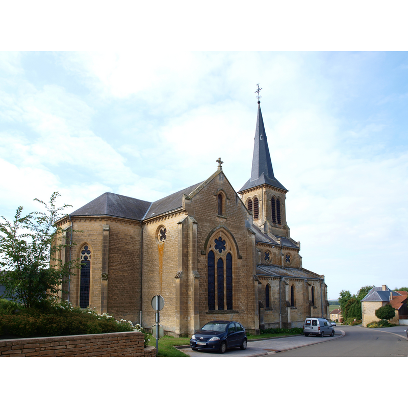
Image copyright © François Goglins, 2013
CC-BY-SA-3.0
Results: 5 records
view of church exterior - northeast view
Scene Description: Source caption: "Saint-Lambert-et-Mont-de-Jeux (Ardennes, France) ; Saint-Lambert,église"
Copyright Statement: Image copyright © François Goglins, 2013
Image Source: digital photograph 1 September 2013 by François Goglins [https://commons.wikimedia.org/wiki/File:Saint-Lambert-et-Mont-de-Jeux-FR-08-Saint-Lambert-église-19.JPG] [accessed 7 August 2023]
Copyright Instructions: CC-BY-SA-3.0
information

Copyright Statement: Image copyright © Jean-Claude Ghislai, 2006
Image Source: digital image of content from Ghislain (2006)
Copyright Instructions: PERMISSION NOT AVAILABLE -- IMAGE NOT FOR PUBLIC USE
information
Copyright Statement: Image copyright © Jean-Claude Ghislai, 2006
Image Source: digital image of content from Ghislain (2006)
Copyright Instructions: PERMISSION NOT AVAILABLE -- IMAGE NOT FOR PUBLIC USE
view of fragment
Scene Description: [cf. FontNotes]
Copyright Statement: Image copyright © [s.n., s.d.]
Image Source: digital image [source N/A] provided by Pol Herman
Copyright Instructions: PERMISSION NOT AVAILABLE -- IMAGE NOT FOR PUBLIC USE
view of fragment
Scene Description: [cf. FontNotes]
Copyright Statement: Image copyright © [s.n., s.d.]
Image Source: digital image [source N/A] provided by Pol Herman
Copyright Instructions: PERMISSION NOT AVAILABLE -- IMAGE NOT FOR PUBLIC USE
INFORMATION
Font ID: 24862MON
Object Type: Baptismal Font1, fragment
Font Century and Period/Style: 12th - 13th century, Romanesque
Workshop/Group/Artisan: Mosan font?
Church / Chapel Name: Église Saint-Lambert de Saint-Lambert-et-Mont-de-Jeux
Font Location in Church: [cf. FontNotes]
Church Patron Saint(s): St. Lambert of Maastricht[aka Lambaert, Lambertus, Lambrecht, Landebertus]
Church Address: 2 Pl. de l'Église, 08130 Saint-Lambert-et-Mont-de-Jeux, France
Site Location: Ardennes, Grand Est, France, Europe
Directions to Site: Located off the D33 [aka rue des Pommes], 2 km E of Charbogne and the D987, 18 km E of Rethel, about 55 km NE of Reims [the 2 communes merged in 1828]
Historical Region: Les crêtes préardennaises
Additional Comments: fragment?
Font Notes:
Click to view
A communication from Pol Herman to BSI (e-mail of 19 October 2022) informs of a head of a Romanesque Mosan baptismal font that may be associated with this church. Pol Herman notes that the fragment is included in Ghislain (2005-2006) [cf. ImagesArea]
Credit and Acknowledgements: We are grateful to Pol Herman for bringing this font to our attention and for his help in documenting it
COORDINATES
UTM: 31U 616490 5484067
Latitude & Longitude (Decimal): 49.498039, 4.608772
Latitude & Longitude (DMS): 49° 29′ 52.94″ N, 4° 36′ 31.58″ E
MEDIUM AND MEASUREMENTS
Material: stone, limestone