Hartmannsdorf / Hartmannsdorf bei Chemnitz
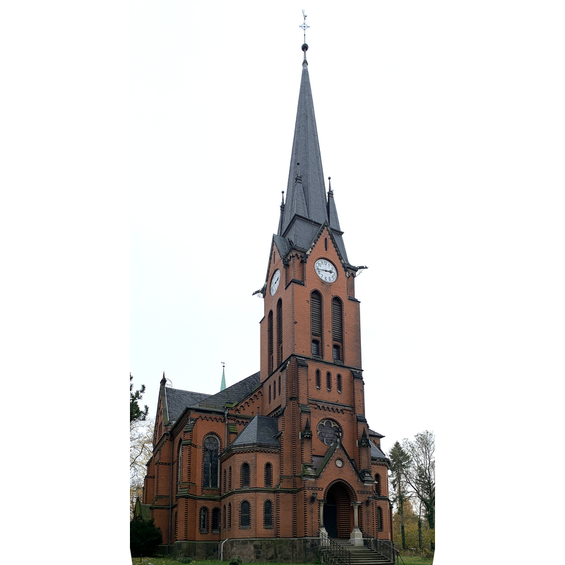
Image copyright © Michael Wolf, 2019
CC-BY-SA-3.0
Results: 2 records
view of church exterior - northwest view
Scene Description: Source caption: "Kulturdenkmal in Hartmannsdorf (bei Chemnitz), Einzeldenkmal der Sachgesamtheit: Kirche, Kirchweg" -- the 1894 building that replaced a much modified medieval church
Copyright Statement: Image copyright © Michael Wolf, 2019
Image Source: digital photograph 19 November 2019 by Michael Wolf [https://commons.wikimedia.org/wiki/File:Kirche_Hartmannsdorf_10550.jpg] [accessed 25 July 2023]
Copyright Instructions: CC-BY-SA-3.0
view of font

Scene Description: shown here probably after it was restored to the church in 2020
Copyright Statement: Image copyright © Martin Günther / Kirchgemeinde Hartmannsdorf-Mühlau, 2023
Image Source: digital photograph by Martin Günther in the Evangelisch-Lutherische Landerskirche-Sachsens [https://kirche-hartmannsdorf-muehlau.de/wp-content/uploads/2022/05/11-DeralteTaufstein.pdf] [accessed 25 July 2023]
Copyright Instructions: PERMISSION NOT AVAILABLE -- IMAGE NOT FOR PUBLIC USE
INFORMATION
Font ID: 24824HAR
Object Type: Baptismal Font1
Font Century and Period/Style: 13th century [basin only] [composite font], Medieval [composite]
Church / Chapel Name: Evangelische Kirche
Font Location in Church: Inside the church (after 2020)
Church Notes: original chapel or church 1150-1250; much modified since; replaced by a new church consecrated in 1894; the old church was demolished in the Spring of 1895, its stone work used to build the path to the new church
Church Address: Kirchweg 3, 09232 Harmannsdorf, Germany -- Tel.: +49 3722 93788
Site Location: Mittelsachsen, Sachsen, Germany, Europe
Directions to Site: Located off (N) the Bd72, 3 km SE of Mühlau, about 12 km NW of Chemnitz
Additional Comments: disused font / restored font / altered font [cf. FontNotes]
Font Notes:
Click to view
The entry for this church in the Evangelisch-Lutherische Landerskirche-Sachsens [https://kirche-hartmannsdorf-muehlau.de/wp-content/uploads/2022/05/11-DeralteTaufstein.pdf] [accessed 25 July 2023] notes and illustrates a Romanesque baptismal font that became disused when the new 1894 church was inaugurated, and was moved to a church elsewhere; in 2020 it became redundant and was brought back to Hartmannsdorf where it is today [2023] ["Auch der alte romanische Taufstein kam an andere Standorte. 2020 konnte er von einer Kirchgemeinde, wo er nicht mehr bebraucht wurde, wieder zurückgeholt werden und hat nun doch noch einen Platz in unserer Kirche gefunden." The font consists of a round tapering besin decorated with a row of rather shallow horseshoe arches without supports all around; rounded underbowl; it has a short stem that is also part of the same block; it is raised on a moulded lower base that appears to be a modern replacement.
Credit and Acknowledgements: We are grateful to Pol Herman for bringing this font to our attention and for his help in documenting it
COORDINATES
UTM: 33U 345413 5639340
Latitude & Longitude (Decimal): 50.885022, 12.802263
Latitude & Longitude (DMS): 50° 53′ 6.08″ N, 12° 48′ 8.15″ E
MEDIUM AND MEASUREMENTS
Material: stone
Font Shape: round, mounted -- chalice shaped
Basin Interior Shape: round
Basin Exterior Shape: round