Liepen nr. Anklam
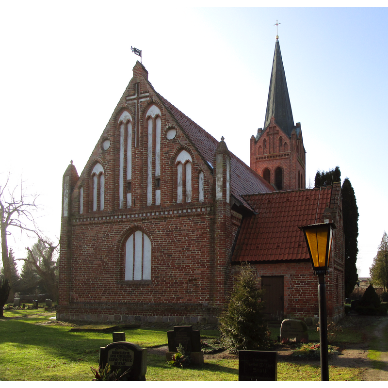
Image copyright © Chron-Paul, 2015
CC-BY-SA-4.0
Results: 2 records
view of church exterior - northeast view
Scene Description: Source caption: "Kirche [...] von liepen"
Copyright Statement: Image copyright © Chron-Paul, 2015
Image Source: edited detail of a digital photograph 14 February 2015 by Chron-Paul [https://commons.wikimedia.org/wiki/File:Liepen-Kirchhof-150214-039.JPG] [accessed 25 July 2023]
Copyright Instructions: CC-BY-SA-4.0
view of church exterior - southwest view
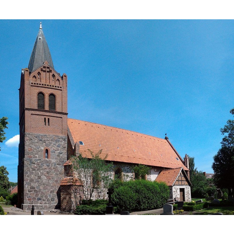
Scene Description: Source caption: "Kirche in Liepen, Landkreis Ostvorpommern"
Copyright Statement: Image copyright © Erell, 2011
Image Source: digtal photograph 13 June 2011 by Erell [https://commons.wikimedia.org/wiki/File:Kirchen_Liepen_Vorpommern_Nordseite.jpg] [accessed 25 July 2023]
Copyright Instructions: GFDL / CC-BY-SA-3.0,2.5,2.0,1.0
INFORMATION
Font ID: 24822LIE
Object Type: Baptismal Font1?
Font Century and Period/Style: 13th century (early?), Late Romanesque
Church / Chapel Name: Evangelisch-lutherische Kirche Liepen
Font Location in Church: [disappeared]
Church Notes: stone church of first half of 13thC; much modified since; present church consecrated 1888
Church Address: Dorfstraße 42, 17391 Neetzow-Liepen, Germany -- Tel.:+49 39721 52214
Site Location: Vorpommern-Greifswald, Mecklenburg-Vorpommern, Germany, Europe
Directions to Site: Located off the Bd110-K62 crossroads, 25 km WNW of Anklam, 25-30 km SSE of Greifswald
Additional Comments: disappeared font? (the one from the medieval church here)
Font Notes:
Click to view
The present font of stone in this church is octagonal, with decorated basin sides; it is located in the chancel, east side; modern. [NB: we have no information on the font of the medieval church here].
COORDINATES
UTM: 33U 399382 5971901
Latitude & Longitude (Decimal): 53.885788, 13.469138
Latitude & Longitude (DMS): 53° 53′ 8.84″ N, 13° 28′ 8.9″ E