Heas / Héas
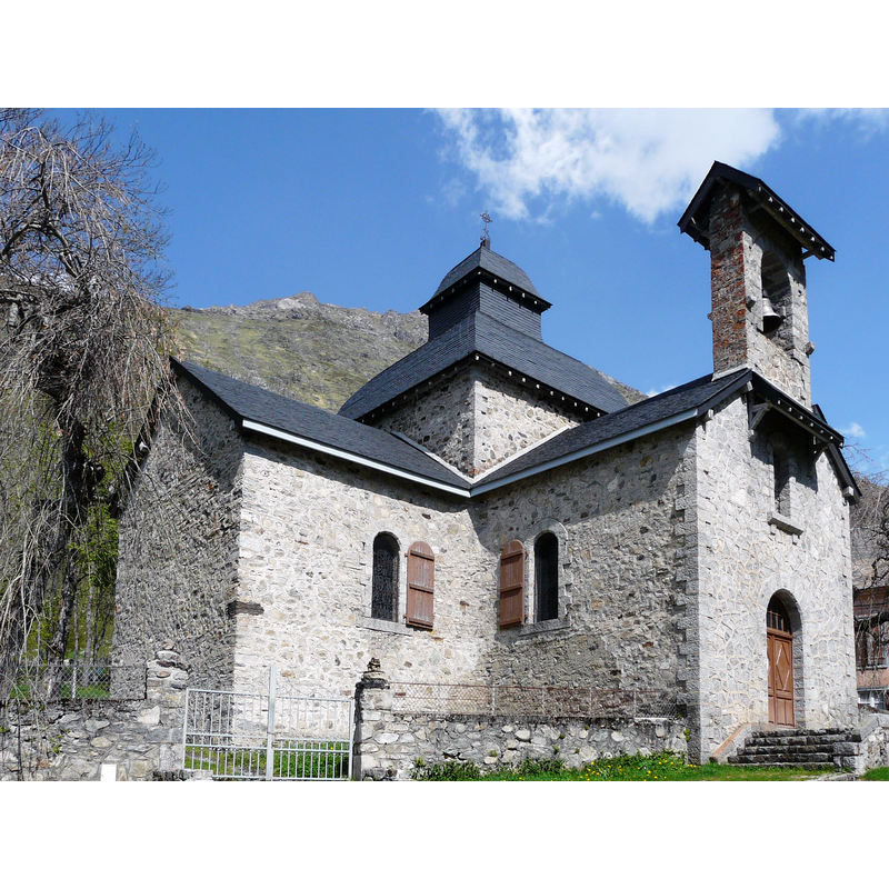
Image copyright © Père Igor, 2012
CC-BY-SA-4.0
Results: 2 records
view of church exterior - northwest view
Scene Description: Source caption: "La chapelle Notre-Dame de Héas vue depuis l'ouest, Gèdre, Hautes-Pyrénées, France."
Copyright Statement: Image copyright © Père Igor, 2012
Image Source: edited detail of a digital photograph 24 May 2012 by Père Igor [https://commons.wikimedia.org/wiki/File:Gèdre_chapelle_de_Héas_(1).JPG] [accessed 18 July 2023]
Copyright Instructions: CC-BY-SA-4.0
view of church interior - chancel and east end
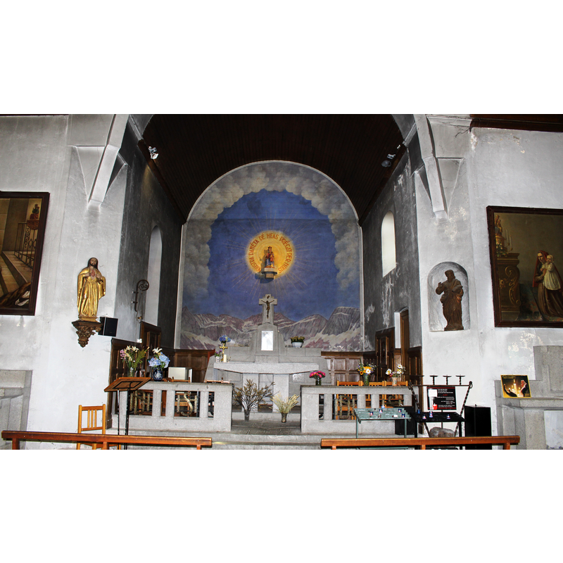
Scene Description: Source caption: "Chapelle Notre-Dame de Héas (Hautes-Pyrénées)"
Copyright Statement: Image copyright © Sotos, 2021
Image Source: digital photograph 17 August 2021 by Sotos [https://commons.wikimedia.org/wiki/File:Chapelle_Notre-Dame_de_Héas_(Hautes-Pyrénées)_3.jpg] [accessed 18 July 2023]
Copyright Instructions: CC-BY-SA-4.0
INFORMATION
Font ID: 24789HEA
Object Type: Baptismal Font1?
Font Century and Period/Style: 14th century (mid?), Gothic
Church / Chapel Name: Chapelle Notre-Dame de Héas
Font Location in Church: [disappeared]
Church Patron Saint(s): St. Mary the Virgin
Church Notes: documented 1349; re-built three times, the last after the chapel was destroyed by an avalanche; re-built 1928
Church Address: D922, 65120 Gavarnie-Gèdre, France
Site Location: Hautes-Pyrénées, Occitanie, France, Europe
Directions to Site: Located off (N) the D922, in the municipality and 8-9 km SE of Gavarnie-Gèdre, about 30 km SSE of Argelès-Gazost
Historical Region: Le Lavedan / Midi-Pyrénées
Additional Comments: disappeared font?
Font Notes:
Click to view
[NB: we have no information on the font of the medieval church here]
COORDINATES
UTM: 31T 261618 4737286
Latitude & Longitude (Decimal): 42.751056, 0.087194
Latitude & Longitude (DMS): 42° 45′ 3.8″ N, 0° 5′ 13.9″ E