Anklam No. 2 / Ancklam / Tanglim / Wendenburg

Image copyright © Elisauer, 2021
CC-BY-SA-4.0
Results: 5 records
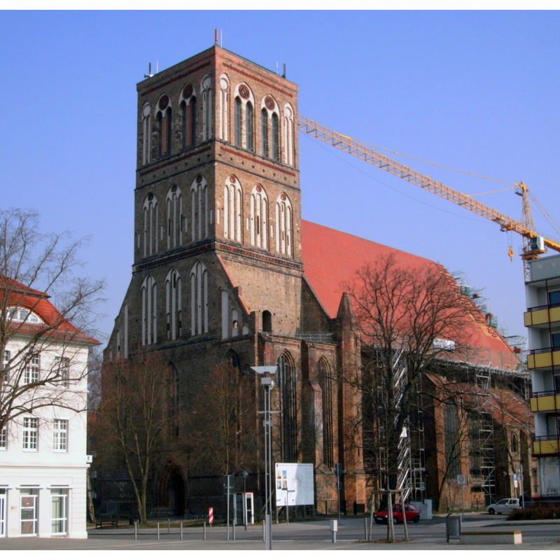
view of church exterior - northeast view
Scene Description: Source caption: "Nikolaikirche Anklam Nordost Ansicht 29.01.2021 nach Fällung der Bäume" -- the decommissioned church [since 200] after its restoration; now a civic centre
Copyright Statement: Image copyright © Elisauer, 2021
Image Source: digital photograph 29 Januar 2021 by Elisauer [https://commons.wikimedia.org/wiki/File:Nikolaikirche_Anklam_Nordost_Ansicht_29.01.2021.jpg] [accessed 16 April 2023]
Copyright Instructions: CC-BY-SA-4.0
view of church exterior - southwest view
view of church exterior in context - southwest view
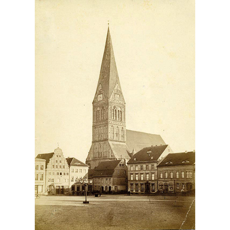
Scene Description: Source caption: "Nikolaikirche Anklam um 1880"
Copyright Statement: Image copyright © [in the public domain]
Image Source: digital image of an undated [ca. 1880-1885] photograph [by Reichard?] in the Archiv Museum im Steintor [https://commons.wikimedia.org/wiki/File:Anklam_Nikolaikirche_03.jpg] [accessed 16 April 2023]
Copyright Instructions: CC-PD-Mark / PD Old
view of church exterior in context
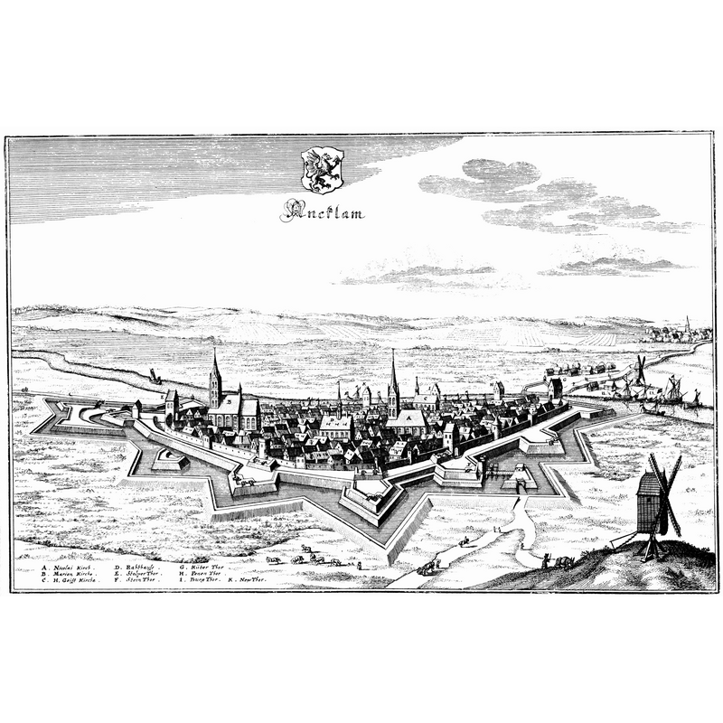
Scene Description: showing the two churches ca. 1650
view of church exterior in context
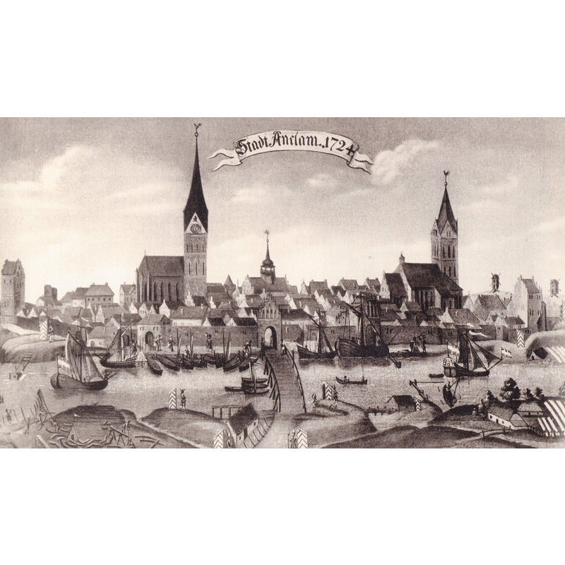
Scene Description: showing the two churches in 1724
INFORMATION
Font ID: 24678ANK
Object Type: Baptismal Font1?
Font Century and Period/Style: 12th - 13th century, Medieval
Church / Chapel Name: Nikolaikirche [deconsecrated since 2004]
Font Location in Church: [cf. FontNotes]
Church Patron Saint(s): St. Nicholas of Myra
Church Notes: originally a Wendish fortress? -- possible predecessor of later church ca. 1180; construction of the Gothic building began 1280; completed ca. 1500; destroyed 1945; de-consecrated 2 October 2004; a civic use building since; re-built 2010
Church Address: Nikolaikirchstraße 7, 17389 Anklam, Germany -- Tel.: +49 3971 245500
Site Location: Vorpommern-Greifswald, Mecklenburg-Vorpommern, Germany, Europe
Directions to Site: Located off the Bd109-Bd110 crossroads, about 40 km SE of Greifswald, about 50 km W of the Polish border
Font Notes:
Click to view
[NB: we have no information on the baptismal font(s) of the medieval church here]
COORDINATES
UTM: 33U 413819 5968339
Latitude & Longitude (Decimal): 53.856389, 13.689722
Latitude & Longitude (DMS): 53° 51′ 23″ N, 13° 41′ 23″ E