Criquetot-le-Mauconduit / Criquetot la Mauconduit / Kriquetot
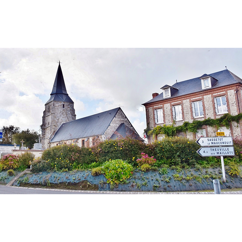
Image copyright © Bastien.pierre, 2017
CC-BY-SA-4.0
Results: 1 records
view of church exterior in context - southeast view
Scene Description: Source caption: "église St Remi et la Mairie"
Copyright Statement: Image copyright © Bastien.pierre, 2017
Image Source: digital photograph 14 September 2017 by Bastien.pierre [https://commons.wikimedia.org/wiki/File:435_Criquetot_le_Mauconduit_(_76540_).jpg] [accessed 24 March 2023]
Copyright Instructions: CC-BY-SA-4.0
INFORMATION
Font ID: 24630CRI
Object Type: Baptismal Font1
Font Century and Period/Style: 14th century, Gothic
Church / Chapel Name: Église paroissiale Saint-Remi-Saint-Lubin
Font Location in Church: [cf. FontNotes]
Church Patron Saint(s): Saint-Remi-Saint-Lubin
Church Notes: 16thC church
Church Address: 2 route de la Distillerie / D479, 76540 Criquetot-le-Mauconduit, France
Site Location: Seine-Maritime, Normandie, France, Europe
Directions to Site: Located off the D479, 3 km ESE of Sassetot-le-Mauconduit [in BSI with a 12thC font], about 15 km ENE of Fécamp
Font Notes:
Click to view
A baptismal font of the 14th century is reported in the Wikipedia entry for Criquetot-le-Mauconduit [https://fr.wikipedia.org/wiki/Criquetot-le-Mauconduit] [accessed 24 March 2023]. A baptismal font identified with the code "PM76005489" is also reported in the site for this church in the Observatoire du Patrimoine Religieux [https://www.patrimoine-religieux.fr/eglises_edifices/76-Seine-Maritime/76195-Criquetot-le-Mauconduit/144495-EgliseSaint-Remy] [accessed 24 March 2023] [but we were unable to link it to a Palissy record].
COORDINATES
UTM: 31U 324389 5518521
Latitude & Longitude (Decimal): 49.793433, 0.559943
Latitude & Longitude (DMS): 49° 47′ 36.36″ N, 0° 33′ 35.8″ E