Schonberg in Schrecksbach / Schönberg in Schrecksbach
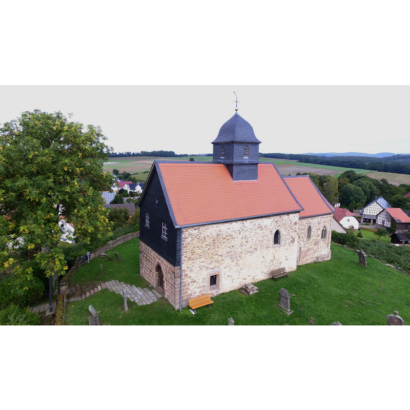
Image copyright © WD9599, 2015
CC-BY-SA-4.0
Results: 2 records
view of church exterior in context - southwest view
Copyright Statement: Image copyright © WD9599, 2015
Image Source: digital photograph 26 September 2015 by WD9599 [https://commons.wikimedia.org/wiki/File:Kapelle_Schönberg.jpg] [accessed 15 December 2022]
Copyright Instructions: CC-BY-SA-4.0
view of font
![[cf. FontNotes]](/static-50478a99ec6f36a15d6234548c59f63da52304e5/others/permission_not_available.jpg)
Scene Description: [cf. FontNotes]
Copyright Statement: Image copyright © [s.n., s.d.]
Image Source: digital photograph [source unknown] provided by Pol Herman
Copyright Instructions: PERMISSION NOT AVAILABLE -- IMAGE NOT FOR PUBLIC USE
INFORMATION
Font ID: 24516SCH
Object Type: Baptismal Font1
Font Century and Period/Style: 12th century, Romanesque
Church / Chapel Name: Kapel Schönberg in Schrecksbach
Font Location in Church: Inside the church
Church Notes: 11th-12thC chapel; documented 1261 as parochial; much modified since
Church Address: 34637 Schrecksbach, Germany
Site Location: Schwalm-Eder-Kreis, Hesse, Germany, Europe
Directions to Site: Located off (E) county road 254, in the municipality and 3 km NNE of Schrecksbach, 12 km N of Alsfeld, about 45 km NNW of Fulda
Additional Comments: damaged font [cf. FontNotes]
Font Notes:
Click to view
The entry for this church in Deutsche Stiftung Denkmalschutz [https://www.denkmalschutz.de/denkmal/kapelle-auf-dem-schoenberg.html] [accessed 15 December 2022] reports a 12th-century baptismal font in this ca, 1000 church: "Die Ausstattung stammt - bis auf den Taufstein des 12. Jahrhunderts - aus dem 18. und 19. Jahrhundert." The medieval monolithic tub-shaped font is roughly cylindrical in shape; its sides are decorated with several [4? / 5?] round arch-heads that may have has somemtif carved in them but are two eroded for identification now; a large part of the upper basin is missing and there are several more damage to it. There is no cover present but there is a metal structure atop probably intended to support a baptismal dish.
Credit and Acknowledgements: We are grateful to Pol Herman for bringing this font to our attention and for his help in documenting it
COORDINATES
UTM: 32U 520877 5633670
Latitude & Longitude (Decimal): 50.85435, 9.2966
Latitude & Longitude (DMS): 50° 51′ 15.66″ N, 9° 17′ 47.76″ E
MEDIUM AND MEASUREMENTS
Material: stone
Font Shape: tub-shaped
Basin Interior Shape: round
Basin Exterior Shape: round
Drainage Notes: no lining