Sarlat la Caneda / Sarlat-la-Canéda
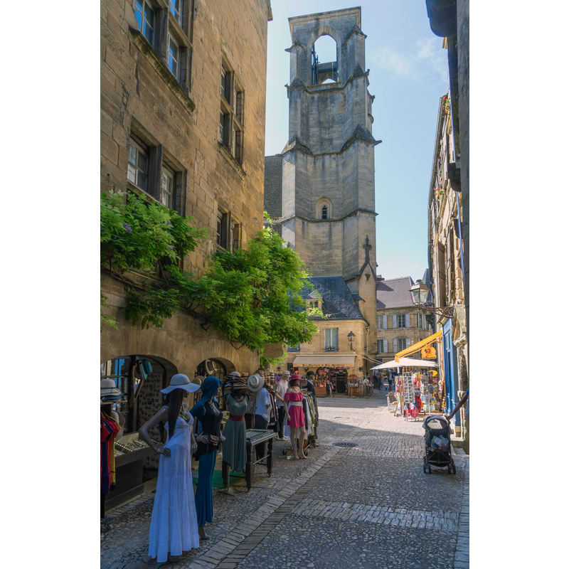
Image copyright © Jean-Christophe BENOIST, 2017
CC-BY-SA-3.0
Results: 2 records
view of church exterior in context - north end
Scene Description: Source caption: "Sarlat - Tour église sainte marie"
Copyright Statement: Image copyright © Jean-Christophe BENOIST, 2017
Image Source: digital photograph 4 August 2017 by Jean-Christophe BENOIST [https://commons.wikimedia.org/wiki/File:Sarlat_-_Tour_église_sainte_marie.jpg] [accessed 6 October 2022]
Copyright Instructions: CC-BY-SA-3.0
view of church exterior - northeast view
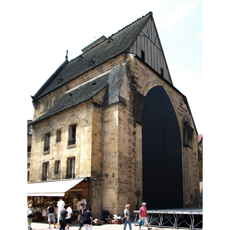
Scene Description: Source caption: "Sarlat-la-Canéda, Dordogne, FRANCE"
Copyright Statement: Image copyright © Christophe Finot, 2007
Image Source: digital photograph [edited] July 2007 by Christophe.Finot [https://commons.wikimedia.org/wiki/File:Sarlat_-_Église_Sainte-Marie_1.jpg] [accessed 6 October 2022]
Copyright Instructions: CC-BY-SA-2.5
INFORMATION
Font ID: 24340SAR
Object Type: Baptismal Font1?
Font Century and Period/Style: 14th century, Medieval
Church / Chapel Name: Ancienne église Paroissiale Sainte-Marie [now a covered market]
Font Location in Church: [cf. FontNotes]
Church Patron Saint(s): St. Mary the Virgin
Church Notes: medieval church redundant in 1794; now a covered market -- listed in Mérimée [ref.: PA00082930]: "14e siècle ; 16e siècle"
Church Address: 63 Rue Louis de Champagne, 24200 Sarlat-la-Canéda, France
Site Location: Dordogne, Nouvelle-Aquitaine, France, Europe
Directions to Site: Located off the D47-D704 crossroads, 40 km SW of Brive-la-Gaillarde
Additional Comments: disappeared font? (the one from the medieval church here)
Font Notes:
Click to view
[NB: we have no information on the font of the medieval church here -- the former church is now a covered market]]
COORDINATES
UTM: 31T 359160 4972300
Latitude & Longitude (Decimal): 44.890194, 1.216444
Latitude & Longitude (DMS): 44° 53′ 24.7″ N, 1° 12′ 59.2″ E