Hidra
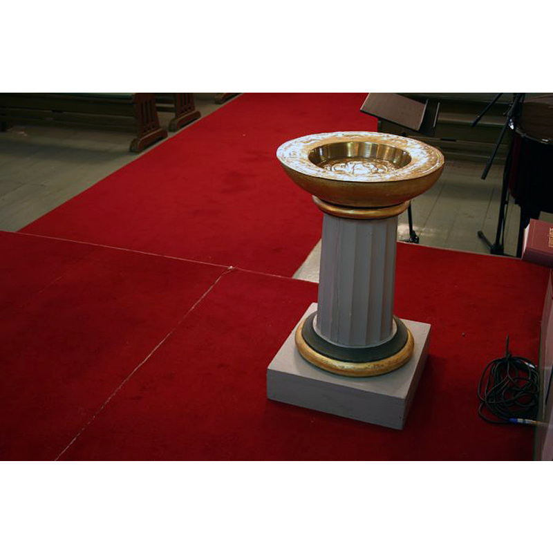
Image copyright © Kirkesøk, 2022
CC-BY-SA-3.0
Results: 3 records
view of font and baptismal dish
Scene Description: the modern font, located in the chancel, north side
Copyright Statement: Image copyright © Kirkesøk, 2022
Image Source: digital photograph in Kirkesøk [https://kirkesok.no/kirke/100400401/] [accessed 3 October 2022]
Copyright Instructions: CC-BY-SA-3.0
view of church exterior
![Source caption: "Hidra kirke i Flekkefjord, Vest-Agder [...] circa 1900 til 1910"](/static-50478a99ec6f36a15d6234548c59f63da52304e5/compressed/1221003016_compressed.png)
Scene Description: Source caption: "Hidra kirke i Flekkefjord, Vest-Agder [...] circa 1900 til 1910"
Copyright Statement: Image copyright © [in the public domain]
Image Source: digital image of a ca. 1900-1910 photograph by Christian Christensen Thomhav, in the Riksantikvaren [https://commons.wikimedia.org/wiki/File:Hidra_kirke,_Vest-Agder_-_Riksantikvaren-T217_01_0133.jpg] [accessed 3 October 2022]
Copyright Instructions: PD Norway / CC-BY-2.0
design element - motifs - roll moulding


INFORMATION
Font ID: 24335HID
Object Type: Baptismal Font1, base only?
Font Century and Period/Style: 13th century, Late Romanesque
Workshop/Group/Artisan: Gotland font
Church / Chapel Name: Hidra Kirke / kyrkje
Font Location in Church: [cf. FontNotes]
Church Notes: original church was a stave church; church documented 1348; burned down 1520; re-built; torn down 1610; replaced by wooden church; 1854 demolished and re-built
Church Address: Fv908 87, 4432 Hidrasund, Norway
Site Location: Agder, Norway, Europe
Directions to Site: Located of local road Fv908, in the village of Kirkehamn on the island of Hidra, about 100 km W of Kristiansand
Ecclesiastic Region: Agder of Telemark Bispedømme
Additional Comments: fragment of a font (only the pedestal and lower base has survived)
Font Notes:
Click to view
Listed and illustrated in Solhaug (2001) as the base (stem and lower base) surviving from a 13th-century baptismal font made of limestone and imported from Gotland. No cover present. Mentioned in Gravgaver [https://www.gravgaver.no/gotland-dopefonter.htm] [accessed 2 October 2022] as the lower basin fragment of one of twelve medieval fonts imported from Gotland into Norway: "Borre (av kummen er kun fragmenter bevart), Eidanger (kun fot), Fon (nederste del av kummen), Hidra (skaft og fot), Holmedal (skaft og fot), Hvaler, Nøtterøy (kun underdel), Ramnes (skaft og fot, fire hoder skyter ut fra vulsten), Sannidal, Sæbø, Tanum, Våle."
Credit and Acknowledgements: We are grateful to Mona Bramer Solhaug for sharing her baptismal font information with BSI
COORDINATES
UTM: 32V 355178 6457261
Latitude & Longitude (Decimal): 58.232628, 6.53357
Latitude & Longitude (DMS): 58° 13′ 57.46″ N, 6° 32′ 0.85″ E
MEDIUM AND MEASUREMENTS
Material: stone, limestone
Height of Base: 51 cm*
Notes on Measurements: * Solhaug (2001)
REFERENCES
- Solhaug, Mona Bramer, Middelalderens døpefonter i Norge, Oslo: Unipub forlag -- Det historisk filosofiske fakultetet, Universitetet i Oslo, 2001, p. 51-52 and fig. 62 on p. 136