Bethune / Béthune
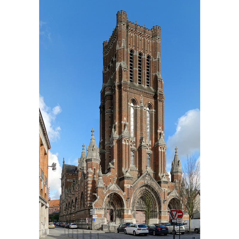
Image copyright © Velvet, 2014
CC-BY-SA-3.0
Results: 3 records
view of church exterior - northwest view
Scene Description: Source caption: "L'église Saint-Vaast de Béthune."
Copyright Statement: Image copyright © Velvet, 2014
Image Source: digital photograph [edited] 23 February 2014 by Velvet [https://commons.wikimedia.org/wiki/File:Bethune_st_vaast_1_bis.jpg] [accessed 12 August 2022]
Copyright Instructions: CC-BY-SA-3.0
view of font and cover in context
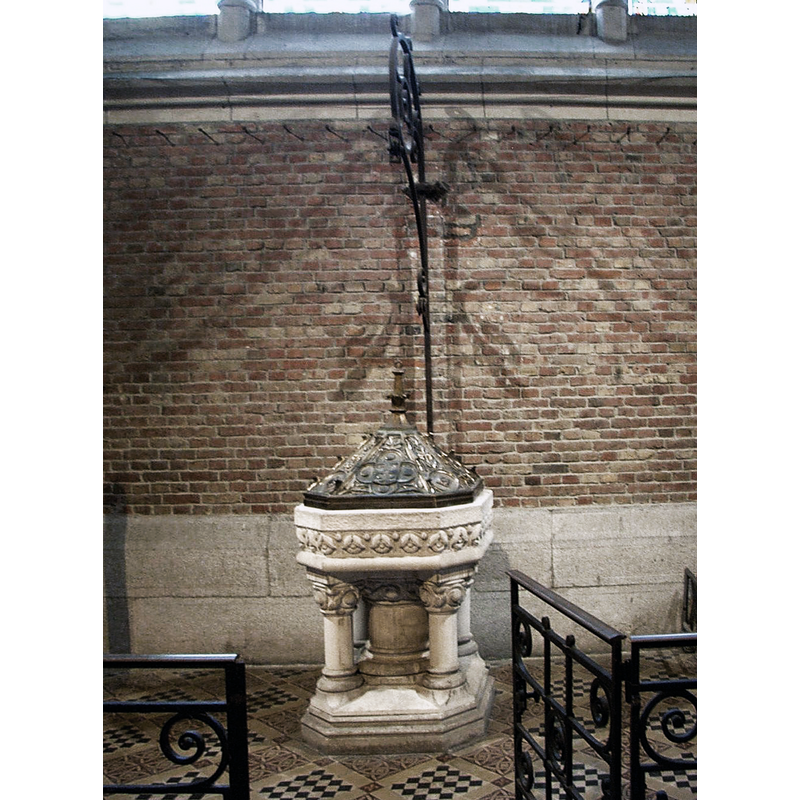
Scene Description: Source caption: "fonts baptismaux dans l'église de Béthune" -- the modern font
Copyright Statement: Image copyright © André Lemoine, 2011
Image Source: digital photograph [edited] 31 December 2011 by André Lemoine [https://www.wikipasdecalais.fr/index.php?title=Fichier:Béthune_fonts_baptismaux.JPG] [accessed 12 August 2022]
Copyright Instructions: CC-BY-SA-3.0
view of church interior - looking east
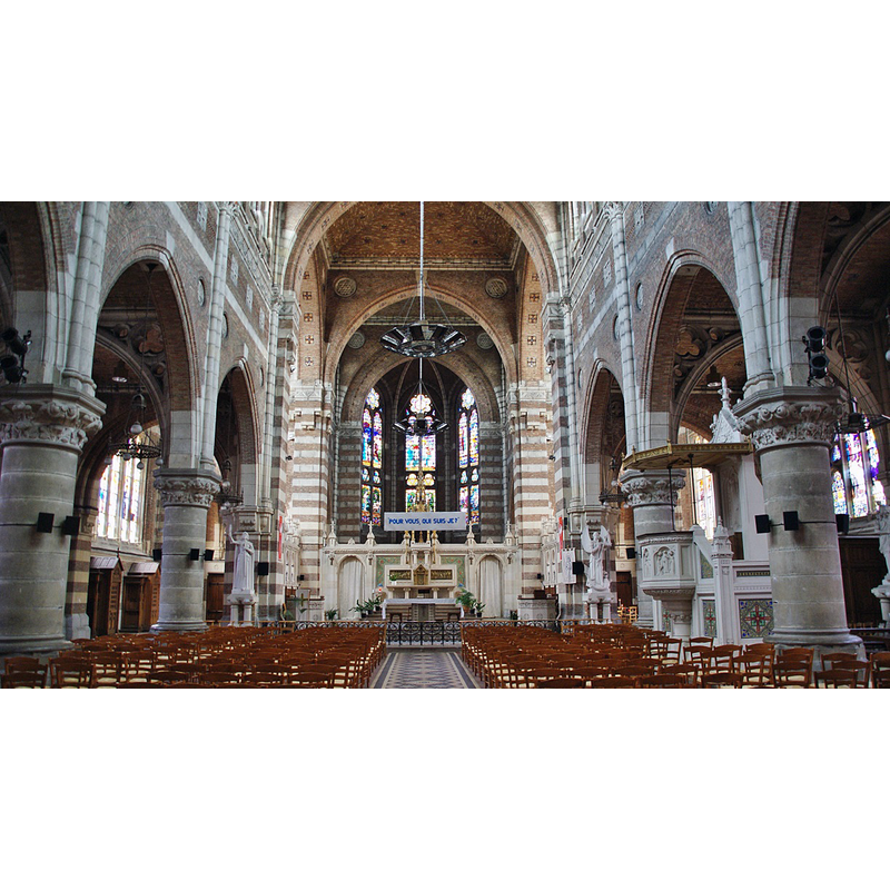
Scene Description: Source caption: "église St Vaast"
Copyright Statement: Image copyright © Bastien.pierre, 2013
Image Source: digital photograph 10 July 2013 by Bastien.pierre [https://commons.wikimedia.org/wiki/File:056_Bethune_(_62400_).JPG] [accessed 12 August 2022]
Copyright Instructions: CC-BY-SA-3.0
INFORMATION
Font ID: 24203BET
Object Type: Baptismal Font1?
Font Date: 1547?
Font Century and Period/Style: 16th century(mid?)
Church / Chapel Name: Église paroissiale Saint-Vaast de Béthune
Font Location in Church: [disappeared]
Church Patron Saint(s): St. Vedast [aka Foster, Vaast, Vedastus]
Church Notes: 1547 church destroyed in WWI; re-built 1924-1927 -- remains of the old church cloister sold and moved to the Château de Montfort (Dordogne), where they eventually were built into a pergola! -- present church listed in Mérimée [ref.: PA62000157]
Church Address: 70 rue Gambetta, 62400 Béthune, France
Site Location: Pas-de-Calais, Hauts-de-France, France, Europe
Directions to Site: Located off the D937, 25-30 km NNW of Arras
Ecclesiastic Region: Diocèse d'Arras
Historical Region: Nord-Pas-de-Calais
Additional Comments: disappeared? / destroyed font? (the one from the 1547 church destroyed in WWI)
Font Notes:
Click to view
The present font in this church is modern [cf. ImagesArea] [NB: we have no information on the font of the 16th-century church destroyed in WWI]
COORDINATES
UTM: 31U 474311 5597817
Latitude & Longitude (Decimal): 50.53174, 2.63754
Latitude & Longitude (DMS): 50° 31′ 54.26″ N, 2° 38′ 15.14″ E