Audinghen / Odingehem
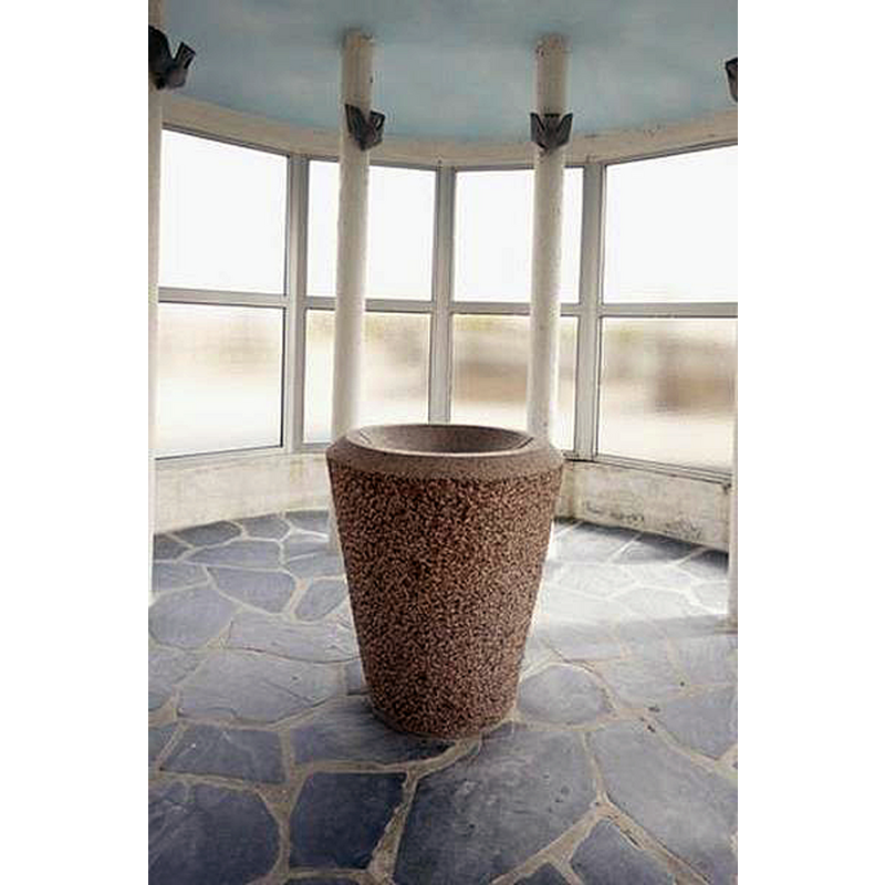
Image copyright © Ministère de la Culture (France), Médiathèque de l'architecture et du patrimoine, diffusion RMN-GP, 2022
CC-BY-SA-NC-ND 4.0 = Licence Ouverte / CC-BY-SA-4.0
Results: 2 records
view of font
Scene Description: the modern font in the new church
Copyright Statement: Image copyright © Ministère de la Culture (France), Médiathèque de l'architecture et du patrimoine, diffusion RMN-GP, 2022
Image Source: digital photograph [20106200679NUCA] by Hubert Bouvet, in Mémoire [ref.: IVR31_20106200679NUCA] [https://www.pop.culture.gouv.fr/notice/memoire/IVR31_20106200679NUCA] [accessed 12 August 2022]
Copyright Instructions: CC-BY-SA-NC-ND 4.0 = Licence Ouverte / CC-BY-SA-4.0
view of church exterior
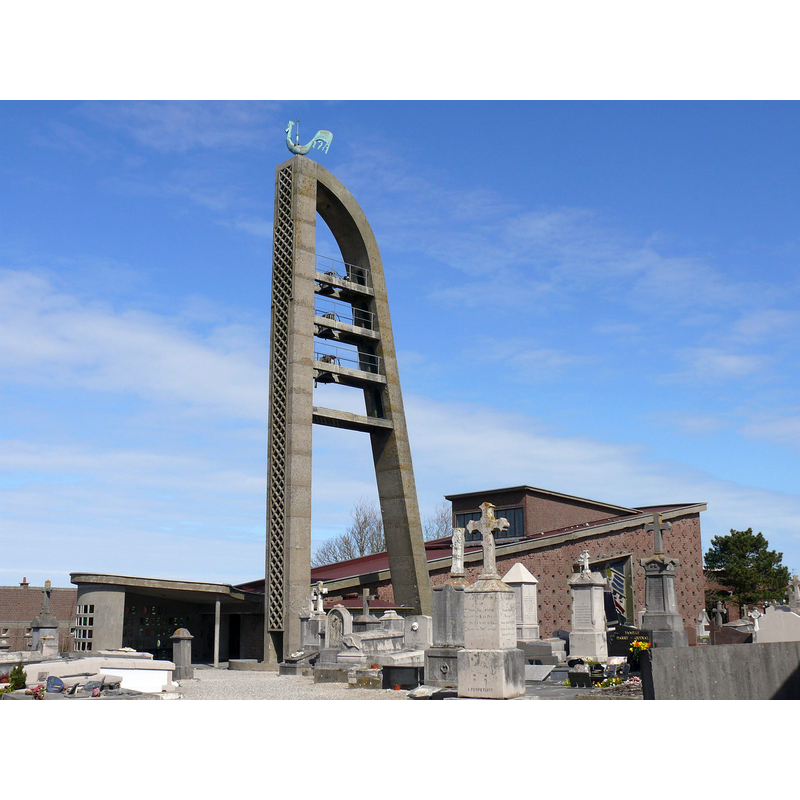
Scene Description: Source caption: "Église d'Audinghen (Pas-de-Calais, France)." -- the modern church; replaced the earlier church destroyed in Allied bombings of 1943
Copyright Statement: Image copyright © Peter17, 2009
Image Source: digital photograph 29 March 2009 by Peter17 [https://fr.wikipedia.org/wiki/Fichier:Église_d'Audinghen.jpg] [accessed 12 August 2022]
Copyright Instructions: GFDL / CC-BY-SA-3.0
INFORMATION
Font ID: 24196AUD
Object Type: Baptismal Font1?
Font Century and Period/Style: Medieval
Church / Chapel Name: Église paroissiale Saint-Pierre
Font Location in Church: [disappeared]
Church Patron Saint(s): St. Peter
Church Notes: medieval(?) church burned down by English soldiers in 1540s; present church 195701960 replaces the earlier one destroyed in Allied bombings in 1943 -- listed in Mérimée [ref.: PA62000064]
Church Address: [NB: address & coordinates for the new church] 509 rue Principale, 62179 Audinghen, France -- Tel.: +33 3 21 34 64 77
Site Location: Pas-de-Calais, Hauts-de-France, France, Europe
Directions to Site: Located off departmental road D940, 14 km N of Boulogne-sur-Mer, 21 km SW of Calais
Ecclesiastic Region: Diocese d'Arras
Historical Region: Le Boulonnais / La Côte d'Opale
Additional Comments: disappeared or destroyed font
Font Notes:
Click to view
Modern (20th-cerntury) baptismal font listed in Mérimée [ref.: IA62001258] [https://www.pop.culture.gouv.fr/notice/merimee/IA62001258] [accessed 12 August 2022]. Illustrated in Mémoire [ref.: IVR31_20106200679NUCA] [https://www.pop.culture.gouv.fr/notice/memoire/IVR31_20106200679NUCA] [accessed 12 August 2022]. [NB: we have no information on the font of the earlier church here].
COORDINATES
UTM: 31U 402305 5634318
Latitude & Longitude (Decimal): 50.8523, 1.61211
Latitude & Longitude (DMS): 50° 51′ 8.28″ N, 1° 36′ 43.6″ E