Karnbo / Kärnbo nr. Mariefred
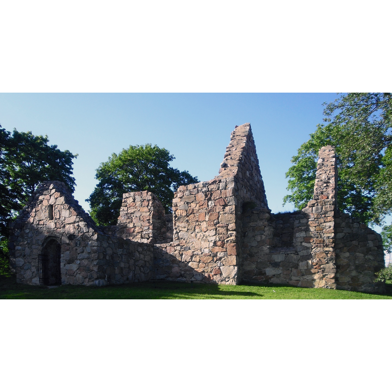
Image copyright © [in the public domain]
PD-self
Results: 2 records
view of church exterior
Scene Description: Source caption: "Kärnbo kyrkoruin strax utanför Mariefred" -- Kärnbo ödekyrka was restored as a ruins in the 20thC
Copyright Statement: Image copyright © [in the public domain]
Image Source: digital photograph 13 September 2009 by Janders [https://commons.wikimedia.org/wiki/File:Kärnbo_kyrkoruin_juli_2009.jpg] [accessed 22 July 2022]
Copyright Instructions: PD-self
view of church exterior - southeast view
![Source caption: "Mariefred, Kärnbo kyrkoruin [...] Kyrkoruinen mot sydöst."](/static-50478a99ec6f36a15d6234548c59f63da52304e5/compressed/0220722017_compressed.png)
Scene Description: Source caption: "Mariefred, Kärnbo kyrkoruin [...] Kyrkoruinen mot sydöst."
Copyright Statement: Image copyright © [in the public domain]
Image Source: digital image [11459-001.TIF] of a 1904 B&W photograph in the Kulturmiljöbild, Riksantikvarieämbetet [https://commons.wikimedia.org/wiki/File:Mariefred,_Kärnbo_kyrkoruin_-_KMB_-_16000200116905.jpg] [accessed 22 July 2022]
Copyright Instructions: PD Sweden
INFORMATION
Font ID: 24133KAR
Object Type: Baptismal Font1?
Church / Chapel Name: Kärnbo kyrkoruin / Kärnbo ödekyrka
Font Location in Church: [disappeared]
Church Notes: built 12thC; expanded late-Middle Ages; abandoned several times in relation with the new church at Mariefred town centre; restored as a ruin in the 20thC
Church Address: Falkebovägen 12, 647 31 Mariefred, Sweden
Site Location: Södermanland, Södermanlands län, Sweden, Europe
Directions to Site: The Kärnbo kyrka ruin site is located off local road 223 [aka Stallarholmsvägen], just W of town Mariefred centre, in the municipality of Strängnäs -- Mariefred itself is located just S of Slottsbrinken, E of highway E20, abouth halfway between Strängnäs (NW) and Södertälje (SE)
Ecclesiastic Region: [Strängnäs stift]
Additional Comments: disappeared font? (the one from the 12thC church here)
Font Notes:
Click to view
[NB: we have no information on the font of the 12th-century church here]
COORDINATES
UTM: 33V 626145 6571242
Latitude & Longitude (Decimal): 59.2613, 17.2127
Latitude & Longitude (DMS): 59° 15′ 40.68″ N, 17° 12′ 45.72″ E