Hamelincourt / EmelinKort / Hamelaincourt / Hameloncourt / Hamelencurt / Hamellincurt
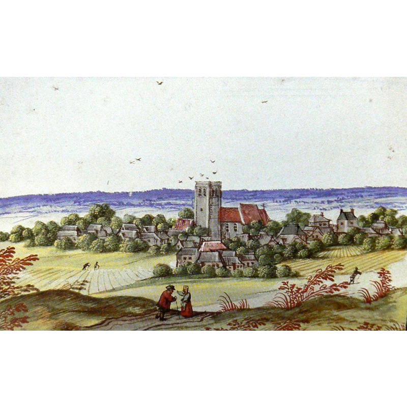
Image copyright © [in the public domain]
Assumed PD
Results: 2 records
view of church exterior in context - southwest view
Scene Description: Source caption: "Présente dans l'Album de Croÿ XVI, l'église d'Hamelincourt et son clocher « fortifié » domine un vaste plateau. Sur la gravure on aperçoit deux passants couverts de riches vêtements qui se rencontrent sur le chemin de Courcelles à Croisilles en surplomb, deux autres plus courbés sous l'effort, en tenue de travail sur le chemin de Moyenneville. A droite les toits de la ferme de l'abbaye et les cheminées du château. Au premier plan, serait-ce le hameau de Lamisol ?"
Copyright Statement: Image copyright © [in the public domain]
Image Source: digital image of an illustration from the Album de Croÿ XVI, reproduced in [https://www.hamelincourt.fr/mon-village/histoire/leglise] [accessed 27 June 2022]
Copyright Instructions: Assumed PD
view of church exterior in context
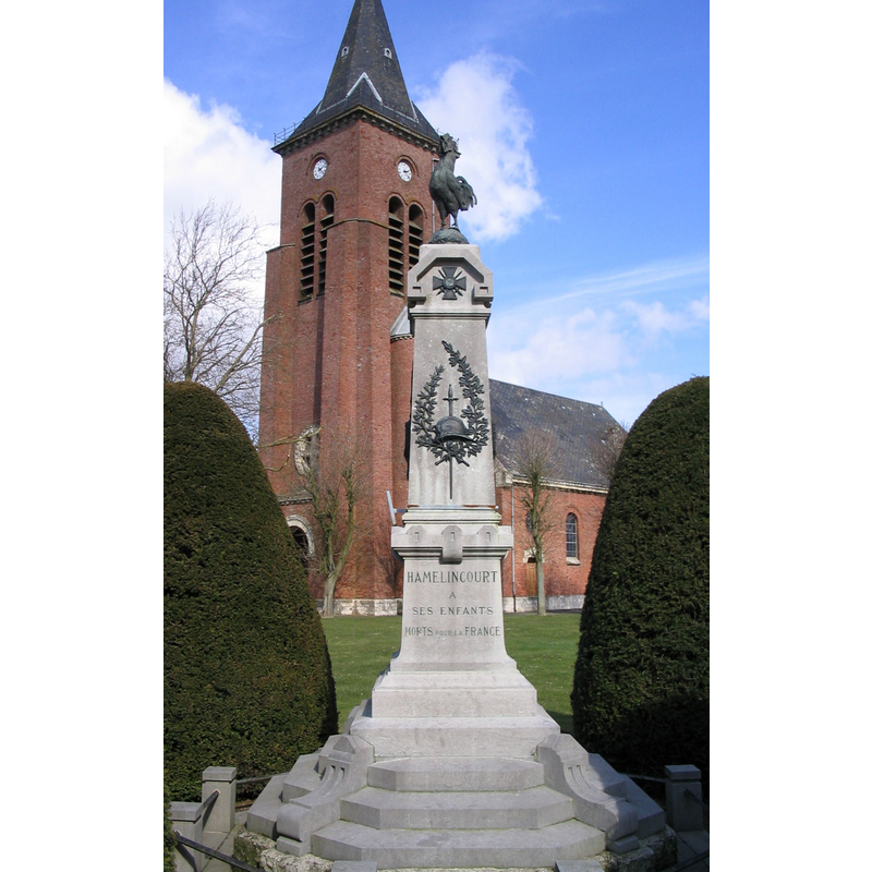
Scene Description: Source caption: "Monument aux morts d'Hamelincourt" -- the former church, like most of the village, was destroyed in WWI
Copyright Statement: Image copyright © Ivan Pacheka, 2004
Image Source: digital photograph March 220 by Ivan Pacheka [https://commons.wikimedia.org/wiki/File:Hamelincourt_monument_aux_morts.jpg] [accessed 27 May 2022]
Copyright Instructions: CC-BY-SA-4.0
INFORMATION
Font ID: 24059HAM
Object Type: Baptismal Font1?
Font Century and Period/Style: Medieval
Church / Chapel Name: Église paroissiale Saint-Vaast d'Hamelincourt
Font Location in Church: [cf. FontNotes]
Church Patron Saint(s): St. Vedast [aka Foster, Vaast, Vedastus]
Church Notes: a fortified church existed here in the 16thC; restored after a fire in 1778; entire village destroyed, dynamited by the German army in WWI; church re-built
Church Address: 8001 La Place, 62121 Hamelincourt, France
Site Location: Pas-de-Calais, Hauts-de-France, France, Europe
Directions to Site: Located off local roads D12-D36 crossroads, W of the D017, about 14 km S of Arras
Ecclesiastic Region: Diocese d'Arras
Additional Comments: disappeared / destroyed font? [cf. FontNotes]
Font Notes:
Click to view
[NB: we have no information on the baptismal font of the earlier church here; the earliest evidence of a church is a depiction in a 16th-century album [cf. ImagesArea]]
Credit and Acknowledgements: We are grateful to Pol Herman for bringing this font to our attention and for his help in documenting it
COORDINATES
UTM: 31U 485673 5559166
Latitude & Longitude (Decimal): 50.18452, 2.79932
Latitude & Longitude (DMS): 50° 11′ 4.27″ N, 2° 47′ 57.55″ E