Berlin No. 26 / Schoneberg / Schoeneberg / Schöneberg
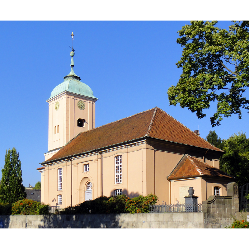
Image copyright © Dirk Ingo Franke, 2012
CC-BY-SA-3.0
Results: 3 records
view of church exterior - southeast view
Scene Description: Source caption: "Old village church, Schöneberg" -- church of 1764/5; destroyed in 1945; re-built 1953-1955
Copyright Statement: Image copyright © Dirk Ingo Franke, 2012
Image Source: digital photograph 29 April 2012 by Dirk Ingo Franke [https://commons.wikimedia.org/wiki/File:Berlin_schoeneberg_hauptstrasse_06.09.2013_09-00-57.jpg] [accessed 23 May 2022]
Copyright Instructions: CC-BY-SA-3.0
view of church exterior in context - southwest view
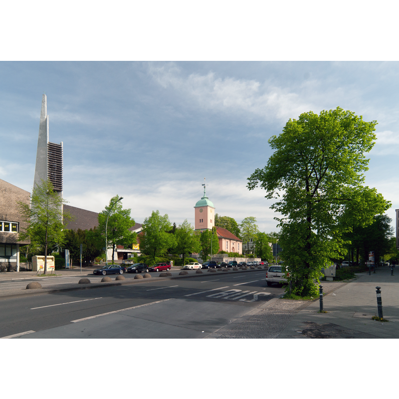
Scene Description: Source caption: "View north along Hauptstrasse street in Berlin-Schöneberg. You can see the older Dorfkirche (Village church) and the newer Paul Gerhardt Church"
Copyright Statement: Image copyright © Dirk Ingo Franke, 2012
Image Source: digital photograph 29 April 2012 by Dirk Ingo Franke [https://commons.wikimedia.org/wiki/File:Berlin_hauptstrasse_mit_kirchen_29.04.2012_09-22-01_ShiftN.jpg] [accessed 23 May 2022]
Copyright Instructions: CC-BY-SA-3.0
view of font and baptismal dish

Copyright Statement: Image copyright © Harry C. Suchland, 1986
Image Source: digital image of a photograph by Harry C. Suchland in Alte Kirchen in Berlin (Berlin: Wichern Verlag, 2nd edition, 1986)
Copyright Instructions: PERMISSION NOT AVAILABLE -- IMAGE NOT FOR PUBLIC USE
INFORMATION
Font ID: 23980BER
Object Type: Baptismal Font1?
Font Century and Period/Style: Medieval
Church / Chapel Name: Alte Dorfkieche Schöneberg [aka St. Immanuelkirche]
Font Location in Church: [cf. FontNotes]
Church Notes: medieval church destroyed by fire in 1544; re-built; destroyed 1760; re-built 1764/5; destroyed in 1945; re-built 1953-1955
Church Address: Hauptstraße 48, 10827 Berlin, Germany -- Tel.: +49 30 7817196
Site Location: Berlin, Berlin, Germany, Europe
Directions to Site: Located off local road B1 [aka Hauptstraße], in the NW area of the Tempelhof-Schoeneberg district of SW Berlin
Additional Comments: disappeared / destroyed font (the one(s) from the medieval and later churches)
Font Notes:
Click to view
The present baptismal in this church is modern. [NB: we have no information on the font(s) of the medieval and later churches here].
Credit and Acknowledgements: We are grateful to Colin Smith for bring this font to our attention and for his help documenting it
COORDINATES
UTM: 33U 387916 5816032
Latitude & Longitude (Decimal): 52.482917, 13.349444
Latitude & Longitude (DMS): 52° 28′ 58.5″ N, 13° 20′ 58″ E