Warhem / Warheem / Warrem / Werhem
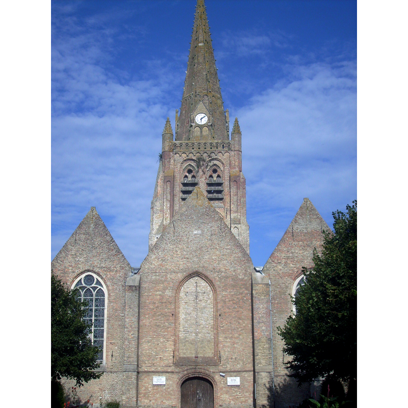
Image copyright © Pichasso, 2009
GFDL / CC-BY-SA-3.0,2.5,2.0,1.0
Results: 1 records
view of church exterior - west end
Scene Description: Source caption: "L'église de Warhem"
Copyright Statement: Image copyright © Pichasso, 2009
Image Source: digital photograph 5 August 2009 by Pichasso [https://commons.wikimedia.org/wiki/File:EgliseWarhem.JPG] [accessed 15 May 2022]
Copyright Instructions: GFDL / CC-BY-SA-3.0,2.5,2.0,1.0
INFORMATION
Font ID: 23962WAR
Object Type: Baptismal Font1
Font Century and Period/Style: 17th century
Church / Chapel Name: Église paroissiale Notre-Dame-de-l'Assomption à Warhem
Font Location in Church: Inside the church
Church Patron Saint(s): The Assumption of St. Mary
Church Notes: 10thC church; destroyed in the mid-16thC riots except for the tower; re-built 1566; re-built 1630; restored 1808-1863 -- listed in Mérimée [ref.: PA59000130]: "Siècle de la campagne principale de construction: 11e siècle ; 12e siècle ; 2e moitié 16e siècle ; 1ère moitié 17e siècle" [...] La première mention écrite de la terre de Warhem date de 938, achetée par un châtelain de Bergues qui la donne aux moines de l'abbaye de Saint-Winoc. De cette époque date sans doute la première église, détruite au 16e siècle, et dont subsiste la tour. En 1566 et 1567, les Gueux ravagèrent l'édifice. En 1587, achèvement de la reconstruction du choeur et des chapelles latérales. En 1630, les travaux s'achèvent par les trois nefs. En 1694, reconstruction de la flèche suite à un tremblement de terre. De 1808 à 1863, restaurations. De 1895 à 1897, installation des vitraux."
Church Address: rue de l'Église, 59380 Warhem, France -- Tel.: +33 3 28 68 32 78
Site Location: Nord, Hauts-de-France, France, Europe
Directions to Site: Located off local road D403 [aka rue de Rexpoede], 3 km ENE of Bergues, 9-10 km SE of Dunkirk
Historical Region: Nord-Pas-de-Calais / Flandre française / Pays de L'Alloeu
Additional Comments: destroyed font? [cf. FontNotes]
Font Notes:
Click to view
A baptismal font in this church is listed in Palissy [ref.: PM59003067]: "Fonts baptismaux [...] Pierre (noir) [...] 17e siècle [...] H = 95 ; la = 66". Kees de Wildt's Doopvont de Beeldenstorm (2018: 114-120) mentions Warhem as one of a number of baptismal fonts of the Westerkwartier (then part of Flanders, later in France) having been desecrated, damaged or destroyed during the Iconoclastic Fury of 1566. [NB: we have no information on the date / period of the font destroyed(?) in the mid-16th century riots or in WWI; was it the font of the medieval church here?].
Credit and Acknowledgements: We are grateful to Pol Herman for bringing this font to our attention and for his help in documenting it
COORDINATES
UTM: 31U 464329 5647325
Latitude & Longitude (Decimal): 50.976416, 2.491901
Latitude & Longitude (DMS): 50° 58′ 35.1″ N, 2° 29′ 30.85″ E
MEDIUM AND MEASUREMENTS
Material: stone, limestone?
Font Height (less Plinth): 95 cm*
Trapezoidal Basin: 66 cm*
Notes on Measurements: * Palissy [ref.: PM59003067]
REFERENCES
- De Wildt, Kees, "Doopvont in de Beeldenstorm", Nederlandse Kerkgeschiedenis, 21, Tijdschrift voor, 2018, pp. 114-120.