Chapelle-d'Armentieres / Armentiers-Kapelle / La Chapelle-d'Armentières
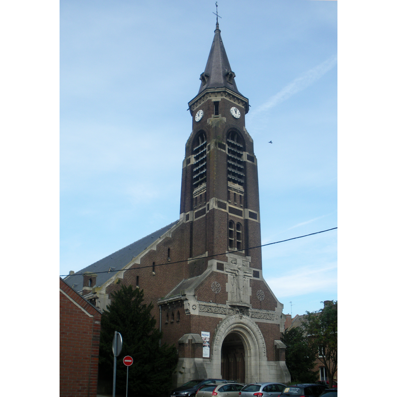
Image copyright © Floflo62, 2013
CC-BY-SA-3.0
Results: 2 records
view of church exterior - northwest end
Scene Description: Source caption: "Vue de l'église Saint-Vaast de La Chapelle-d'Armentières."
Copyright Statement: Image copyright © Floflo62, 2013
Image Source: digital photograph 28 September 2013 by Floflo62 [https://commons.wikimedia.org/wiki/File:Eglise_Saint-Vaast_de_La_Chapelle-d'Armentières.JPG] [accessed 15 May 2022]
Copyright Instructions: CC-BY-SA-3.0
view of church exterior - northeast view
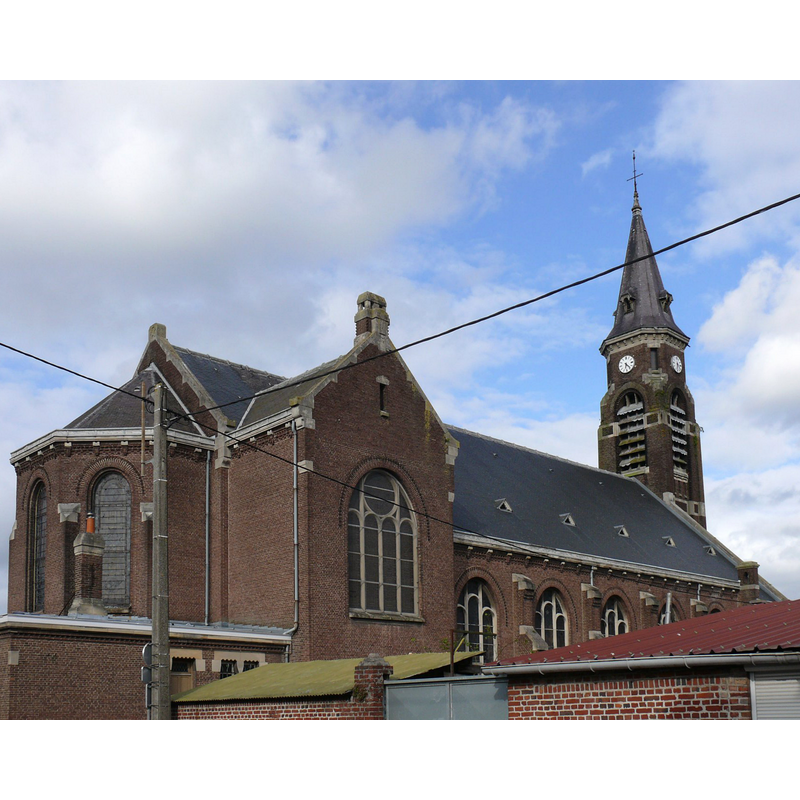
Scene Description: Source caption: " L'église Saint-Vaast de La Chapelle-d'Armentières (Nord, France)."
Copyright Statement: Image copyright © Peter Potrowl, 2014
Image Source: digital photograph 11 May 2014 by Peter Potrowl [https://commons.wikimedia.org/wiki/File:La_Chapelle_d'Armentières_-_Église_Saint-Vaast_-_1.jpg] [accessed 15 May 2022]
Copyright Instructions: CC-BY-SA-3.0
INFORMATION
Font ID: 23960CHA
Object Type: Baptismal Font1
Font Century and Period/Style: Medieval
Church / Chapel Name: Église paroissiale Saint-Vaast à La Chapelle-d'Armentières
Font Location in Church: [cf. FontNotes]
Church Patron Saint(s): St. Vedast [aka Foster, Vaast, Vedastus]
Church Notes: [formerly Notre-Dame du Vieil Biez?] first church here said to be in the 19thC; much damaged in the mid-16thC riots; re-built; destroyed in WWI;
Church Address: Ctr de l'Église, 59930 La Chapelle-d'Armentières, France -- Tel.: +33 3 20 35 30 10
Site Location: Nord, Hauts-de-France, France, Europe
Directions to Site: Located off local road D933 [route Nationale], just S of Armentières, 15 km N of Lille, 60 km S of Dunkirk
Ecclesiastic Region: Diocèse de Lille
Historical Region: Flandre gallicante
Additional Comments: destroyed font? [cf. FontNotes]
Font Notes:
Click to view
Noted in Kees de Wildt's Doopvont de Beeldenstorm (2018: 114-120) as possibly one of a number of baptismal fonts of the Westerkwartier (then part of Flanders, later in France) having been desecrated, damaged or destroyed during the Iconoclastic Fury of 1566. [NB: we have no information on the date / period of the font destroyed(?) in the mid-16th century riots].
Credit and Acknowledgements: We are grateful to Pol Herman for bringing this font to our attention and for his help in documenting it
COORDINATES
UTM: 31U 493263 5613211
Latitude & Longitude (Decimal): 50.6707, 2.90466
Latitude & Longitude (DMS): 50° 40′ 14.52″ N, 2° 54′ 16.78″ E
REFERENCES
- De Wildt, Kees, "Doopvont in de Beeldenstorm", Nederlandse Kerkgeschiedenis, 21, Tijdschrift voor, 2018, pp. 114-120.