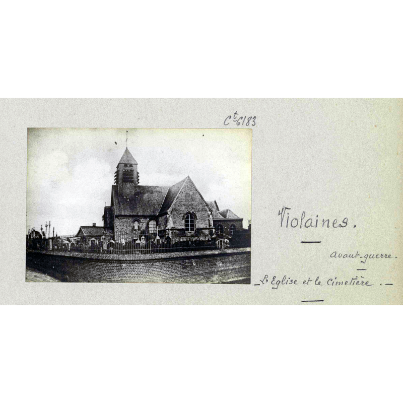
Violaines
Results: 3 records
view of church exterior in context - south view
Scene Description: Source caption: "Violaines. L'Eglise te le cimetière. Avant la guerre"
view of church exterior - west view
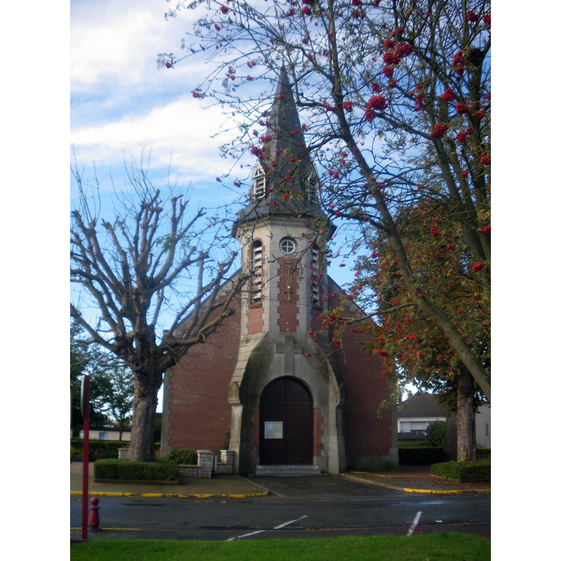
Scene Description: Source caption: "Vue de l'église Saint-Vaast de Violaines."
Copyright Statement: Image copyright © Floflo62, 2013
Image Source: digital photograph 20 October 2013 by Floflo62 [https://commons.wikimedia.org/wiki/File:Eglise_de_Violaines_-_1.JPG] [accessed 14 May 2022]
Copyright Instructions: CC-BY-SA-3.0
view of church exterior - northeast view
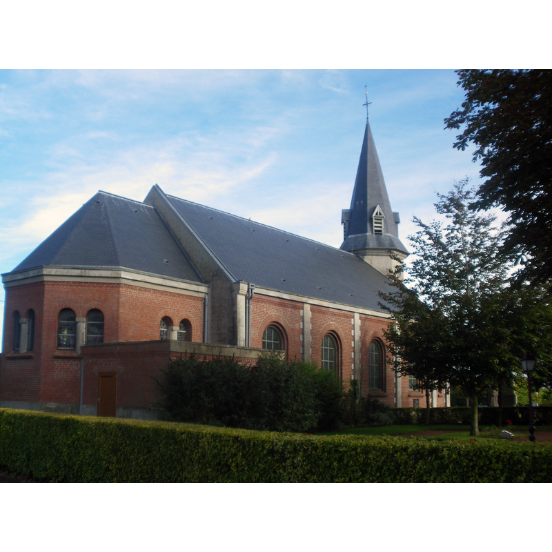
Scene Description: Source caption: "Vue de l'église Saint-Vaast de Violaines."
Copyright Statement: Image copyright © Floflo62, 2013
Image Source: digital photograph 20 October 2013 by Floflo62 [https://commons.wikimedia.org/wiki/File:Eglise_de_Violaines_-_3.JPG] [accessed 14 May 2022]
Copyright Instructions: CC-BY-SA-3.0
INFORMATION
Font ID: 23954VIO
Object Type: Baptismal Font1
Font Century and Period/Style: 12th - 13th century, Romanesque
Church / Chapel Name: Église paroissiale Saint-Vaast à Violaines
Font Location in Church: [cf. FontNotes]
Church Patron Saint(s): St. Vedast [aka Foster, Vaast, Vedastus]
Church Notes: church 12th, 13th, 16thC
Church Address: rue de la Grand'place, 62138 Violaines, France -- Tel.: +33 3 21 27 64 53
Site Location: Pas-de-Calais, Hauts-de-France, France, Europe
Directions to Site: Located off the D167E2 [aka rue de l'Eglise], W of the D947, 10 km E of Béthune, about 35 km SW of Lille
Ecclesiastic Region: Diocese d'Arras
Historical Region: Nord-Pas-de-Calais / Flandre française / Pays de L'Alloeu
Additional Comments: destroyed font? [cf. FontNotes]
Font Notes:
Click to view
Noted in Kees de Wildt's Doopvont de Beeldenstorm (2018: 114-120) as one of a number of baptismal fonts of the Westerkwartier (then part of Flanders, later in France) having been desecrated, damaged or destroyed during the Iconoclastic Fury of 1566. [NB: we have no information on the date or period of the font destroyed in the mid-16th century riots; it may have been the one from the medieval church here; we have no information on the present font in use in the present church, re-built after WWI]
Credit and Acknowledgements: We are grateful to Pol Herman for bringing this font to our attention and for his help in documenting it
COORDINATES
UTM: 31U 484926 5598633
Latitude & Longitude (Decimal): 50.539445, 2.787282
Latitude & Longitude (DMS): 50° 32′ 22″ N, 2° 47′ 14.21″ E
REFERENCES
- De Wildt, Kees, "Doopvont in de Beeldenstorm", Nederlandse Kerkgeschiedenis, 21, Tijdschrift voor, 2018, pp. 114-120.