Terdeghem / Terdegem
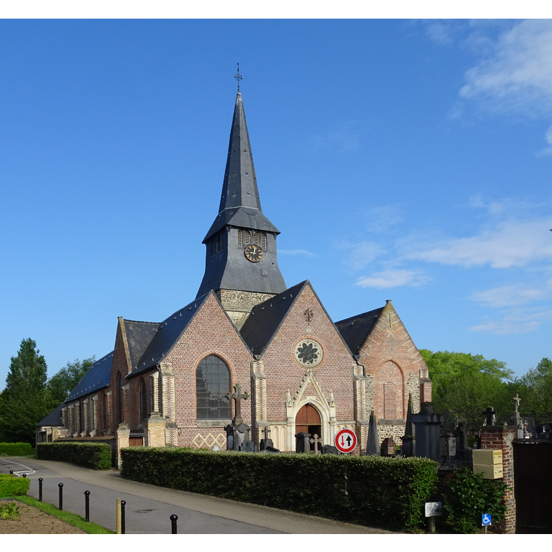
Image copyright © Pierre André Leclercq, 2021
CC-BY-SA-4.0
Results: 3 records
view of church exterior in context - northeast view
Scene Description: Source caption: "L'église Saint-Martin Terdeghem, Nord, France" [NB: the church was re-oriented in the 19thC, therefore the apse is at the west end]
Copyright Statement: Image copyright © Pierre André Leclercq, 2021
Image Source: edited detail of a digital photograph 17 May 2021 by Pierre André Leclercq [https://commons.wikimedia.org/wiki/File:Terdeghem.-_Église_Saint-Martin_en_2021_(2).JPG] [accessed 14 May 2022]
Copyright Instructions: CC-BY-SA-4.0
view of font and cover in context
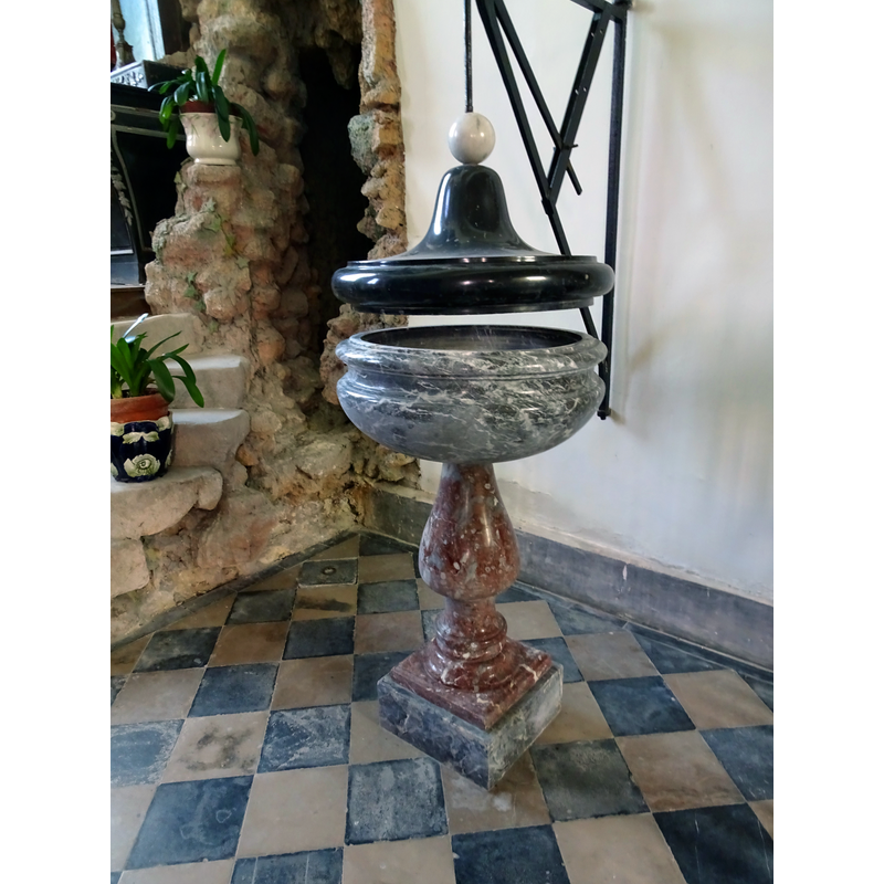
Scene Description: Source caption: "Baptistère de l'église Saint-Martin Terdeghem , Nord, France"
Copyright Statement: Image copyright © Pierre André Leclercq, 2019
Image Source: digital photograph 29 August 2019 by Pierre André Leclercq [https://commons.wikimedia.org/wiki/File:Terdeghem_L'_église_Saint-Martin_(baptistère).jpg] [accessed 14 May 2022]
Copyright Instructions: CC-BY-SA-4.0
view of church interior - looking west
![Source caption: "Nef centrale, chaire de prêche et chœur de l'église Saint-Martin Terdeghem , Nord, France" [NB: the church was re-oriented in the 19thC, therefore the apse is at the west end]](/static-50478a99ec6f36a15d6234548c59f63da52304e5/compressed/1220514008_compressed.png)
Scene Description: Source caption: "Nef centrale, chaire de prêche et chœur de l'église Saint-Martin Terdeghem , Nord, France" [NB: the church was re-oriented in the 19thC, therefore the apse is at the west end]
Copyright Statement: Image copyright © Pierre André Leclercq, 2021
Image Source: digital photograph 17 May 2021 by Pierre André Leclercq [https://commons.wikimedia.org/wiki/File:Terdeghem.-_Église_Saint-Martin_en_2021_(2).JPG] [accessed 14 May 2022]
Copyright Instructions: CC-BY-SA-4.0
INFORMATION
Font ID: 23953TER
Object Type: Baptismal Font1
Font Century and Period/Style: 16th - 18th century
Church / Chapel Name: Église paroissiale Saint-Martin à Terdeghem
Font Location in Church: Inside the church
Church Patron Saint(s): St. Martin of Tours
Church Notes: original church probably 12thC; re-built 16th-17thC; modified 19thC with the orientation change [apse at the west end now]
Church Address: pl. Saint-Martin, 59114 Terdeghem, France
Site Location: Nord, Hauts-de-France, France, Europe
Directions to Site: Located S of the D948, 5 km E of Cassel, 8 km N of Hazebrouck, about 45 km NW of Lille
Historical Region: Nord-Pas-de-Calais / Flandre française / Pays de L'Alloeu
Additional Comments: destroyed font? [cf. FontNotes]
Font Notes:
Click to view
Noted in Kees de Wildt's Doopvont de Beeldenstorm (2018: 114-120) as one of a number of baptismal fonts of the Westerkwartier (then part of Flanders, later in France) having been desecrated, damaged or destroyed during the Iconoclastic Fury of 1566. The present font in this church is of a type common in France, a style of font used from the 16th through the 18th century. [NB: we have no information on the font of the medieval church here; perhaps it was the one destroyed in the Iconoclastic Fury riots noted in the source above].
Credit and Acknowledgements: We are grateful to Pol Herman for bringing this font to our attention and for his help in documenting it
COORDINATES
UTM: 31U 467520 5627558
Latitude & Longitude (Decimal): 50.798855, 2.539113
Latitude & Longitude (DMS): 50° 47′ 55.88″ N, 2° 32′ 20.81″ E
REFERENCES
- De Wildt, Kees, "Doopvont in de Beeldenstorm", Nederlandse Kerkgeschiedenis, 21, Tijdschrift voor, 2018, pp. 114-120.