Nouvelle-Eglise / Harrawaye / Hereweg / Newkirke / Nieuwkerke
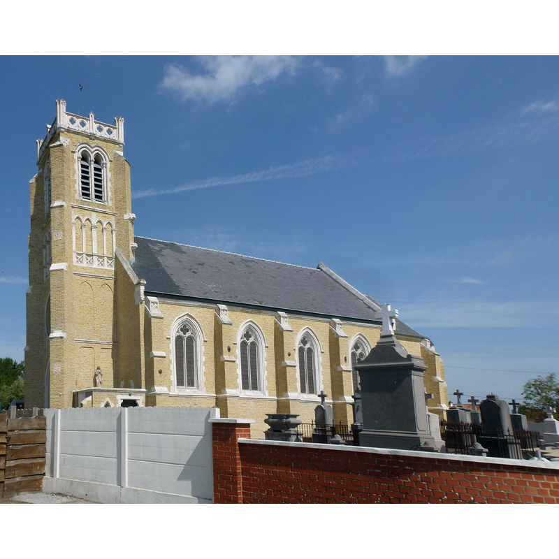
Image copyright © [in the public domain]
CC-Zero
Results: 2 records
view of church exterior - southwest view
Scene Description: Source caption: "Nouvelle-Église (Pas-de-Calais) église Notre-Dame-du-Mont- Carmel"
Copyright Statement: Image copyright © [in the public domain]
Image Source: digital photograph [edited] 21 August 2013 by Havang(nl) [https://commons.wikimedia.org/wiki/File:Nouvelle-Église_(Pas-de-Calais)_église_Notre-Dame-du-Mont-_Carmel_(02).JPG]
Copyright Instructions: CC-Zero
view of church interior
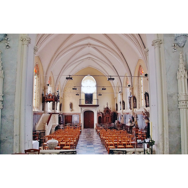
Scene Description: the modern font is partially visible in the foreground, left side; the church itself, of 1875 and much restored after WWI, had replaced earlier churches going back to the medieval period
Copyright Statement: Image copyright © Pierre Bastien, 2018
Image Source: digital photograph 23 June 2018 ny Pierre Bastien, reproduced in Communes [https://www.communes.com/photo-nouvelle-eglise,372864] [accessed 12 May 2022]
Copyright Instructions: CC-BY-SA-4.0
INFORMATION
Font ID: 23943EGL
Object Type: Baptismal Font1
Font Century and Period/Style: Medieval
Museum: Diocèse de Boulogne [formerly in the Diocèse de Thérouanne]
Church / Chapel Name: Église Notre-Dame-du-Mont- Carmel
Font Location in Church: [cf. FontNotes]
Church Patron Saint(s): St. Mary the Virgin
Church Notes: chapel documented her 9thC; 1875 church damaged in WWI
Church Address: 62162 Vieille-Église, France
Site Location: Pas-de-Calais, Hauts-de-France, France, Europe
Directions to Site: Located off the D219-D229 crossroads, 9-10 km E of Calais, 30 km W of Dunkirk, 35 km N of Saint-Omer
Historical Region: Nord-Pas-de-Calais / Flandre française
Additional Comments: destroyed font? (the one from the early church here)
Font Notes:
Click to view
Noted in Kees de Wildt's Doopvont de Beeldenstorm (2018: 114-120) as one of a number of baptismal fonts of the Westerkwartier (then part of Flanders, later in France) having been desecrated, damaged or destroyed during the Iconoclastic Fury of 1566. The present font in the much restored 1875 church is modern.
Credit and Acknowledgements: We are grateful to Pol Herman for bringing this font to our attention and for his help in documenting it
COORDINATES
UTM: 31U 433490 5641935
Latitude & Longitude (Decimal): 50.925219, 2.053667
Latitude & Longitude (DMS): 50° 55′ 30.79″ N, 2° 3′ 13.2″ E
REFERENCES
- De Wildt, Kees, "Doopvont in de Beeldenstorm", Nederlandse Kerkgeschiedenis, 21, Tijdschrift voor, 2018, pp. 114-120.