Lorgies
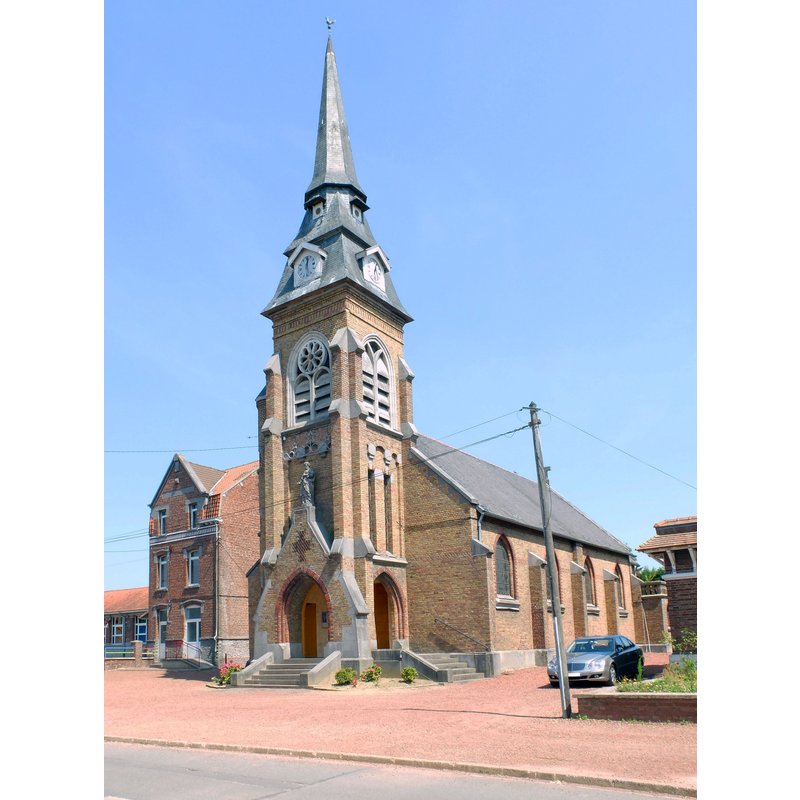
Image copyright © Floflo62, 2015
CC-BY-SA-4.0
Results: 2 records
view of church exterior - southwest view
Scene Description: Source caption: "Vue de l'église Saint-Mathieu de Lorgies."
Copyright Statement: Image copyright © Floflo62, 2015
Image Source: digital photograph 11 July 2015 by Floflo62 [https://commons.wikimedia.org/wiki/File:Lorgies_-_Eglise.JPG] [accessed 12 May 2022]
Copyright Instructions: CC-BY-SA-4.0
view of stoup
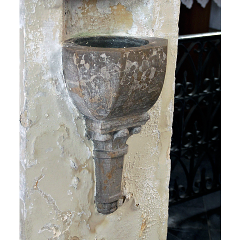
Scene Description: a wall-mounted stoup inside the modern church
Copyright Statement: Image copyright © Pierre Bastien, 2000
Image Source: digital photograph 1 January 2000 by Pierre Bastien, reproduced in Communnes [https://www.communes.com/photo-lorgies,186275] [accessed 12 May 2022]
Copyright Instructions: CC-BY-SA-4.0
INFORMATION
Font ID: 23941LOR
Object Type: Baptismal Font1
Font Century and Period/Style: 12th - 13th century, Romanesque
Church / Chapel Name: Église paeoissiale Saint-Matthieu à Lorgies
Font Location in Church: [cf. FontNotes]
Church Patron Saint(s): St. Matthew
Church Notes: church here described as 'ancienne' in the Dictionnaire historique et archéologique du département du Pas-de [...], (Arras, 1875), Volume 2, p. 234, with Romanesque archivolts in the portal of the tower
Church Address: 5 rue des Tronchants, 62840 Lorgies, France -- Tel.: +33 3 21 27 64 53
Site Location: Pas-de-Calais, Hauts-de-France, France, Europe
Directions to Site: Located off the D168 [aka rue des Tronchants], 15 km NNE of Béthune, just W of the departmental border with Nord, about 25 km WSW of Lille
Ecclesiastic Region: Diocèse de Lille
Historical Region: Nord-Pas-de-Calais / Pays de l'Alleu / Flandre française / Comté de Flandre
Additional Comments: destroyed font?
Font Notes:
Click to view
Noted in Kees de Wildt's Doopvont de Beeldenstorm (2018: 114-120) as one of a number of baptismal fonts of the Westerkwartier (then part of Flanders, later in France) having been desecrated, damaged or destroyed during the Iconoclastic Fury of 1566. A church with Romanesque traces is documented in the Dictionnaire historique et archéologique du département du Pas-de [...], (1875), Volume 2, p. 234. [NB: was the font of that time the one destroyed in the mid-16th century riots?]
Credit and Acknowledgements: We are grateful to Pol Herman for bringing this font to our attention and for his help in documenting it
COORDINATES
UTM: 31U 485167 5601814
REFERENCES
- De Wildt, Kees, "Doopvont in de Beeldenstorm", Nederlandse Kerkgeschiedenis, 21, Tijdschrift voor, 2018, pp. 114-120.