Ghyvelde / Ghivelde / Gijvelde
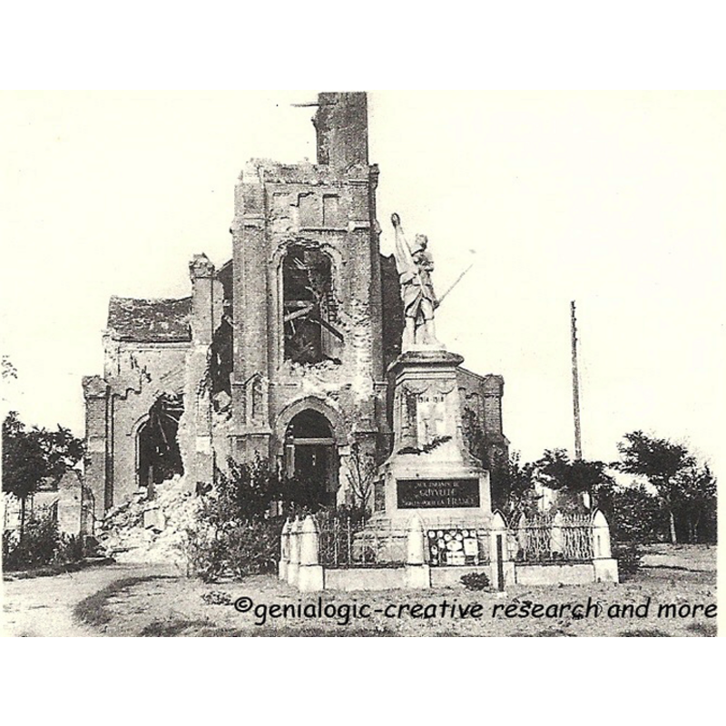
Image copyright © genealogic, 2022
No known copyright restriction / Fair Dealing
Results: 5 records
view of church exterior - west view
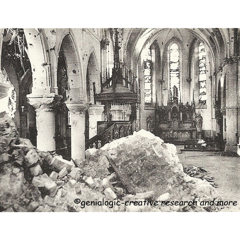
Scene Description: Source caption: "Kirche St. Vincentius, Ghyvelde - Innenansicht nach dem Luftangriff, Westfeldzug 1940. Na het bombardement in 1940 , de binnenkant van de kerk in Gijvelde - Après le bombardement en 1940, Intérieur de l'église Saint Vincent de Ghyvelde (Foto: Eigenopname van Laarmans en Dasseville, Oostende)"
Copyright Statement: Image copyright © genealogic, 2022
Image Source: digital image of a B&W photograph (Foto: Eigenopname van Laarmans en Dasseville, Oostende) reproduced in genealogic [https://www.genialogic.de/fr/imagesfr/ghyvelde-impressionen-und-historische-bilder.html#null] [accessed 11 May 2022]
Copyright Instructions: No known copyright restriction / Fair Dealing
view of church exterior in context - northwest view
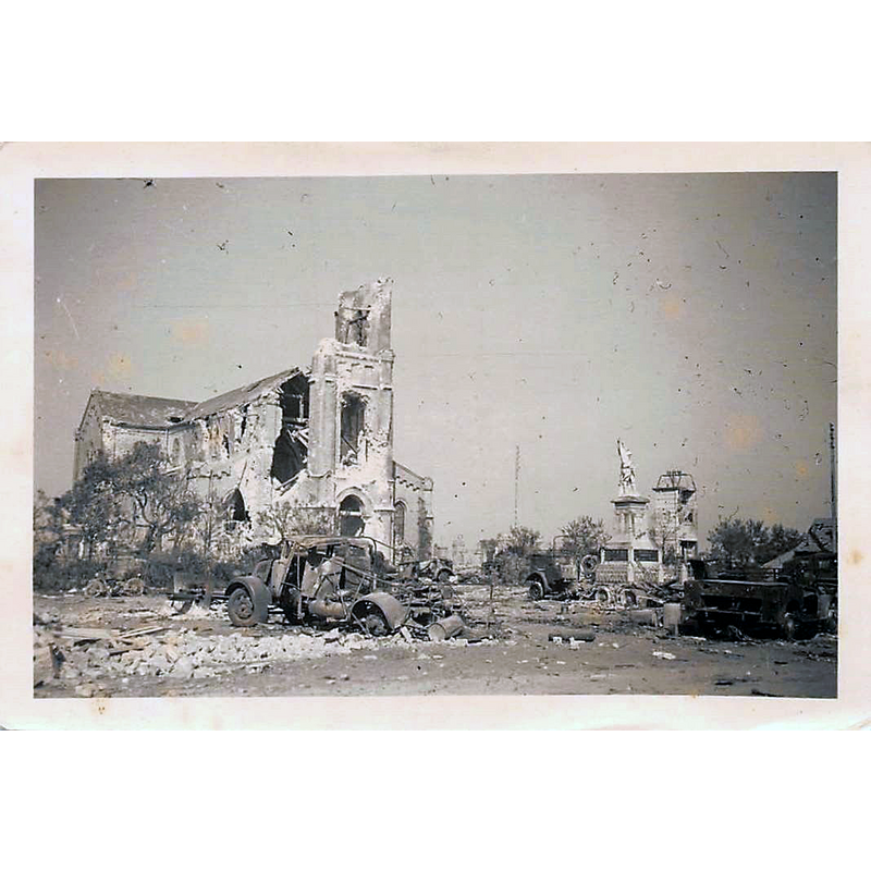
Scene Description: the 1872 building was destroyed in WWII; replaced by new church consecrated in 1958
Copyright Statement: Image copyright © [in the public domain]
Image Source: digital image of an undated [pre-1946] B&W photograph [origin not available] reproduced in Skycraper City [https://www.skyscrapercity.com/threads/aide-moi-didentifier-lÉglise-de-france-1940-1942.1842954/page-2] [accessed 11 May 2022]
Copyright Instructions: Assumed PD
view of church exterior - northeast view
![Source caption: "Eglise Saint-Vincent à Ghyvelde [...] Nord, Nord-Pas-de-Calais, France." -- the new church, consecrated 1958 replaced the earlier church destroyed in WWII](/static-50478a99ec6f36a15d6234548c59f63da52304e5/compressed/1220511009_compressed.png)
Scene Description: Source caption: "Eglise Saint-Vincent à Ghyvelde [...] Nord, Nord-Pas-de-Calais, France." -- the new church, consecrated 1958 replaced the earlier church destroyed in WWII
Copyright Statement: Image copyright © LimoWreck, 2007
Image Source: digital photograph 13 September 2007 by LimoWreck [https://commons.wikimedia.org/wiki/File:Ghyvelde_-_Eglise_Saint-Vincent_2.jpg] [accessed 11 May 2022]
Copyright Instructions: GFDL / CC-BY-SA-3.0
view of church interior - looking east
Scene Description: Source caption: "Kirche St. Vincentius, Ghyvelde - nach dem Luftangriff, Westfeldzug 1940. Na het bombardement in 1940 , de kerk in Gijvelde - Après le bombardement en 1940, l'église Saint Vincent de Ghyvelde. Devant l'église: monument aus morts 1914-1918 : Aux enfants de Ghyvelde morts pour la France (Foto: Eigenopname van Laarmans en Dasseville, Oostende)"
Copyright Statement: Image copyright © genealogic, 2022
Image Source: digital image of a B&W photograph (Foto: Eigenopname van Laarmans en Dasseville, Oostende) reproduced in genealogic [https://www.genialogic.de/fr/imagesfr/ghyvelde-impressionen-und-historische-bilder.html#null] [accessed 11 May 2022]
Copyright Instructions: No known copyright restriction / Fair Dealing
view of church interior - looking east
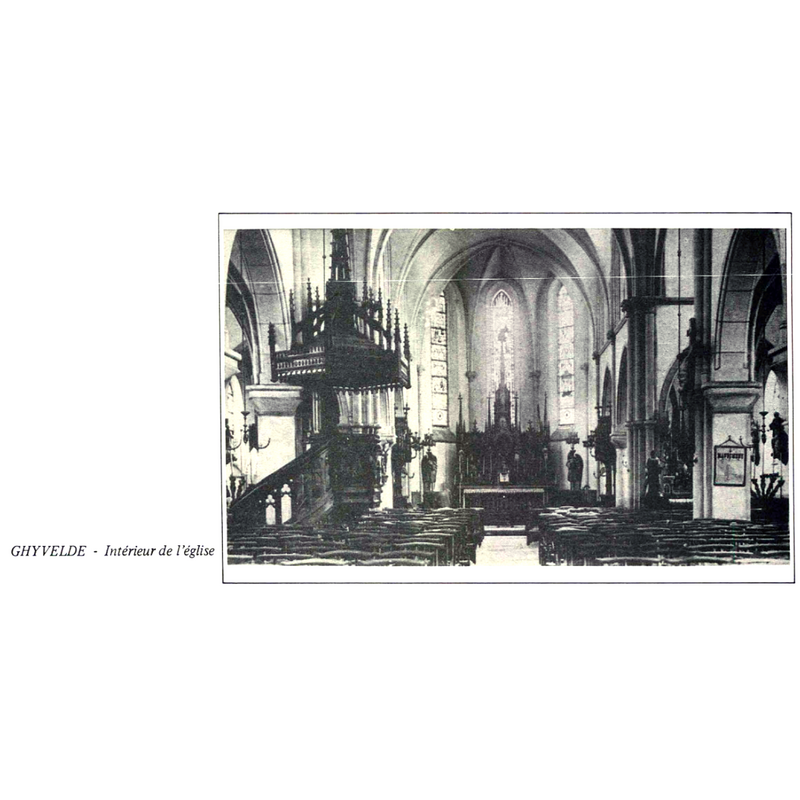
Scene Description: the interior of the 1872 church; the building would be destroyed in WWII
Copyright Statement: Image copyright © [in the public domain]
Image Source: digital image of an undated B&W photograph [original source unknown] reproduced in Robert Noote's Le Père Frédéric Janssoone de Ghyvelde [https://perefrederic.ca/wp-content/uploads/2019/05/SL1983.pdf] [accessed 11 May 2022]
Copyright Instructions: Assumed PD
INFORMATION
Font ID: 23932GHY
Object Type: Baptismal Font1
Church / Chapel Name: Église paroissiale Saint-Vincent
Font Location in Church: [cf. FontNotes]
Church Patron Saint(s): St. Vincent
Church Notes: 10thC Romanesque church; re-built 1802; demolished; re-built 1872 on a new site; destroyed in WWII; re-built on the site of the old cemetery; consecrated 1958;
Church Address: rue Nationale, 59254 Ghyvelde, France -- Tel.: 0328265140
Site Location: Nord, Hauts-de-France, France, Europe
Directions to Site: Located off the D2-D947A crossroads, about 14 km E of Dunkirk
Ecclesiastic Region: Diocèse de Lille [since 1929]
Additional Comments: destroyed font [cf. FontNotes]
Font Notes:
Click to view
Noted in Kees de Wildt's Doopvont de Beeldenstorm (2018: 114-120) as one of a number of baptismal fonts of the Westerkwartier (then part of Flanders, later in France) having been desecrated, damaged or destroyed during the Iconoclastic Fury of 1566. [NB: we have no information on the font in use in this church at the time when the building was destroyed in WWII; was it the font of the original medieval church? or, had that one been destroyed in the mid-16th- century riots?]
Credit and Acknowledgements: We are grateful to Pol Herman for bringing this font to our attention and for his help in documenting it
COORDINATES
UTM: 31U 466750 5655677
Latitude & Longitude (Decimal): 51.051661, 2.525625
Latitude & Longitude (DMS): 51° 3′ 5.98″ N, 2° 31′ 32.25″ E
REFERENCES
- De Wildt, Kees, "Doopvont in de Beeldenstorm", Nederlandse Kerkgeschiedenis, 21, Tijdschrift voor, 2018, pp. 114-120.