Festubert / Festhubert / Fresthubert / Frestubert
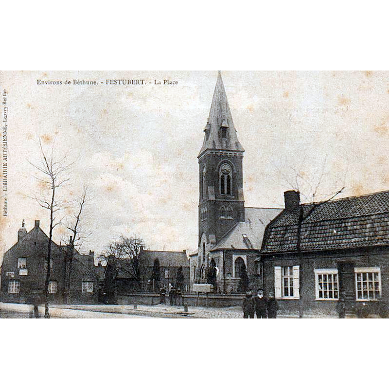
Image copyright © [in the public domain]
PD / Image dans le domaine public
Results: 2 records
view of church exterior in context - southwest end
Scene Description: Source caption: "L'église de Festubert, carte postale ancienne [...] Coll. particulière [...] Date Inconnue" [NB: the whole village was destroyed in May 1915 -- a new church was built after the war, ca. 1927, when the village itself was re-built]
Copyright Statement: Image copyright © [in the public domain]
Image Source: digital image of an undated [pre-May 1915] postcard [http://www.wikipasdecalais.fr/index.php?title=Fichier:Festubert_eglise.jpg] [accessed 11 May 2022]
Copyright Instructions: PD / Image dans le domaine public
view of church exterior - west view
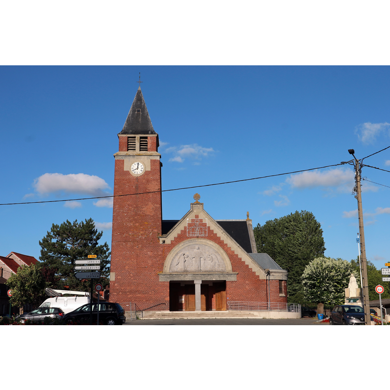
Scene Description: Source caption: "Festubert — Église Notre-Dame – Façade Ouest. L'ancienne église de Festubert ayant subi les ravages de la Grande Guerre de 1914-1918 a été remplacée par un édifice ouvert aux fidèles en 1926 "
Copyright Statement: Image copyright © Jpcuvelier, 2020
Image Source: digital photograph 5 July 2020 by Jpcuvelier [https://commons.wikimedia.org/wiki/File:Festubert_(France_-_dép._du_Nord)_—_Église_Notre-Dame_–.jpg] [accessed 11 May 2022]
Copyright Instructions: CC-BY-SA-4.0
INFORMATION
Font ID: 23931FRE
Object Type: Baptismal Font1
Font Century and Period/Style: 15th - 16th century, Late Gothic
Church / Chapel Name: Rglise paroissiale Notre-Dame
Font Location in Church: [destroyed]
Church Patron Saint(s): St. Mary the Virgin
Church Notes: original church may have been 15thC; the whole village practically destroyed in May 1915; village and church re-built thereafter
Church Address: Grand rue, 62149 Festubert, France -- Tel.: +33 3 21 65 17 22
Site Location: Pas-de-Calais, Hauts-de-France, France, Europe
Directions to Site: Located off the D72-D166 crossroads, 8 km W of Béthune, 34 km SW of Lille
Ecclesiastic Region: Diocese d'Arras
Historical Region: Nord-Pas-de-Calais / Artois
Additional Comments: destroyed font [cf. FontNotes]
Font Notes:
Click to view
Noted in Kees de Wildt's Doopvont de Beeldenstorm (2018: 114-120) as one of a number of baptismal fonts of the Westerkwartier (then part of Flanders, later in France) having been desecrated, damaged or destroyed during the Iconoclastic Fury of 1566. The whole village, including the church, destroyed in May 1915 [NB: font assumed destroyed as well].
***SOME SOURCES GIVE THE DEPT. AS NORD -- IT IS VERY NEAR THE DIVISION LINE***
***SOME SOURCES GIVE THE DEPT. AS NORD -- IT IS VERY NEAR THE DIVISION LINE***
Credit and Acknowledgements: We are grateful to Pol Herman for bringing this font to our attention and for his help in documenting it
COORDINATES
UTM: 31U 481354 5599133
Latitude & Longitude (Decimal): 50.543841, 2.736851
Latitude & Longitude (DMS): 50° 32′ 37.83″ N, 2° 44′ 12.67″ E