Meteren nr. West Betuwe
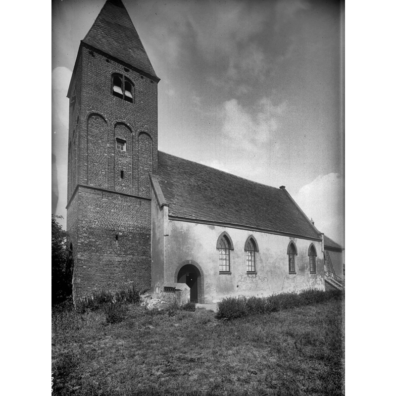
Image copyright © Rijksdienst voor het Cultureel Erfgoed, 2022
CC-BY-SA-4.0
Results: 4 records
view of church exterior - southwest view
Scene Description: Source caption: "Nederlands Hervormde Kerk: Overzicht van kerk en kerktoren met tentdak, vanuit het zuidwesten"
Copyright Statement: Image copyright © Rijksdienst voor het Cultureel Erfgoed, 2022
Image Source: digital image of an August 1911 B&W photograph by G. de Hoog, in the Rijksdienst voor het Cultureel Erfgoed [https://commons.wikimedia.org/wiki/File:Overzicht_van_kerk_en_kerktoren_met_tentdak,_vanuit_het_zuidwesten_-_Meteren_-_20409696_-_RCE.jpg] [accessed 11 May 2022]
Copyright Instructions: CC-BY-SA-4.0
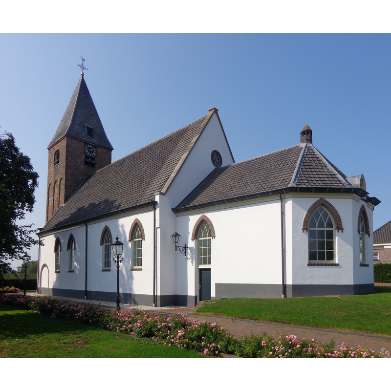
view of church exterior - southeast view
Copyright Statement: Image copyright © HenkvD, 2020
Image Source: digital photograph 14 September 2020 by HenkvD [https://commons.wikimedia.org/wiki/File:Meteren_NH_Kerk.jpg] [accessed 11 May 2022]
Copyright Instructions: CC-BY-SA-4.0
view of font in context
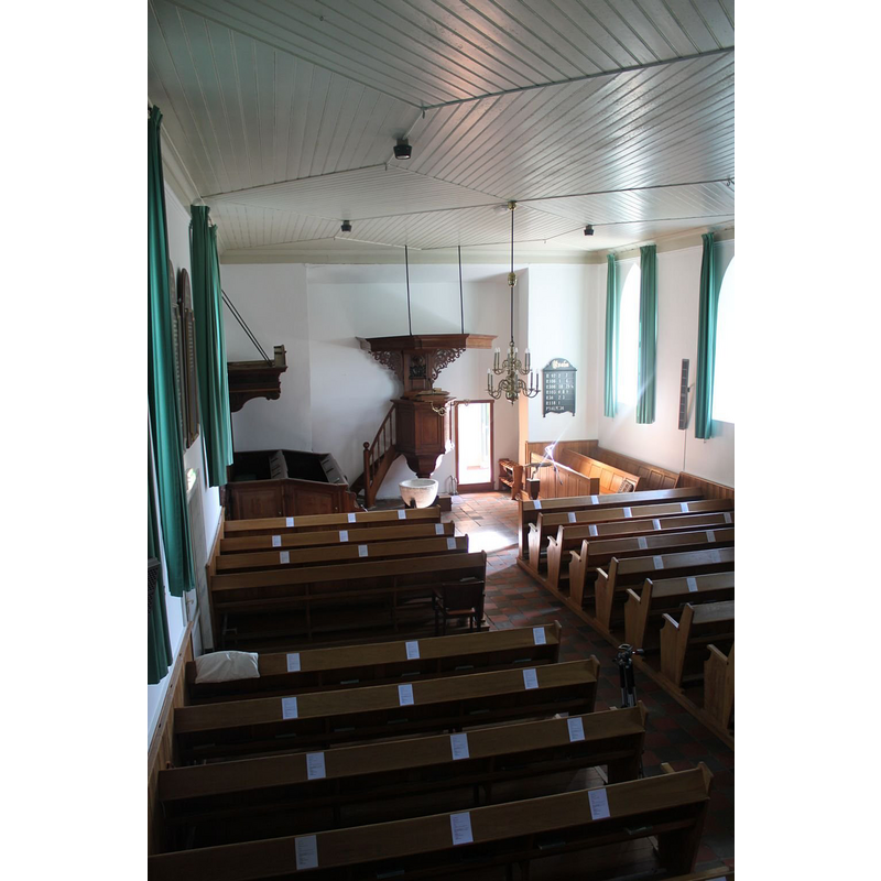
Scene Description: the modern font in use
Copyright Statement: Image copyright © Michiel van 't Einde, 2011
Image Source: digital photograph 2 September 2011 by Michiel van 't Einde, in Reliwiki [https://reliwiki-nl.translate.goog/index.php/Bestand:Meteren_HV_008.jpg?_x_tr_sl=nl&_x_tr_tl=en&_x_tr_hl=en&_x_tr_pto=sc] [accessed 11 May 2022]
Copyright Instructions: No known copyright restriction / Fair Dealing
view of font in context
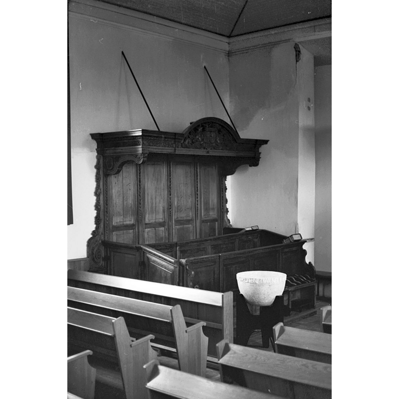
Scene Description: the modern font in use
Copyright Statement: Image copyright © Rijksdienst voor het Cultureel Erfgoed, 2022
Image Source: digital image of an April 1967 B&W photograph by DIJKSTRA (Fotograaf), in the Rijksdienst voor het Cultureel Erfgoed [https://commons.wikimedia.org/wiki/File:Herenbank_-_Meteren_-_20153537_-_RCE.jpg] [accessed 11 May 2022]
Copyright Instructions: CC-BY-SA-4.0
INFORMATION
Font ID: 23929MET
Object Type: Baptismal Font1
Font Century and Period/Style: 14th century, Gothic
Church / Chapel Name: PKN Hervormde Kerk
Font Location in Church: [cf. FontNotes]
Church Notes: 14thC tower; church much modified 19thC -- Rijksmonument [number 16509]
Church Address: Dorpsstraat 16, 4194 TD Meteren, Netherlands
Site Location: Gelderland, Netherlands, Europe
Directions to Site: Located off (N) highway A15/E31, in the SW outskirts of Geldermalsen, in the municipality of West Betuwe, 20 km W of Tiel, about 20 km N of 's-Hertogenbosch
Additional Comments: disappeared / destroyed font? the one from the medieval church here [cf. FontNotes])
Font Notes:
Click to view
Noted in Kees de Wildt's Doopvont de Beeldenstorm (2018: 114-120) as one of a number of baptismal fonts of the Westerkwartier (then part of Flanders, later in France) having been desecrated, damaged or destroyed during the Iconoclastic Fury of 1566.
Credit and Acknowledgements: We are garteful to Pol Herman for bringing this font to our attention and for his help in documenting it
COORDINATES
UTM: 31U 657160 5748363
Latitude & Longitude (Decimal): 51.863889, 5.2825
Latitude & Longitude (DMS): 51° 51' 50" N, 5° 16' 57" E
REFERENCES
- De Wildt, Kees, "Doopvont in de Beeldenstorm", Nederlandse Kerkgeschiedenis, 21, Tijdschrift voor, 2018, pp. 114-120.