Meteren nr. Bailleul / Matrenes / Méteren (Nord)
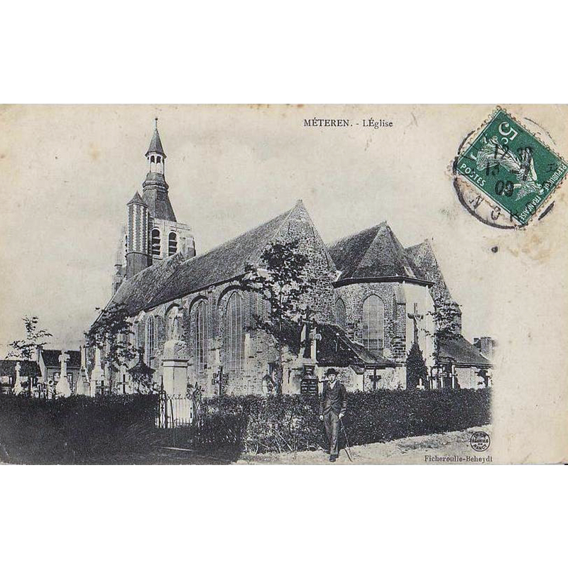
Image copyright © Commune de Méteren, 2022
CC-BY-NC-SA-2.0-FR
Results: 3 records
view of church exterior - southeast view
Scene Description: Source caption: "Méteren. L'église" -- the 16thC church was destroyed in April 1918 bombings
Copyright Statement: Image copyright © Commune de Méteren, 2022
Image Source: digital image of an undated [pre-April 1918] postcard reproduced in Commune de Méteren [https://ville-meteren.fr/fr/rb/982230/paroisse-et-lieux-de-culte-1] [accessed 11 May 2022]
Copyright Instructions: CC-BY-NC-SA-2.0-FR
view of church exterior in context - south view
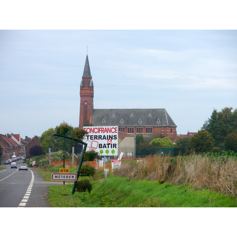
Scene Description: Source caption: "Vue du panneau d'entrée de la commune de Méteren. Au fond, se trouve l'église de la commune." -- the new church consecrated in 1927 replaced the earlier church destroyed in April 1918 bombings
Copyright Statement: Image copyright © Floflo62, 2013
Image Source: digital photograph 19 October 2013 by Floflo62 [https://commons.wikimedia.org/wiki/File:Panneau_d'entrée_de_Méteren.JPG] [accessed 11 May 2022]
Copyright Instructions: CC-BY-SA-3.0
view of font in context
![[NB: this font was destroyed in the April 1918 that destroyed the whole church]](/static-50478a99ec6f36a15d6234548c59f63da52304e5/compressed/1220510011_compressed.png)
Scene Description: [NB: this font was destroyed in the April 1918 that destroyed the whole church]
Copyright Statement: Image copyright © [in the public domain]
Image Source: digital image of an undated [pre-April 1918] B&W photograph [source not available] supplied by Pol Herman
Copyright Instructions: Assumed PD
INFORMATION
Font ID: 23928NET
Object Type: Baptismal Font1
Font Century and Period/Style: 16th century, Late Gothic
Church / Chapel Name: Église paroissiale Saint-Pierre-Saint-Paul de Méteren [Saint-Martin de Méteren?]
Font Location in Church: [destroyed in 1918]
Church Patron Saint(s): St. Peter & St. Paul [St. Martin of Tours?]
Church Notes: 1550 church replaced the medieval church of unknown date; damaged August 1566 by the iconoclasts; restored 1617; contents sold and church sold 1793; used as hospital by the German army; destroyed by bombs April 1918; new church consecrated 1927
Church Address: 10 rue de l'Haeghe Doorne, 59270 Méteren, France
Site Location: Nord, Hauts-de-France, France, Europe
Directions to Site: Located off (E) the D18, S of the D933 [aka rue Nationale], N of highway A25/E42, 2 km W of Bailleul, 4-5 km W of the border with Belgium, 40 km from Lille
Historical Region: Nord-Pas-de-Calais
Additional Comments: destroyed font? (the one from the 16thC church was destroyed April 1918) -- disappeared font (the medieval font)
Font Notes:
Click to view
Noted in Kees de Wildt's Doopvont de Beeldenstorm (2018: 114-120) as one of a number of baptismal fonts of the Westerkwartier (then part of Flanders, later in France) having been desecrated, damaged or destroyed during the Iconoclastic Fury of 1566. A 16th-century font [cf. ImagesArea] and the whole church were desroyed in April 1918 bombings; the font appears to be one of late-Gothic design.
A communication from Pol Herman to BSI (e-mail 0f 3 May 2022) expands on the destruction caused by the 1566 riots to the then new church, a long list of details which conclude with: "L’église, toute neuve, a été saccagée de fond en comble, les cloches emportées, les vitraux brisés, il faudra attendre 1617 pour qu’elle retrouve sa beauté initiale." Pol Herman further notes that the parish church was destroyed by bombardment in April 1918, in which the font was destroyed.
[NB: we have no information on the original font of the medieval church here].
Credit and Acknowledgements: We are garteful to Pol Herman for bringing this font to our attention and for his help in documenting it
COORDINATES
UTM: 31U 478205 5620965
Latitude & Longitude (Decimal): 50.740064, 2.691121
Latitude & Longitude (DMS): 50° 44′ 24.23″ N, 2° 41′ 28.04″ E
MEDIUM AND MEASUREMENTS
Material: stone
Font Shape: octagonal, mounted
Basin Exterior Shape: octagonal
REFERENCES
- De Wildt, Kees, "Doopvont in de Beeldenstorm", Nederlandse Kerkgeschiedenis, 21, Tijdschrift voor, 2018, pp. 114-120.