Xaffevillers / Chaféviler / Safleviller / Sasleviller / Xaffévillers / Xaflaviller / Xefflevilleir / Xeufflevillers
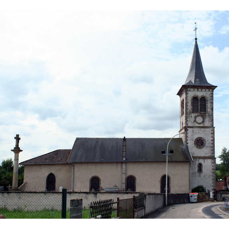
Image copyright © Coyau, 2009
GFDL / CC-BY-SA-3.0,2.5,2.0,1.0
Results: 2 records
view of church exterior in context - north view
Scene Description: Source caption: "Église de Xaffévillers (Vosges), cimetière au premier plan à gauche"
Copyright Statement: Image copyright © Coyau, 2009
Image Source: digital photograph [edited] 3 August 2009 by Coyau [https://commons.wikimedia.org/wiki/File:Xaffévillers_église_01_photoStitch.jpg] [accessed 1 May 2022]
Copyright Instructions: GFDL / CC-BY-SA-3.0,2.5,2.0,1.0
view of font in context
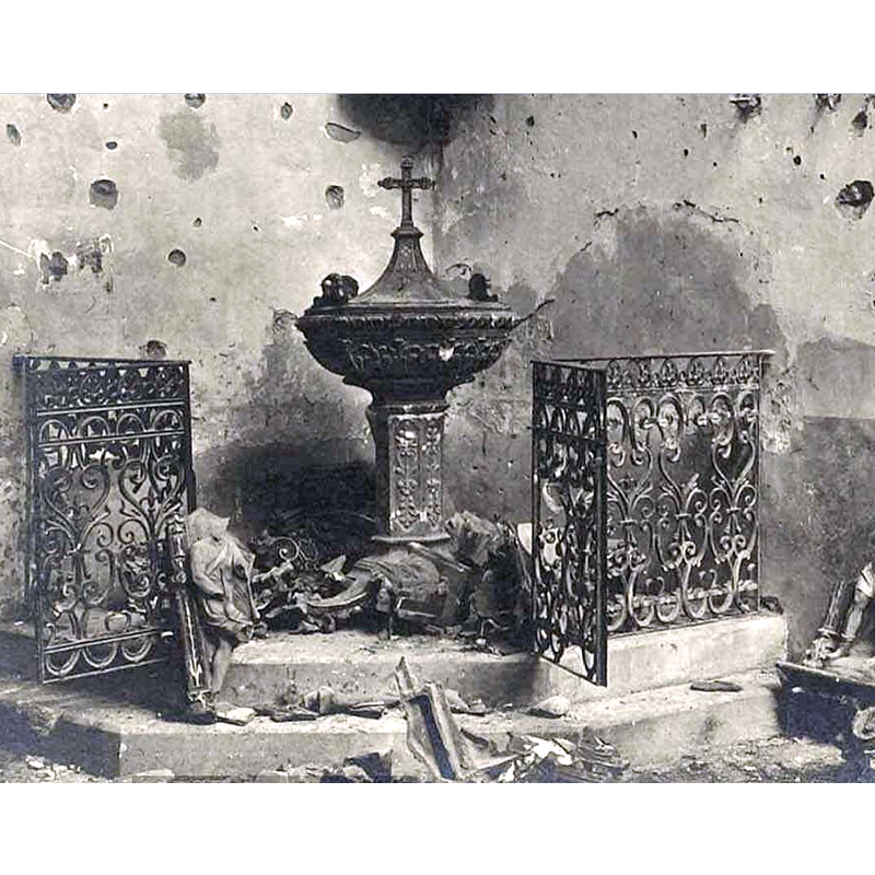
Scene Description: the original photograph of the modern font in Xaffévillers is probably in one of WWI war retribution archives; we were unable to locate its exact location
Copyright Statement: Image copyright © Archives de France, 2022
Image Source: digital image of a 31 August 2015 photograph probably in Archives France [not corroborated] provided by Pol Herman
Copyright Instructions: Assumed PD
INFORMATION
Font ID: 23904XAF
Object Type: Baptismal Font1?
Font Century and Period/Style: 13th century, Medieval
Church / Chapel Name: Église Saint-Gengoult
Font Location in Church: [disappeared]
Church Patron Saint(s): St. Gangulphus [aka Gangolf, Gengoul, Gengoult]
Church Notes: medieval church documented in 1294 as a gift to the Abbaye d'Etival; present church is modern
Church Address: rue de l'Eglise, 88700 Xaffévillers, France
Site Location: Vosges, Grand Est, France, Europe
Directions to Site: Located off the D9, E of the D414 and the departmental border with Meurthe-et-Moselle, 8 km N of Rambervillers, about 45 km SE of Nancy
Ecclesiastic Region: Diocèse de Saint-Dié
Historical Region: Région de Rambervillers / Lorraine
Additional Comments: disappeared? (the one from the medieval church here)
Font Notes:
Click to view
The medieval church at Xaffévillers is mentioned in 1294 as a gift to the Abbaye d'Etival in Henri Lepage and Charles Charton's Le Department des Vosges, statistique, historique et administrative (Nancy, 1845, deux. partie, p. 549). The present font, damaged in WWI is modern, probably 19th-century. [NB: we have no information on the font of the medieval church here].
Credit and Acknowledgements: We are grateful to Pol Herman for bringing this font to our attention
COORDINATES
UTM: 32U 323407 5364403
Latitude & Longitude (Decimal): 48.40802, 6.613705
Latitude & Longitude (DMS): 48° 24′ 28.87″ N, 6° 36′ 49.34″ E