Luyksgestel
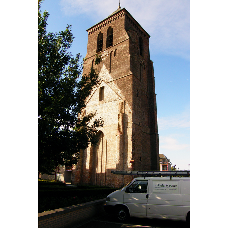
Image copyright © MHB Verkuijlen, 2010
CC-BY-SA-3.0-NL
Results: 2 records
view of church exterior - tower - northeast view
Scene Description: the contour of the demolished nave is discernible on the east side of the tower
Copyright Statement: Image copyright © MHB Verkuijlen, 2010
Image Source: digital photograph 20 September 2010 by MHB Verkuijlen [https://commons.wikimedia.org/wiki/File:T.T_Toren_RK_Kerk_Luyksgestel_(9).JPG] [accessed 20 March 2022]
Copyright Instructions: CC-BY-SA-3.0-NL
view of church exterior in context
![Source caption: "Heilige Martinus: Overzicht van de westgevel (opmerking: Gefotografeerd voor Monumenten van Herrezen Nederland)" [NB: the 15thC tower was retained when the old church was demolished in 1842]](/static-50478a99ec6f36a15d6234548c59f63da52304e5/compressed/1220320001_compressed.png)
Scene Description: Source caption: "Heilige Martinus: Overzicht van de westgevel (opmerking: Gefotografeerd voor Monumenten van Herrezen Nederland)" [NB: the 15thC tower was retained when the old church was demolished in 1842]
Copyright Statement: Image copyright © Rijksdienst voor het Cultureel Erfgoed, 2007
Image Source: digital photograph 2007 by Sergé Technau,
in the Rijksdienst voor het Cultureel Erfgoed [https://commons.wikimedia.org/wiki/File:Overzicht_van_de_westgevel_-_Luyksgestel_-_20421946_-_RCE.jpg] [accessed 20 March 2022]
Copyright Instructions: CC-BY-SA-4.0
INFORMATION
Font ID: 23835LUY
Object Type: Baptismal Font1, base only?
Font Century and Period/Style: 15th century, Late Gothic
Church / Chapel Name: Oude Martinuskerk [demolished 1842]
Font Location in Church: [cf. FontNotes]
Church Patron Saint(s): St. Martin of Tours
Church Notes: 15thC(?) church; badly damaged by fire 1 April 1840; demolished 1842 except for the tower; new replacement church completed 1958 and now listed [Monumentnummer: 530925 R.K. St. Martinuskerk]; old tower also listed [Rijksmonument ID: 26322]
Church Address: Kerkstraat 98/100, 5575 AZ Luyksgestel, Netherlands -- Tel.: +31 497 571 828
Site Location: Noord-Brabant, Netherlands, Europe
Directions to Site: Located S of the E34/A67, about 20 km SW of Eindhoven
Additional Comments: disappeared font? [cf. FontNotes]
Font Notes:
Click to view
A communication from Pol Hermans to BSI (e-mail of 19 March 2022) refers to GESCHIEDENIS VAN NOORDBRABANT Door Peter Norbertus Panken te Bergeik, vernieuwd en gerangschikt, 1898, Stichting Cultureel Brabant (CuBra), gedigitaliseerd door Johan Biemans, which reports that "After the fire of the church – April 1, 1840 – the basin of the old baptismal font lay in the sacristy for some time." There is no information about its current whereabouts; presumed lost.
COORDINATES
UTM: 31U 661793 5684607
Latitude & Longitude (Decimal): 51.28978, 5.32036
Latitude & Longitude (DMS): 51° 17′ 23.21″ N, 5° 19′ 13.3″ E