Sassenheim No. 1 / Sassenhaym / Sassenhem
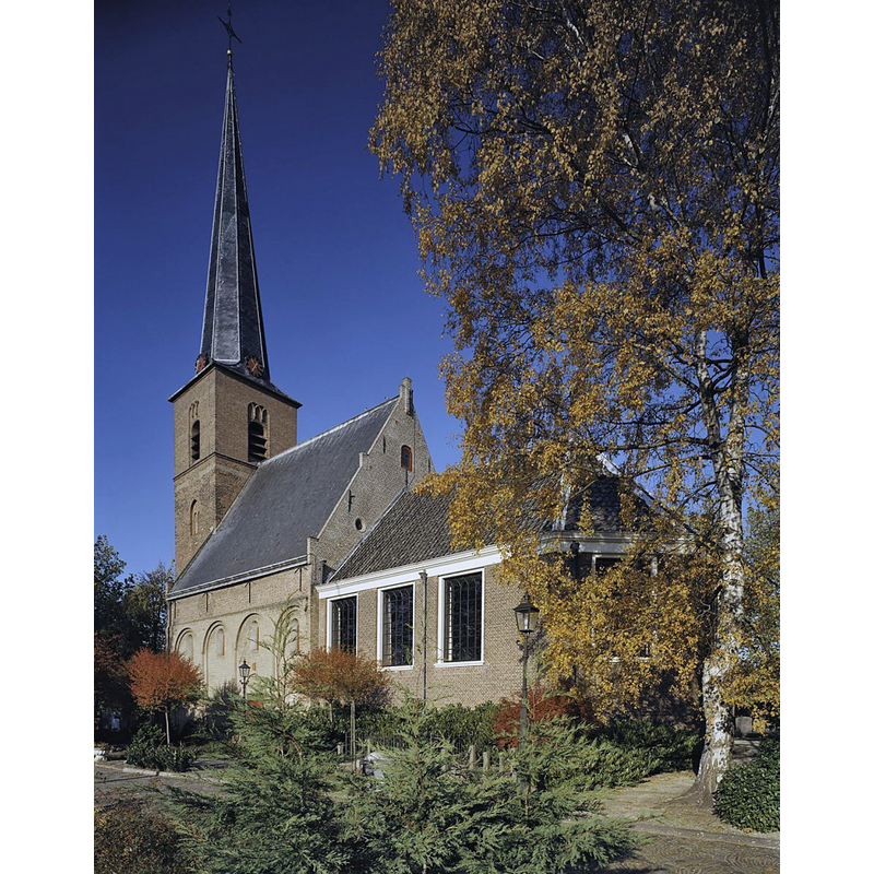
Image copyright © Rijksdienst voor het Cultureel Erfgoed, 2022
CC-BY-SA-4.0
Results: 2 records
view of church exterior - southeast view
Scene Description: Source caption: "Nederlands Hervormde Kerk: Overzicht zuidgevel met consistorie als aanbouw (opmerking: Gefotografeerd voor Monumenten In Nederland Zuid-Holland)"
Copyright Statement: Image copyright © Rijksdienst voor het Cultureel Erfgoed, 2022
Image Source: digital photograph October 2003 by Gerard Dukker, in the Rijksdienst voor het Cultureel Erfgoed [https://commons.wikimedia.org/wiki/File:Overzicht_zuidgevel_met_consistorie_als_aanbouw_-_Voorhout_-_20365859_-_RCE.jpg] [accessed 2 March 2022]
Copyright Instructions: CC-BY-SA-4.0
view of church exterior - north view
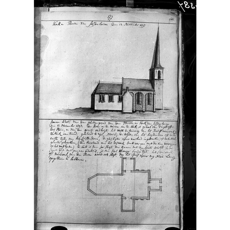
Scene Description: Source caption: "Nederlands Hervormde Kerk: kerk, plattegrond en opstand Hs.Verhees"
Copyright Statement: Image copyright © Rijksdienst voor het Cultureel Erfgoed, 2022
Image Source: digital image of a 1920 drawing by Hs. Verhees, in the Rijksdienst voor het Cultureel Erfgoed
Copyright Instructions: CC-BY-SA-4.0
INFORMATION
Font ID: 23793SAS
Object Type: Baptismal Font1?
Font Century and Period/Style: 12th - 13th century, Romanesque
Church / Chapel Name: Hervormde Dorfskerk
Font Location in Church: [disappeared]
Church Patron Saint(s): [originally dedicated to St. Pancras]
Church Notes: original stone church 12thC; re-built 13thC with tower added; destroyed 1573; re-built 1595; enlarged 1720; restored 1971-1973 -- listed church [Monumentnummer: 33032]
Church Address: Hoofdstraat 217, 2171 CM Sassenheim, Netherlands -- Tel.: +31 252 211 843
Site Location: Zuid-Holland, Netherlands, Europe
Directions to Site: Located off (W) the N208, N of highway A44, in the municipality of Teylingen, 7-8 km NNE of Leiden
Additional Comments: disappeared font? / destroyed font (in 1573?)
Font Notes:
Click to view
There is no mention of a baptismal font in this church in E.H. ter Kuile's Leiden en Westelijk Rijnland (1944) [https://www.dbnl.org/tekst/kuil005prov02_01/kuil005prov02_01_0021.php#660] [accessed 2 March 2022]. [NB: we have no information on the medieval font of this church, possibly lost when the whole medieval church was destroyed in 1573].
COORDINATES
UTM: 31U 603828 5787083
Latitude & Longitude (Decimal): 52.224372, 4.520075
Latitude & Longitude (DMS): 52° 13′ 27.74″ N, 4° 31′ 12.27″ E