Sassenheim No. 2 / Sassenhaym / Sassenhem
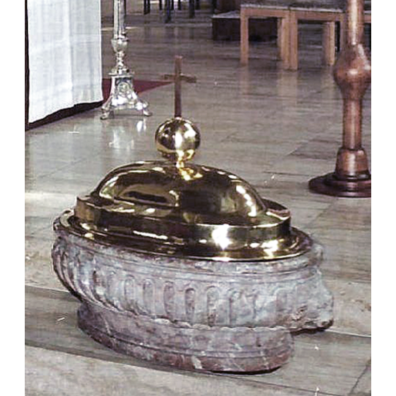
Image copyright © André van Dijk Veenendaal, 2022
No known copyright restriction / Fair Dealing
Results: 3 records
view of font and cover
Scene Description: [cf. FontNotes]
Copyright Statement: Image copyright © André van Dijk Veenendaal, 2022
Image Source: edited detail of a digital image of a 1988 photograph by André van Dijk Veenendaal, in Reliwiki [https://www.reliwiki.nl] [accessed 2 March 2022]
Copyright Instructions: No known copyright restriction / Fair Dealing
view of church exterior in context - southwest view
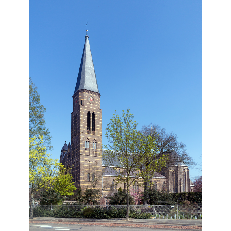
Scene Description: Source caption; "Sassenheim, de Sint Pancratiuskerk:"
Copyright Statement: Image copyright © Michielverbeek, 2017
Image Source: digital photograph 9 April 2017 by Michielverbeek [https://commons.wikimedia.org/wiki/File:Sassenheim,_de_Sint_Pancratiuskerk_GM1525WN046_foto4_2017-04-09_12.58.jpg] [accessed 2 March 2022]
Copyright Instructions: CC-BY-SA-4.0
view of font and cover in context
![[cf. FontNotes]](/static-50478a99ec6f36a15d6234548c59f63da52304e5/compressed/1220302027_compressed.png)
Scene Description: [cf. FontNotes]
Copyright Statement: Image copyright © André van Dijk Veenendaal, 2022
Image Source: digital image of a 1988 photograph by André van Dijk Veenendaal, in Reliwiki [https://www.reliwiki.nl] [accessed 2 March 2022]
Copyright Instructions: No known copyright restriction / Fair Dealing
INFORMATION
Font ID: 23792SAS
Object Type: Baptismal Font1?
Font Century and Period/Style: 17th century
Church / Chapel Name: Rooms-katholieke Sint Pancratiuskerk
Font Location in Church: Inside the 20thC church
Church Patron Saint(s): St. Pancras of Rome [aka Pancrace, Pancratius]
Church Notes: replaced an earlier church of 1870; partly re-built 1913, with old remains demolished 1928;
Church Address: Hoofdstraat 188, 2171 BM Sassenheim, Netherlands -- Tel.: +31 252 211 568
Site Location: Zuid-Holland, Netherlands, Europe
Directions to Site: Located off (W) the N208, N of highway A44, in the municipality of Teylingen, 7-8 km NNE of Leiden
Additional Comments: re-cycgled onject now used as font [cf. FontNotes]
Font Notes:
Click to view
E.H. ter Kuile's Leiden en Westelijk Rijnland (1944) [https://www.dbnl.org/tekst/kuil005prov02_01/kuil005prov02_01_0021.php#660] [accessed 2 March 2022] notes that the basin of red veined marble, oval, with lion masks at the ends, probably 17th century, now serving as a baptismal font, may have originally intended for profane use.
Credit and Acknowledgements: We are grateful to Pol Herman for bringing this item to our attention and for his help in documenting it
COORDINATES
UTM: 31U 603827 5787077
Latitude & Longitude (Decimal): 52.22432, 4.52005
Latitude & Longitude (DMS): 52° 13′ 27.55″ N, 4° 31′ 12.18″ E
MEDIUM AND MEASUREMENTS
Material: stone, marble
Font Shape: oval
Basin Exterior Shape: oval
LID INFORMATION
Material: metal, brass
Apparatus: no
Notes: [cf. Images area]