Marx No. 1
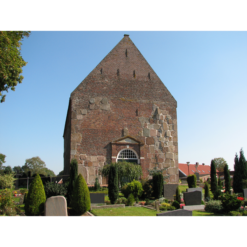
Image copyright © Klaus-Peter Wolf, 2006
GFDL / CC-BY-SA-3.0-migrated
Results: 2 records
view of church exterior in context - west view
Scene Description: Source caption: "St. Marcus-Kirche in Marx, Landkreis Wittmund. Entrance on west side, Eingang auf der Westseite "
Copyright Statement: Image copyright © Klaus-Peter Wolf, 2006
Image Source: digital photograph 21 September 2006 by Klaus-Peter Wolf [https://commons.wikimedia.org/wiki/File:St._Marcus-Kirche_in_Marx_(Ostfriesland)_-_Eingang.jpg] [accessed 22 February 2022]
Copyright Instructions: GFDL / CC-BY-SA-3.0-migrated
view of church exterior in context - southeast view
![Source caption: "Marx, kerk: Sankt Marcuskirche" [NB: 12thC(?) Romanesque church; detached tower added 1660; renovated 1990]](/static-50478a99ec6f36a15d6234548c59f63da52304e5/compressed/1220222001_compressed.png)
Scene Description: Source caption: "Marx, kerk: Sankt Marcuskirche" [NB: 12thC(?) Romanesque church; detached tower added 1660; renovated 1990]
Copyright Statement: Image copyright © Michielverbeek, 2010
Image Source: edited detail of a digital photograph 15 May 2010 by Michielverbeek [https://commons.wikimedia.org/wiki/File:Marx,_Sankt_Marcuskirche_2010-05-15_11.35.JPG] [accessed 22 February 2022]
Copyright Instructions: GFDL / CC-BY-SA-3.0,2.5,2.0,1.0
INFORMATION
Font ID: 23774MAR
Object Type: Stoup
Font Century and Period/Style: 13th century (early?), Late Romanesque
Church / Chapel Name: Sint-Marcuskerk / Evangelisch-lutherische St.-Marci-Kirche
Font Location in Church: [cf. FontNotes]
Church Patron Saint(s): St. Mark
Church Notes: 12thC(?) Romanesque church; tower added 1660; renovated 1990
Church Address: Papenstraße 18, Marx, 26446 Friedeburg, Germany
Site Location: Ostfriesland, Niedersachsen, Germany, Europe
Directions to Site: Located off (W) road 437 [aka Marxer-Hauptstraße], in the municipality and 1-2 km SE of Friedeburg, about 20 km SW of Wilhelmshaven
Additional Comments: [unable to locate images of the stoup at this time 22 Feb 2022 / mt]
Font Notes:
Click to view
Holy-water stoup [Weihwasserkessel] made of granite in the early-13th century. [cf. BSI entry for Marx No. 2 for a baptismal font made of wood in 1654]
COORDINATES
UTM: 32U 423960 5921368
Latitude & Longitude (Decimal): 53.435857, 7.855364
Latitude & Longitude (DMS): 53° 26′ 9.08″ N, 7° 51′ 19.31″ E
MEDIUM AND MEASUREMENTS
Material: stone, granite