Mill / Mill en Sint Hubert
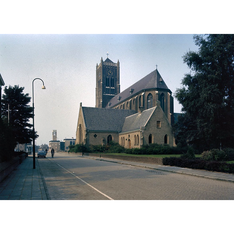
Image copyright © Rijksdienst voor het Cultureel Erfgoed, 2022
CC-BY-SA-4.0
Results: 2 records
view of church exterior in context - southeast view
Scene Description: Source caption: "Sint Willibrorduskerk: Overzicht van de zuidoostgevel"
Copyright Statement: Image copyright © Rijksdienst voor het Cultureel Erfgoed, 2022
Image Source: digital image of an undated photograph in the Rijksdienst voor het Cultureel Erfgoed [https://commons.wikimedia.org/wiki/File:Overzicht_van_de_zuidoostgevel_-_Mill_-_20383239_-_RCE.jpg] [accessed 13 February 2022]
Copyright Instructions: CC-BY-SA-4.0
view of font in context

Scene Description: modern stone font, a replica of an earlier style, now serving as water fountain outside the church
Copyright Statement: Image copyright © [s.n.] 2021
Image Source: digital photograph 13 December 2021 [source not available] provided by Pol Herman
Copyright Instructions: PERMISSION NOT AVAILABLE -- IMAGE NOT FOR PUBLIC USE
INFORMATION
Font ID: 23751MIL
Object Type: Baptismal Font1?
Font Century and Period/Style: 14th century, Gothic
Church / Chapel Name: Rooms-Katholieke Sint-Willibrordkerk
Font Location in Church: [disappeared]
Church Patron Saint(s): St. Willibrord [aka Willibrordus]
Church Notes: pre-1323 'ecclesia baptismalis' chapel-of-ease to Boxmeer; became independent parish 1326; new church built after 1820 but collapsed and was demolished 1879; present church 1877-1878; modified 1939 -- liested church [Monumentnummer: 29932]
Church Address: Kerkstraat 2, 5451 BM Mill, Netherlands -- Tel.: +31 485 451 282
Site Location: Noord-Brabant, Netherlands, Europe
Directions to Site: Located off (N) the N264, in the municipality of Land van Cuijk, about 10 km SSW of Nijmegen
Additional Comments: disappeared font? (the one from the ecclesia baptismalis ca. 1323)
Font Notes:
Click to view
There is a modern baptismal font of stone serving as water fountain outside thise church [cf. ImagesArea] [NB: we have no information on the font of the ca. 1323 church here].
Credit and Acknowledgements: We are grateful to Pol Herman for bringing this font to our attention
COORDINATES
UTM: 31U 692378 5729836
Latitude & Longitude (Decimal): 51.686477, 5.783129
Latitude & Longitude (DMS): 51° 41′ 11.32″ N, 5° 46′ 59.26″ E