Groede / De Groe
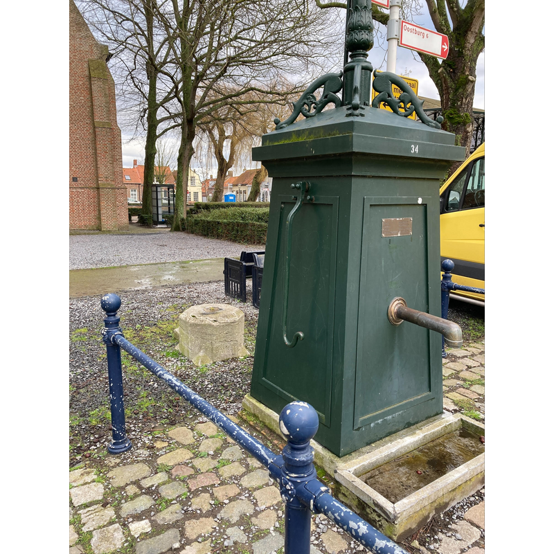
Image copyright © Huib van Iwaarden, 2022
Image received from the author via Pol Herman (e-mail of 7 February 2022)
Results: 6 records
view of font in context - fragment
Copyright Statement: Image copyright © Huib van Iwaarden, 2022
Image Source: digital photograph 6 February 2022 by Huib van Iwaarden
Copyright Instructions: Image received from the author via Pol Herman (e-mail of 7 February 2022)
view of font in context - fragment
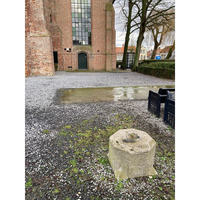
Copyright Statement: Image copyright © Huib van Iwaarden, 2022
Image Source: digital photograph 6 February 2022 by Huib van Iwaarden
Copyright Instructions: Image received from the author via Pol Herman (e-mail of 7 February 2022)
view of font in context - fragment
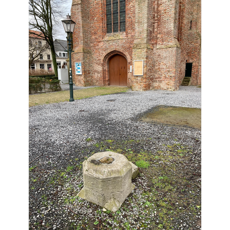
Copyright Statement: Image copyright © Huib van Iwaarden, 2022
Image Source: digital photograph 6 February 2022 by Huib van Iwaarden
Copyright Instructions: Image received from the author via Pol Herman (e-mail of 7 February 2022)
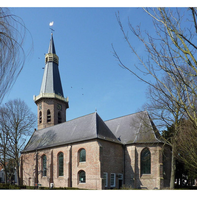
view of church exterior - west view
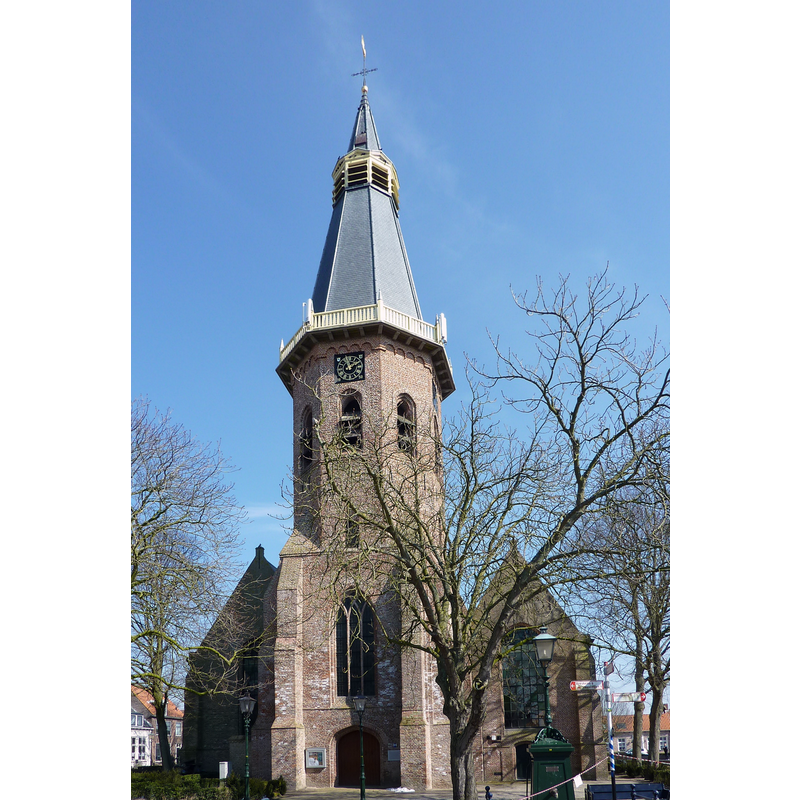
Scene Description: Source caption: "Grote Kerk, Groede"
Copyright Statement: Image copyright © Chris06, 2013
Image Source: digital photograph 25 March 2013 by Chris06 [https://commons.wikimedia.org/wiki/File:Grote_Kerk_(Groede)_(2).JPG] [accessed 9 February 2022]
Copyright Instructions: CC-BY-SA-3.0
view of church exterior - southeast view
Scene Description: Source caption: "Grote Kerk, Groede"
Copyright Statement: Image copyright © Chris06, 2013
Image Source: digital photograph 25 March 2013 by Chris06 [https://commons.wikimedia.org/wiki/File:Grote_Kerk_(Groede)_(4).JPG] [accessed 9 February 2022]
Copyright Instructions: CC-BY-SA-3.0
view of font - fragment
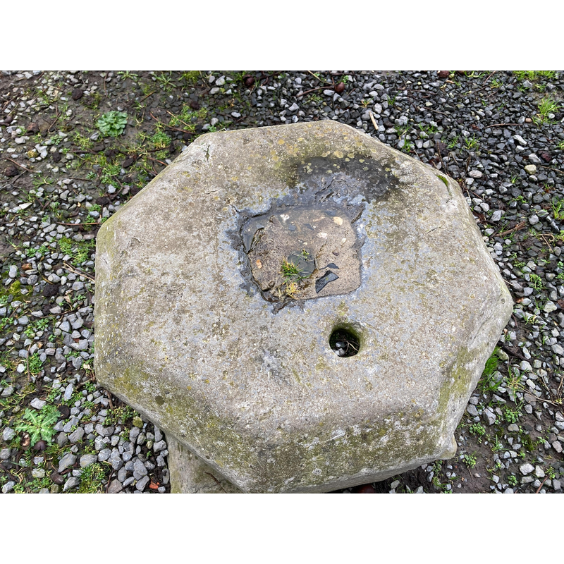
Copyright Statement: Image copyright © Huib van Iwaarden, 2022
Image Source: digital photograph 6 February 2022 by Huib van Iwaarden
Copyright Instructions: Image received from the author via Pol Herman (e-mail of 7 February 2022)
INFORMATION
Font ID: 23739GRO
Object Type: Baptismal Font2, fragment
Font Century and Period/Style: Medieval
Church / Chapel Name: Grote Kerk / Hervormde kerk
Font Location in Church: [cf. FontNotes]
Church Notes: 13thC church with later modifications; town under water 1583-1613; church restored thereafter; renovated 1868; restored 1950, 1970 and 2010 -- listed church [Rijksmonument no. 31516]
Church Address: Markt 1, 4503 AG Groede, Netherlands
Site Location: Zeeland, Netherlands, Europe
Directions to Site: Located off (S) N675 [Nieuwflietseweg], 7 km NNE of Oostburg, about 50 km WNW of Antwerp
Additional Comments: fragment of a font? [cf. FontNotes] / re-cycled font fragment (served as stepping-stone for horse and chariot riders after the Reformation)
Font Notes:
Click to view
We have no information on the baptismal font of the 13th-century church here, but the Wandelingen door Nederland met pen en potlood. Deel 7, Jacobus Craandijk, Kruseman & Tjeenk Willink, Haarlem, 1884, mentions a lump of stone at the entrance of the park that could perhaps be the base of a former baptismal font of this church.
A communication from Pol Herman to BSI (e-mail of 7 February 2022) conveys photographs of a fragment of al old stone font here and comments from Huib van Iwaarden, a Groede local resident: "My great-grandmother and -father (named Luteijn on mother's side) lived diagonally across from the entrance of the church. The baptismal font was put in the ground in front of the entrance of the church around 1650 and served then and later in the carriage and chariot times as a step-on and -off for the carriage-goers who went to church. Or to mount the horse. This was of course also a sneer at the Catholics!! A baptismal font, something sacred in the RC. church as a stepping stone for the reformed churchgoers after the Reformation! My great-grandparents and grandparents also used this font in this way. Also my mother as a little girl who went from Zuidzande to visit her grandparents in Groede."
A further communication from Pol Herman to BSI (e-mail of 15 February) reports: "in the Grote Kerk at Groede are kept the fragments of the mid-twelfth-century Tournai-type Romanesque baptismal font of the lost village of Nieuwerkerke, found on the 6th of May 2010"
Credit and Acknowledgements: We are grateful to Pol Herman for bringing this font to our attention and for his help in documenting it, and to Huib van Iwaarden for his comments and photographs
COORDINATES
UTM: 31U 535300 5692144
Latitude & Longitude (Decimal): 51.379444, 3.507222
Latitude & Longitude (DMS): 51° 22′ 46″ N, 3° 30′ 26″ E
MEDIUM AND MEASUREMENTS
Material: stone
Drainage System: centre hole in basin