Cothen / Kothen
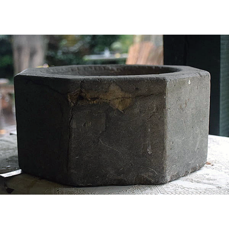
Image copyright © Frits van der Leije, 2020
No known copyright restriction / Fair Dealing
Results: 3 records
view of basin
Scene Description: the object found in Ossenwaard [cf. FontNotes]
Copyright Statement: Image copyright © Frits van der Leije, 2020
Image Source: digital photograph 8 October 2020 by Frits van der Leije, in Doopvont of wijwaterbak? [https://www.tussenrijnenlek.nl/2020/doopvont-of-wijwaterbak/] [accessed 2 February 2022]
Copyright Instructions: No known copyright restriction / Fair Dealing
view of basin
![the object found in Ossenwaard [cf. FontNotes]](/static-50478a99ec6f36a15d6234548c59f63da52304e5/compressed/1220202021_compressed.png)
Scene Description: the object found in Ossenwaard [cf. FontNotes]
Copyright Statement: Image copyright © Frits van der Leije, 2020
Image Source: digital photograph 8 October 2020 by Frits van der Leije, in Doopvont of wijwaterbak? [https://www.tussenrijnenlek.nl/2020/doopvont-of-wijwaterbak/] [accessed 2 February 2022]
Copyright Instructions: No known copyright restriction / Fair Dealing
view of church exterior in context - northeast view
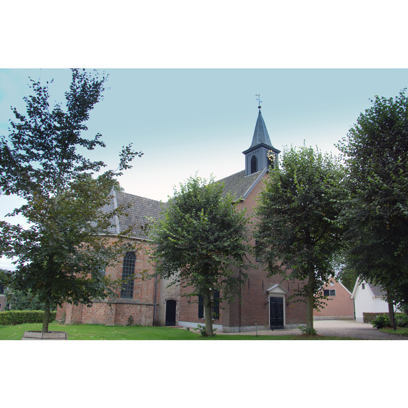
Scene Description: Source caption: "De mooie vrijstaande Hervormde kerk van Cothen een dorp in de Gem. Wijk bij Duurstede" -- the present building dates from 1735, with later modifications. A church has existed here since ca. 1200
Copyright Statement: Image copyright © Jan dijkstra, 2018
Image Source: digital photograph 12 September 2018 by Jan dijkstra [https://commons.wikimedia.org/wiki/File:Cothen_Hervormde_kerk.jpg] [accessed 2 February 2022]
Copyright Instructions: CC-BY-SA-4.0
INFORMATION
Font ID: 23716COT
Object Type: Baptismal Font2
Font Date: ca. 1200?
Font Century and Period/Style: 12th - 13th century, Romanesque
Church / Chapel Name: PKN Hervormde Kerk / Sint Agneskerk
Font Location in Church: [disappeared]
Church Patron Saint(s): St. Agnes
Church Notes: original church ca. 1200; present building 1735; modified 1890; restored 1980 -- listed church [Rijksmonument ID: 11519]
Church Address: De Brink 9, 3945 BE Cothen, Netherlands
Site Location: Utrecht, Netherlands, Europe
Directions to Site: Located off the N227-N229 crossroads, on the W bank of the Kromme Rijn, W of the N229, in the municipality of Wijk Bij Duurstede, about 15 km SE of Utrecht
Additional Comments: disappeared font? (the one from the ca.1200 church here)
Font Notes:
Click to view
[NB: We have no information on the medieval baptismal font from this church]. A communication by Pol Herman to BSI (e-mail of 12 January 2022] forwarded a query originally from Frits van der Leije on 8 October 2020 in Doopvont of wijwaterbak? [https://www.tussenrijnenlek.nl/2020/doopvont-of-wijwaterbak/] [accessed 2 February 2022], in which the author describes an octagonal basin of stone of about 30 cm in diameter, and questions whether it could be a font or a stoup [cf. ImagesArea]; the object in question is octagonal on the outise, with plain vertical sides, round interior, no drain visible; it was found in 1980 in the Ossenwaard during the construction of a barn and the construction of a water pipe. Apart from this nothing else was found; so it was not part of a (renovation) landfill, but it also does not originate from a former building on the spot, because before 1900, as far as we know, nothing was ever standing here. One possibility is that it was auctioned off as 'superfluous inventory' in connection with the renovations of the Catholic Church in Cothen, the H.H. Peter and Paul Church. This auction by notary Luijkx took place in 1966 on behalf of Pastor van Leer. Perhaps there still exists an auction list of this sale. Unfortunately, due to privacy legislation, notarial archives are only accessible before 1935, but someone else may have kept a copy. The author of the piece makes an appeal for any help from the readers.
Credit and Acknowledgements: We are grateful to Pol Herman for conveying the access to the piece by Frits van der Leije [cf. FontNotes]
COORDINATES
UTM: 31U 658898 5763196
Latitude & Longitude (Decimal): 51.996656, 5.314573
Latitude & Longitude (DMS): 51° 59′ 47.96″ N, 5° 18′ 52.46″ E