Middelaar
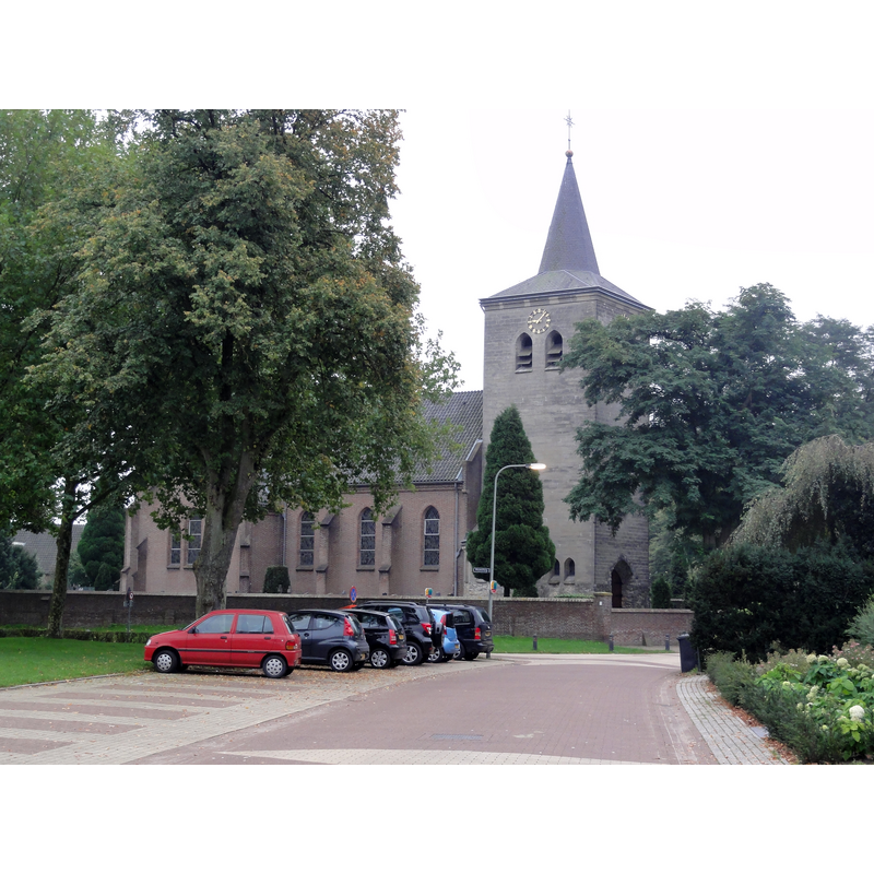
Image copyright © [in the public domain]
CC-Zero
Results: 2 records
view of church exterior in context - northwest view
Scene Description: Source caption; "Heumen Rijksmonument 30071 Lambertuskerk " [NB: the new church built in 1948-1950]
Copyright Statement: Image copyright © [in the public domain]
Image Source: digital photograph 30 September 2010 by Havang(nl) [https://commons.wikimedia.org/wiki/File:Middelaar_Rijksmonument_30071_Lambertuskerk.JPG] [accessed 20 January 2022]
Copyright Instructions: CC-Zero
view of church exterior - southeast view
![Source caption: "St. Lambertuskerk: Kerk vanuit het zuid-oosten" [NB: this church would be badly damaged in WWII and later demolished]](/static-50478a99ec6f36a15d6234548c59f63da52304e5/compressed/1220120021_compressed.png)
Scene Description: Source caption: "St. Lambertuskerk: Kerk vanuit het zuid-oosten" [NB: this church would be badly damaged in WWII and later demolished]
Copyright Statement: Image copyright © Rijksdienst voor het Cultureel Erfgoed, 2022
Image Source: digital image of a 1926 B&W photograph in the Rijksdienst voor het Cultureel Erfgoed [https://commons.wikimedia.org/wiki/File:Kerk_vanuit_het_zuid-oosten_-_Middelaar_-_20153956_-_RCE.jpg] [accessed 20 January 2022]
Copyright Instructions: CC-BY-SA-4.0
INFORMATION
Font ID: 23684MID
Object Type: Baptismal Font1
Font Date: ca. 1700?
Font Century and Period/Style: 17th - 18th century
Church / Chapel Name: Rooms Katholieke Parochiekerk Lambertus en Brigida
Font Location in Church: [cf. FontNotes]
Church Patron Saint(s): St. Lambert of Maastricht[aka Lambaert, Lambertus, Lambrecht, Landebertus] & St. Brigida
Church Notes: wooden church reported here before 1000 AD; stone church built with tufa stones from Roman buildings; modified 1250; modified with tower added ca. 1450; destroyed 1596 and demolished thereafter; new church 1620 dedicated to St Lambert; much damaged by WWII bombings in 1944-1945; demolished 1946; re-built 1948-1950
Church Address: Doorpstraat 47, 6587 AW Middelaar, Netherlands
Site Location: Limburg, Netherlands, Europe
Directions to Site: Located off (S) the N271, on the W bank of the Maas/Meude, about 10 km SSE of Nijmegen
Ecclesiastic Region: Bisdom Roermond (RK)
Additional Comments: destroyed font and stoup [cf. FontNotes] -- disappeared font(s) (the font(s) of the medieval church(es) here)
Font Notes:
Click to view
Voorloopige lijst der Nederlandsche monumenten van geschiedenis en kunst. Deel VIII, II. De provincie Limburg (Meerloo-Zwalmen), 1926 reported a font and a stoup of made of blue limestone ca. 1700. Pol Herman (e-mail to BSI of 30 December 2021) reckons bot of them destroyed in WWII. [NB: we have no information on the font(s) of the medieval church(es) here]
Credit and Acknowledgements: We are grateful to Pol Herman for bringing this font to our attention and for his help in documenting it
COORDINATES
UTM: 31U 701410 5734354
Latitude & Longitude (Decimal): 51.723881, 5.916231
Latitude & Longitude (DMS): 51° 43′ 25.97″ N, 5° 54′ 58.43″ E
MEDIUM AND MEASUREMENTS
Material: stone, limestone