Well nr. Goch / Welle
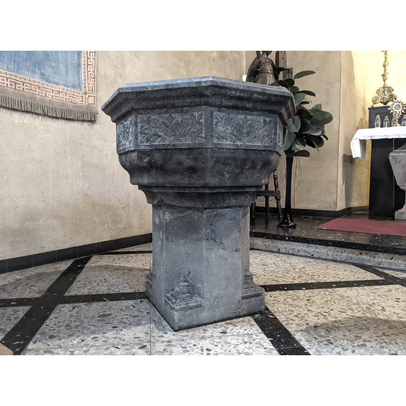
Image copyright © Michel Stevens, 2022
Image and permission received from the author via Pol Herman (e-mail of 9 January 2022)
Results: 12 records
view of font
Copyright Statement: Image copyright © Michel Stevens, 2022
Image Source: digital photograph 9 January 2022 by Michel Stevens, of Stichting Archief Well
Copyright Instructions: Image and permission received from the author via Pol Herman (e-mail of 9 January 2022)
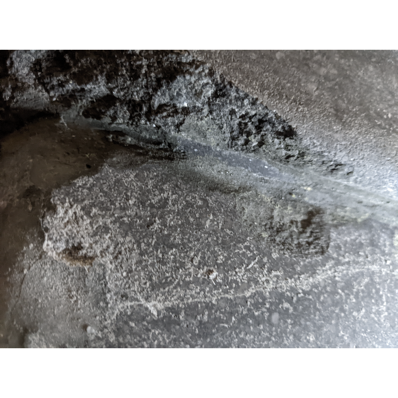
view of basin - underbowl - detail
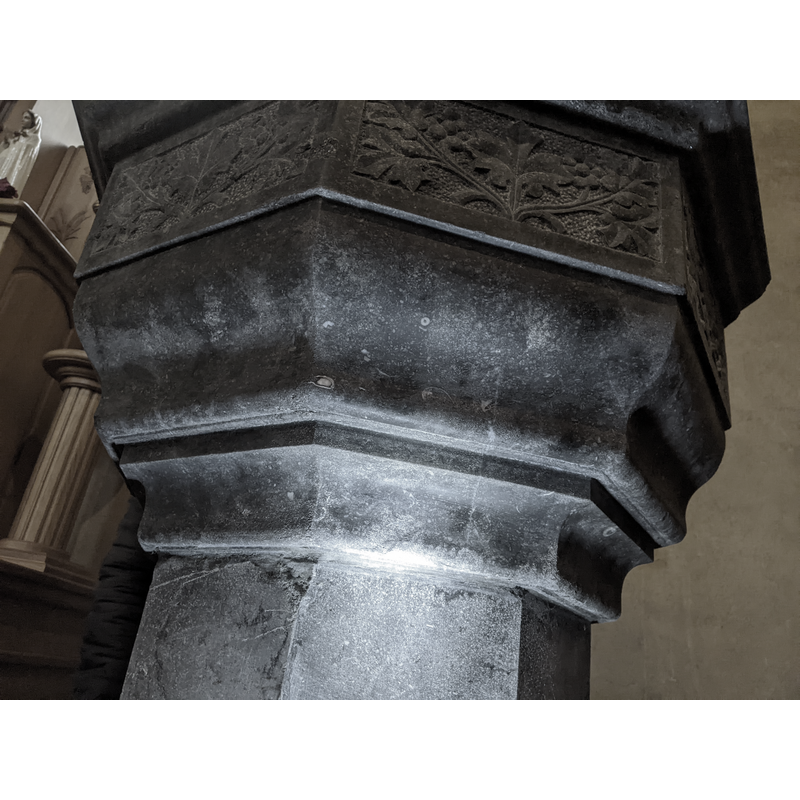
Copyright Statement: Image copyright © Michel Stevens, 2022
Image Source: digital photograph 9 January 2022 by Michel Stevens, of Stichting Archief Well
Copyright Instructions: Image and permission received from the author via Pol Herman (e-mail of 9 January 2022)
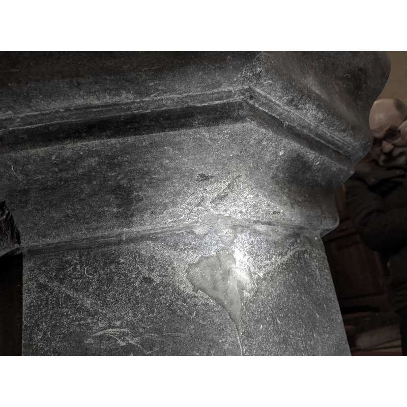
view of basin
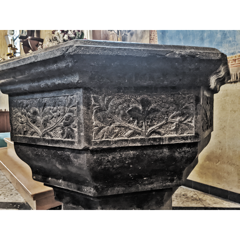
Copyright Statement: Image copyright © Michel Stevens, 2022
Image Source: digital photograph 9 January 2022 by Michel Stevens, of Stichting Archief Well
Copyright Instructions: Image and permission received from the author via Pol Herman (e-mail of 9 January 2022)
view of basin and cover
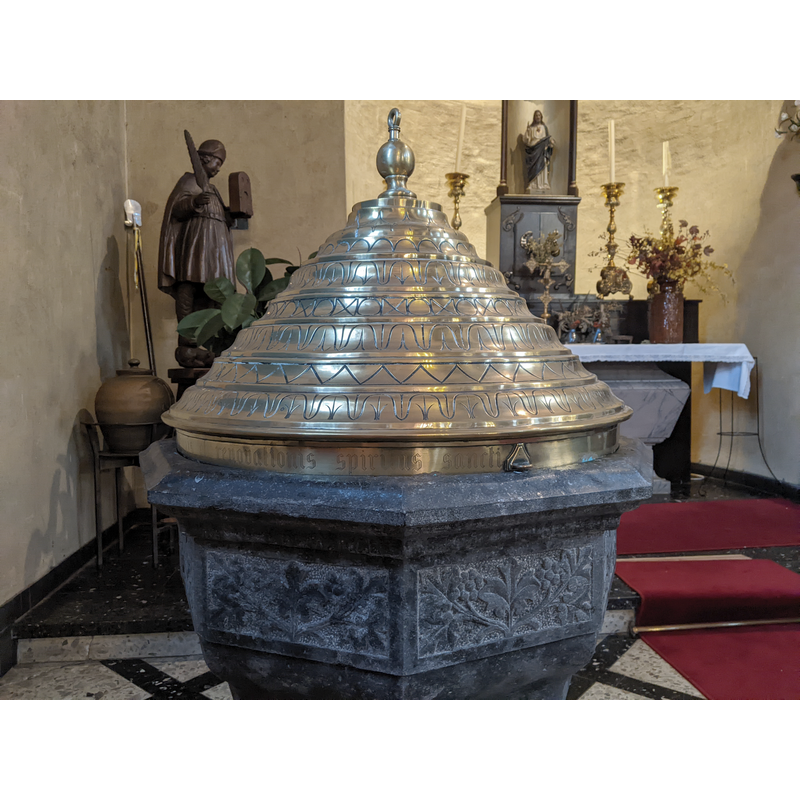
Copyright Statement: Image copyright © Michel Stevens, 2022
Image Source: digital photograph 9 January 2022 by Michel Stevens, of Stichting Archief Well
Copyright Instructions: Image and permission received from the author via Pol Herman (e-mail of 9 January 2022)
view of church exterior in context
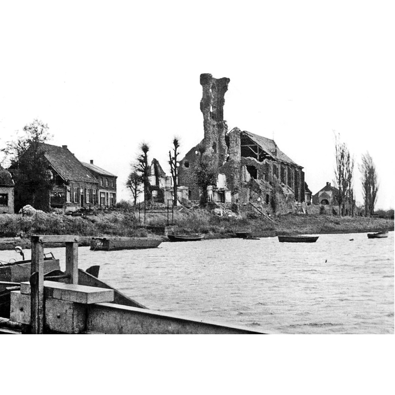
Scene Description: the old church, seen here across the river Maas, had been severely damaged by Allied fire bombings in 1944 and would eventually be demolished in 1956
Copyright Statement: Image copyright © [s.n., s.d.]
Image Source: digital image of an undated [1944-1956] B&W photograph supplied by Pol Herman [original source not available]
Copyright Instructions: Assumed PD / CC-BY-SA-4.0
view of church exterior in context
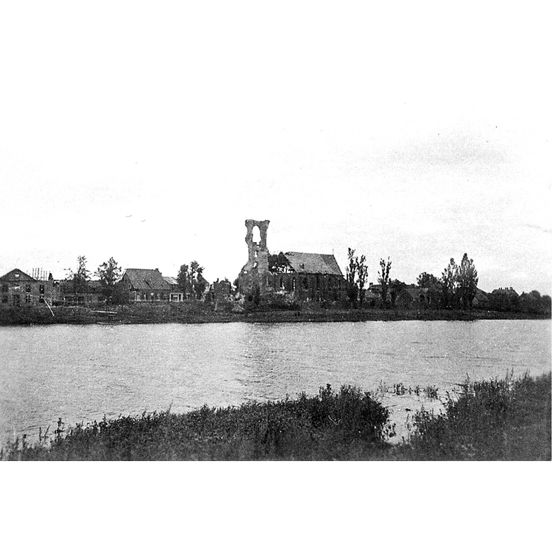
Scene Description: the old church, seen here across the river Maas, had been severely damaged by Allied fire bombings in 1944 and would eventually be demolished in 1956
Copyright Statement: Image copyright © [in the public domain]
Image Source: digital image of an undated [1944-1956] B&W photograph supplied by Pol Herman [original source not available]
Copyright Instructions: Assumed PD
view of church exterior - west view
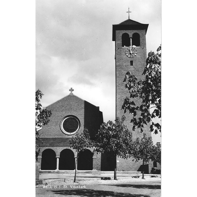
Scene Description: the new church, consecrated 1958
Copyright Statement: Image copyright © Gbennink, 2011
Image Source: digital photograph 26 September 2011 by Gbennink, in Reliwiki [https://reliwiki.nl/index.php/Bestand:Well_RK_Vituskerk.jpg] [accessed 11 January 2022]
Copyright Instructions: CC-BY-SA-4.0
view of church exterior in context - southwest view
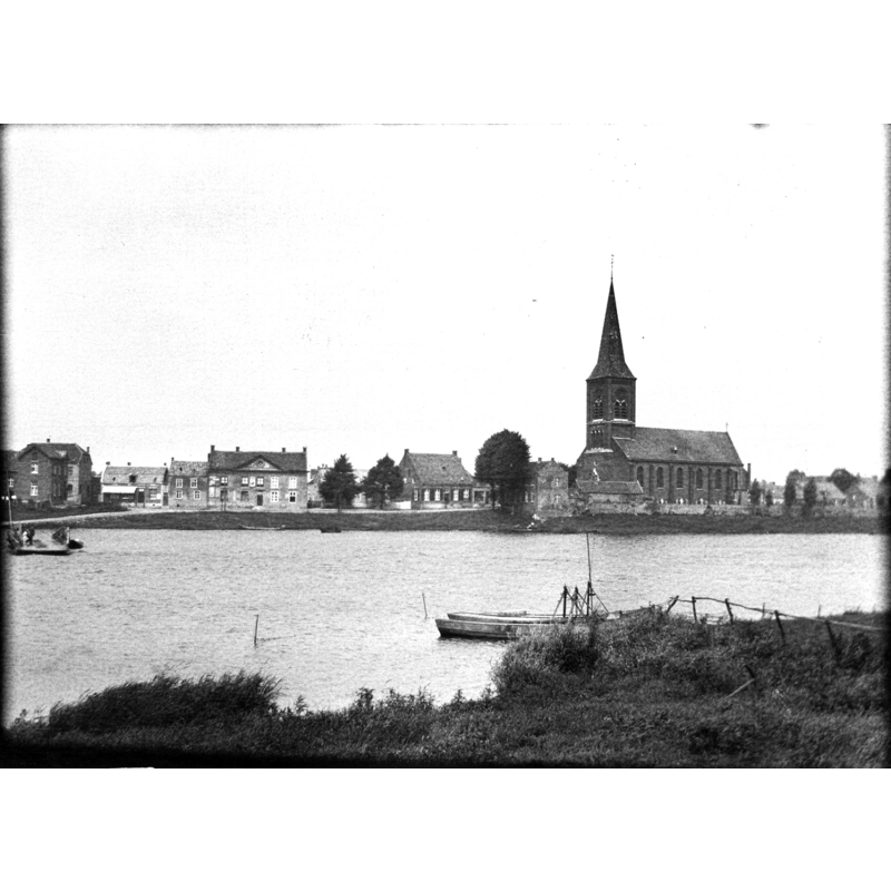
Scene Description: the old church, demolished in 1956, seen here across the river Maas
Copyright Statement: Image copyright © Rijksdienst voor het Cultureel Erfgoed, 2022
Image Source: digital image of undated [pre-1956] B&W photograph in the Rijksdienst voor het Cultureel Erfgoed [https://commons.wikimedia.org/wiki/File:Water_met_op_achtergrond_de_kerk_-_Well_-_20407224_-_RCE.jpg] [accessed 11 January 2022]
Copyright Instructions: CC-BY-SA-4.0
view of church interior - looking east
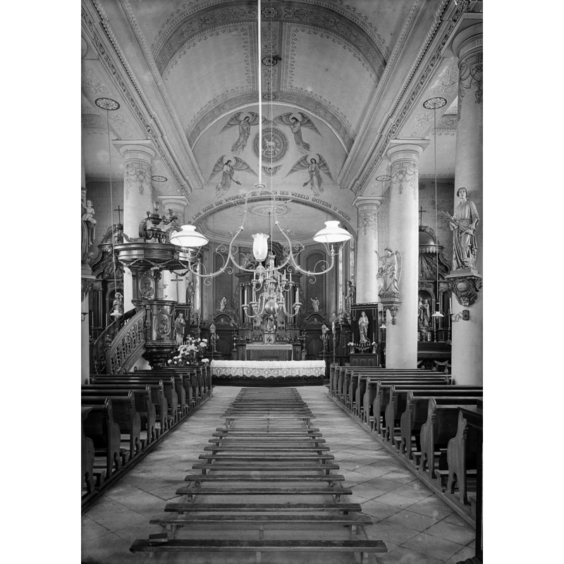
Scene Description: Source caption: "Rooms-Katholieke Kerk: Interieur naar het oosten" -- the old church would be demolished in 1956
Copyright Statement: Image copyright © Rijksdienst voor het Cultureel Erfgoed, 2022
Image Source: digital image of November 1928 B&W photograph in the Rijksdienst voor het Cultureel Erfgoed [https://commons.wikimedia.org/wiki/File:Interieur_naar_het_oosten_-_Well_-_20252988_-_RCE.jpg] [accessed 11 January 2022]
Copyright Instructions: CC-BY-SA-4.0
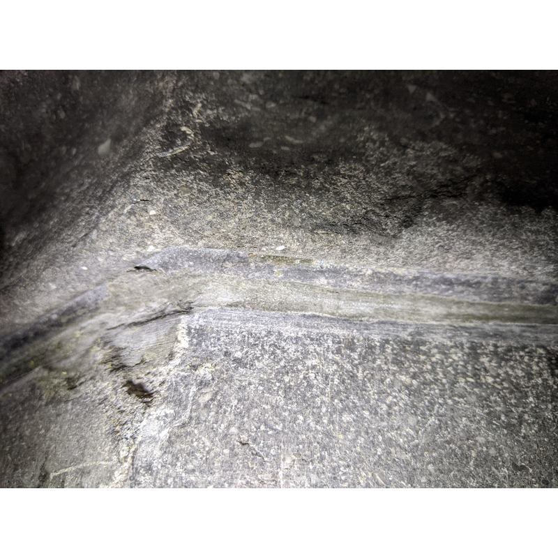
view of font - underbowl - detail
Copyright Statement: Image copyright © Michel Stevens, 2022
Image Source: digital photograph 9 January 2022 by Michel Stevens, of Stichting Archief Well
Copyright Instructions: Image and permission received from the author via Pol Herman (e-mail of 9 January 2022)
view of font - underbowl - detail
Copyright Statement: Image copyright © Michel Stevens, 2022
Image Source: digital photograph 9 January 2022 by Michel Stevens, of Stichting Archief Well
Copyright Instructions: Image and permission received from the author via Pol Herman (e-mail of 9 January 2022)
view of font - underbowl - detail
Copyright Statement: Image copyright © Michel Stevens, 2022
Image Source: digital photograph 9 January 2022 by Michel Stevens, of Stichting Archief Well
Copyright Instructions: Image and permission received from the author via Pol Herman (e-mail of 9 January 2022)
INFORMATION
Font ID: 23665WEL
Object Type: Baptismal Font1?
Font Century and Period/Style: Medieval
Church / Chapel Name: Rooms-Katholieke Parochiekerk Sint-Vitus
Font Location in Church: [cf. FontNotes]
Church Patron Saint(s): St. Vitus [originally St. Peter?]
Church Notes: original ca. 974 church dedicated to St Peter (later to St Vitus) donated to the Sint-Vitusabdij te Mönchengladbach; destroyed in the Eighty Years' War, except for the tower; re-built 1607; modified 1844, 1869; damaged by UK fire bombs in 1944; demolished 1956; new church consecrated 1958
Church Address: Hoenderstraat 9 [the old church was located on Grotestraat], 5855 AG Well, Netherland
Site Location: Limburg, Netherlands, Europe
Directions to Site: Located off (W) the N270, on the N bank of the Maas river in the municipality of Bergen, 10-12 km SSW of Goch, about 25 km SSE of Nijmegen
Ecclesiastic Region: Bisdom Roermond (RK)
Additional Comments: disappeared font? / destroyed font? (the one from the medieval church here [cf. Font & Church Notes])
Font Notes:
Click to view
In his description of the baptismal font on this church in 1844, J.H.A. Mialaret says : Baptismal font, flat round black marble bowl on gray marble baluster base. Diameter 45 cm, height 1 meter (± 1700). This is probably the same font mentioned in the entry for this church in Kerkgebouwen in Limburg [https://www.kerkgebouwen-in-limburg.nl/kerken/well/vitus] [accessed 11 January 2022] which reports a baptismal font made of marble ca. 1700 located in a north chapel [=" Doopvont, marmer, ca. 1700. Platronde cuppa op een balustervoet. In de noordkapel"]. The present font, an octagonal basin with decorated side panels, raised on an octagonal to square pedestal base, and a metal [brass?] cover does not match the above descriptions and is likely a later replacement after the old church was practically destroyed in 1944. [NB; we have no information on the font(s) of the medieval churches here, starting with the earliest one ca. 974 A.D.]
Credit and Acknowledgements: We are grateful to Pol Herman for bringing this font to our attention and for his help in deocumenting it. We are also grateful to Michel Stevens, of Stichting Archief Well, for his photographs of the present font.
COORDINATES
UTM: 32U 298246 5714993
Latitude & Longitude (Decimal): 51.549906, 6.089958
Latitude & Longitude (DMS): 51° 32′ 59.66″ N, 6° 5′ 23.85″ E