Vaux-sur-Aure No. 2 / Manoir d'Argouges
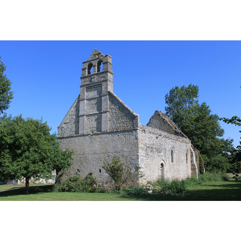
Image copyright © Roi.dagobert, 2013
CC-BY-SA-3.0
Results: 2 records
view of church exterior - southwest view
Scene Description: Source caption: " Ruines de l'église Saint-Pierre du Manoir d'Argouges à Vaux-sur-Aure (Calvados)"
Copyright Statement: Image copyright © Roi.dagobert, 2013
Image Source: digital photograph 27 August 2013 by Roi.dagobert [https://fr.wikipedia.org/wiki/Fichier:Vaux-sur-Aure_Manoir_d'Argouges_église_01.JPG] [accessed 11 January 2022]
Copyright Instructions: CC-BY-SA-3.0
view of church exterior - northeast view
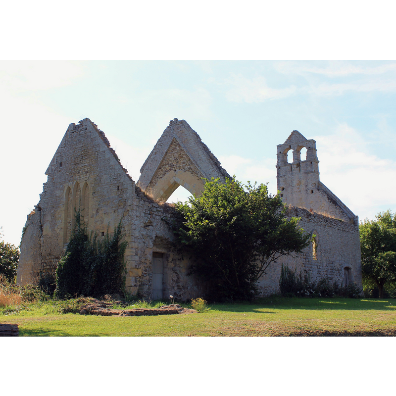
Copyright Statement: Image copyright © Roi.dagobert, 2013
Image Source: digital photograph 27 August 2013 by Roi.dagobert [https://commons.m.wikimedia.org/wiki/File:Vaux-sur-Aure_Manoir_d'Argouges_église_01.JPG] [accessed 11 January 2022]
Copyright Instructions: CC-BY-A-3.0
INFORMATION
Font ID: 23663VAU
Object Type: Baptismal Font1?
Font Century and Period/Style: 12th century, Romanesque
Church / Chapel Name: Église paroissiale Saint-Pierre du Manoir d'Argouges à Vaux-sur-Aure [in ruins]
Font Location in Church: [disappeared]
Church Notes: -- listed in Mérimée [ref.: IA00122133]: "Eglise paroissiale de l'ancienne commune d'Argouges, dédiée à saint Pierre, édifiée au 12e siècle ; entièrement reprise au 13e siècle : réfection partielle des murs et changement des baies, de l'arc triomphal et des contreforts, chapelle seigneuriale ajoutée peut-être à la même époque sur le côté nord du choeur (détruite) ; 17e siècle reprise de la façade ouest et adjonction du clocher arcade ; paroisse supprimée sous la Révolution et édifice laissé à l'abandon depuis"
Church Address: Le Manoir d'Argouges, 14400 Vaux-sur-Aure, France
Site Location: Calvados, Normandie, France, Europe
Directions to Site: Located off the D153, on the S bank of the Aure river, 6-7 km NNW of Bayeux
Historical Region: Basse-Normandie
Additional Comments: ***NOT TO BE MISTAKEN WITH the parish church in Argouges, Manche*** -- disappeared font? (the one from the 12thC church in ruins here)
Font Notes:
Click to view
[NB: we have no information of the font from the 12thC church now in ruins]
COORDINATES
UTM: 30U 665689 5465635
Latitude & Longitude (Decimal): 49.320938, -0.719938
Latitude & Longitude (DMS): 49° 19′ 15.38″ N, 0° 43′ 11.78″ W