Oude Niedorp
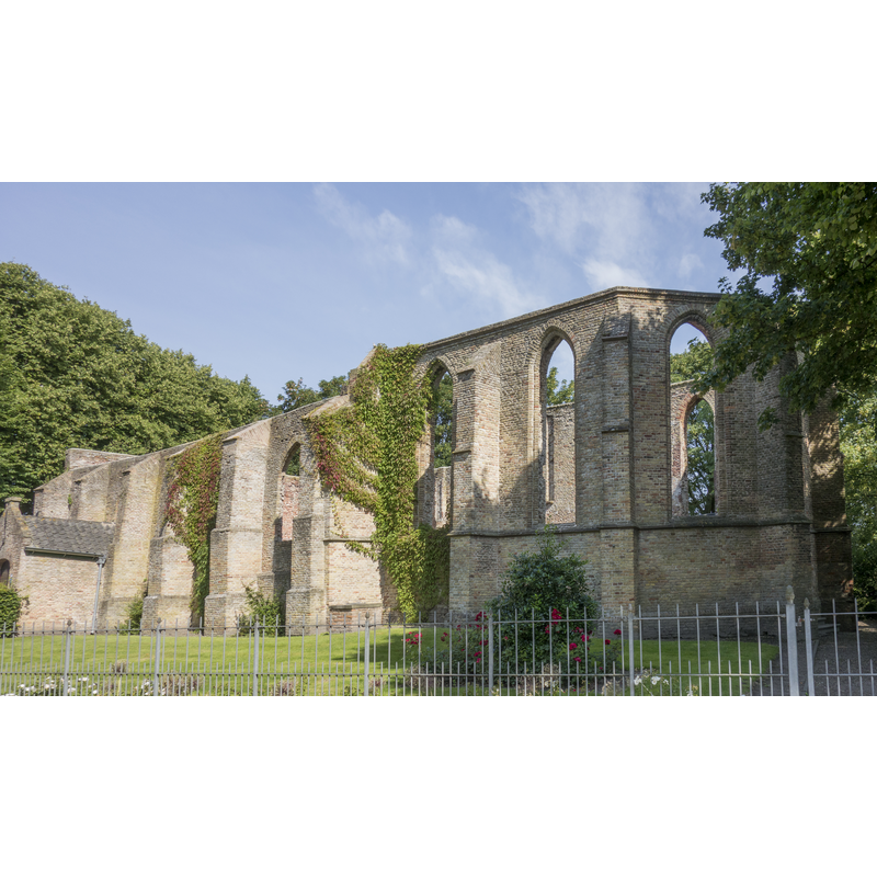
Image copyright © Dqfn13, 2016
CC-BY-SA-4.0
Results: 3 records
view of church exterior - southeast view
Scene Description: Source caption: " Overzicht van de ruïnekerk in Oude Niedorp, Noord-Holland, gezien vanaf de koorzijde." -- the remains of the former parish church are now managed as a ruin
Copyright Statement: Image copyright © Dqfn13, 2016
Image Source: digital photograph 15 July 2016 by Dqfn13 [https://commons.wikimedia.org/wiki/File:Ruïnekerk,_Oude_Niedorp_01.jpg] [accessed 2 January 2021]
Copyright Instructions: CC-BY-SA-4.0
view of church exterior - southeast view
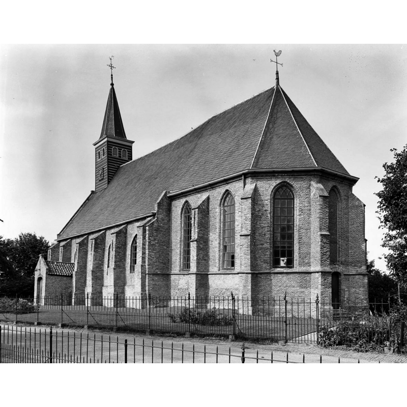
Scene Description: Source caption: "Nederlands Hervormde Kerk: zuid-oost zijde, exterieur" -- it would be largely damaged by lightning strike and fire in 1977
Copyright Statement: Image copyright © Rijksdienst voor het Cultureel Erfgoed, 2022
Image Source: digital image of an August 1968 B&W photograph by Gerard Dukker, in the Rijksdienst voor het Cultureel Erfgoed [https://commons.wikimedia.org/wiki/File:Zuid-oost_zijde,_exterieur_-_Oude_Niedorp_-_20178851_-_RCE.jpg] [accessed 2 January 2022]
Copyright Instructions: CC-BY-SA-4.0
view of church interior - chancel and east end
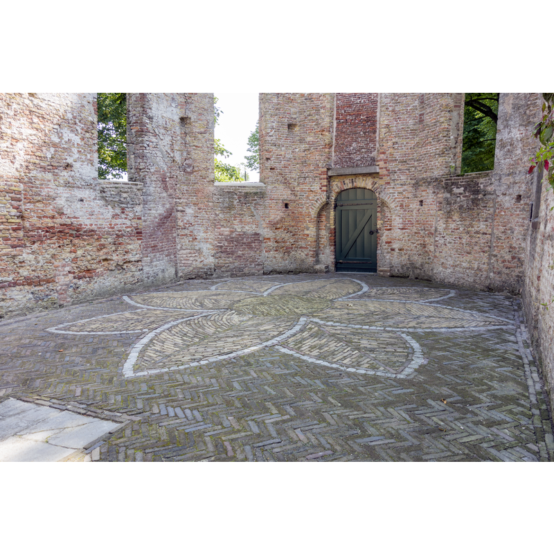
Scene Description: Source caption: "Op de plek waar ooit het koor was, is in de vloer een bloem aangebracht."
Copyright Statement: Image copyright © Dqfn13, 2016
Image Source: digital photograph 15 July 2016 by Dqfn13 [https://commons.wikimedia.org/wiki/File:Ruïnekerk,_koor,_Oude_Niedorp.jpg] [accessed 2 January 2021]
Copyright Instructions: CC-BY-SA-4.0
INFORMATION
Font ID: 23646NIE
Object Type: Baptismal Font1
Church / Chapel Name: Nederlands Hervormde Kerk [in ruins]
Font Location in Church: [cf. FontNotes]
Church Patron Saint(s): St. Werenfried of Elst [aka Werenfrid, Werenfridus] [originally]
Church Notes: original 13thC church demolished 14thC due to subsidience; re-built thereafter; demolished again 1783 again due to subsidience; re-built; restored 1953-1954; church largely destroyed by lightning strike in 1977
Church Address: Ruïnekerk Oude Niedorp, Dorpsstraat 31, 1734 JJ Oude Niedorp, Netherlands
Site Location: Noord-Holland, Netherlands, Europe
Directions to Site: Located between the N242 (N) and the N241 (S), just E of Verlaat, in the municipality of Hollands Kroon, 8-9 km NE of Heerhugowaard, about 12 km NW of Hoorn
Additional Comments: destroyed font? [cf. FontNotes]
Font Notes:
Click to view
A communication from Pol Herman to BSI (e-mail of 20 December 2021) provides mention to an exceptional baptismal font in this church.
1) Kerkelijke historie en outheden der zeven vereenigde provincien, vierde deel, Oudheden en Gestichten van Kemmenerland, Amstelland, Noordholland en Westvriesland. Uit het latijn vertaald door Hugo Franciscus van Heussen (Laiden, 1726), writes of a baptismal font of this church was so stately and artfully made that its peer could not be found in all of Holland, perhaps with the exception of Leiden.
2) ONZE OMGEVING. Uit de Kroniek door W. Wijker, J. van Leverink (Schagerbrug, 1899) notes: The church at Oude Niedorp was dedicated to St. Werenfridius. The most beautiful baptismal font in all of our country was once located here.
Unfortunately we have not been able to find further details of the font yet. Was it destroyed in the 1977 fire?
Credit and Acknowledgements: We are grateful to Pol Herman for bringing this font to our attention and for his help in documenting it
COORDINATES
UTM: 31U 626848 5842747
Latitude & Longitude (Decimal): 52.719717, 4.878097
Latitude & Longitude (DMS): 52° 43′ 10.98″ N, 4° 52′ 41.15″ E