Wouw
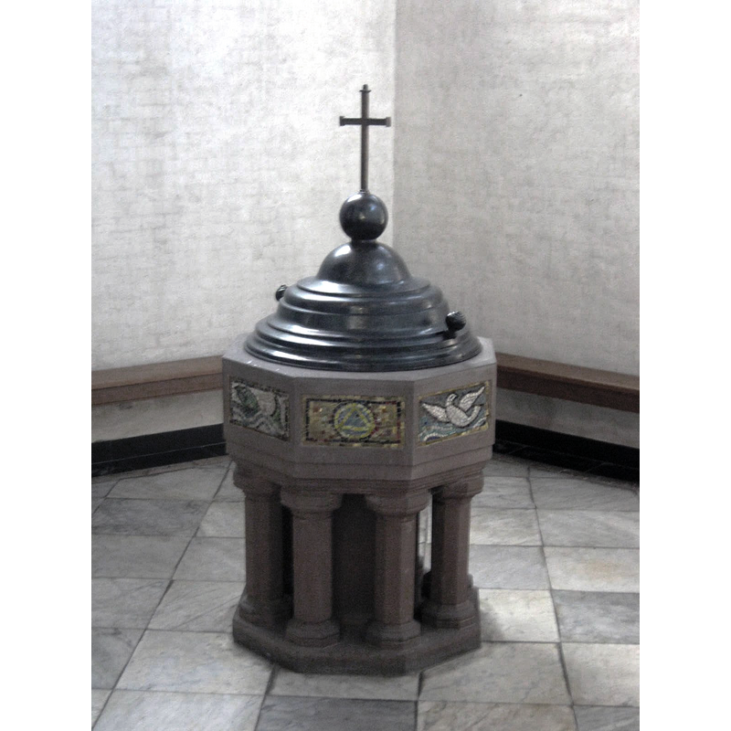
Image copyright © Hans1967, 2014
CC-BY-SA-3.0
Results: 2 records
view of font and cover
Scene Description: the modern font that replaced the one destroyed by the German arny in WWII
Copyright Statement: Image copyright © Hans1967, 2014
Image Source: digital photograph 13 September 2014 by Hans1967 [https://reliwiki.nl/index.php/Bestand:Wouw_R.K.Kerk_H.Lambertus-Doopvont.jpg] [accessed 28 December 2021]
Copyright Instructions: CC-BY-SA-3.0
view of church interior - detail
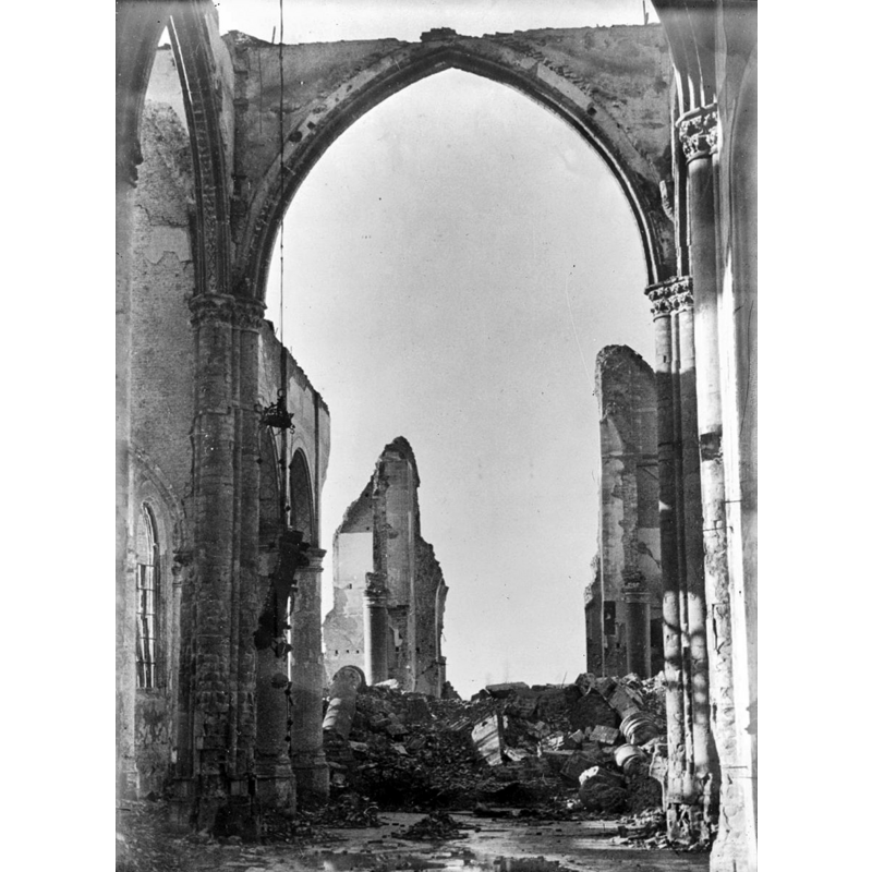
Scene Description: Source caption: "Sint Lambertus Kerk: kerk" -- destroyed by the German army in 1944
Copyright Statement: Image copyright © Rijksdienst voor het Cultureel Erfgoed, 2021
Image Source: digital image of a December 1944 B&W photograph in the Rijksdienst voor het Cultureel Erfgoed [https://commons.wikimedia.org/wiki/File:Kerk_-_Wouw_-_20218463_-_RCE.jpg] [accessed 28 December 2021]
Copyright Instructions: CC-BY-SA-4.0
INFORMATION
Font ID: 23635WOU
Object Type: Baptismal Font1
Font Century and Period/Style: 17th century
Church / Chapel Name: Sint Lambertus Kerk
Font Location in Church: [destroyed]
Church Patron Saint(s): St. Lambert of Maastricht[aka Lambaert, Lambertus, Lambrecht, Landebertus]
Church Notes: early-13thC wooden chapel replaced by stone church in 1270; re-built 15thC with tower added in 1480; restored 1882; damaged by German army bombing 1944; restored 1951
Church Address: Torenplein 1, 4724 BX Wouw, Netherlands -- Tel.: +31 165 301 214
Site Location: Noord-Brabant, Netherlands, Europe
Directions to Site: Located off (N) the A58, 25-30 km N of Antwerp
Additional Comments: destroyed font (by the German army in WWII)
Font Notes:
Click to view
The earlier font here, a stone font of the 17th century, was destroyed by the German army in 1944 [source: Voorloopige lijst der Nederlandsche monumenten van geschiedenis en kunst. Deel X. De provincie Noord-Brabant (1931)]. The present baptismal font in this church is modern.
Credit and Acknowledgements: We are grateful to Pol Herman for bringing this font to our attention and for his help in documenting it
COORDINATES
UTM: 31U 596272 5708753
Latitude & Longitude (Decimal): 51.521679, 4.387635
Latitude & Longitude (DMS): 51° 31′ 18.04″ N, 4° 23′ 15.49″ E