Maasbracht
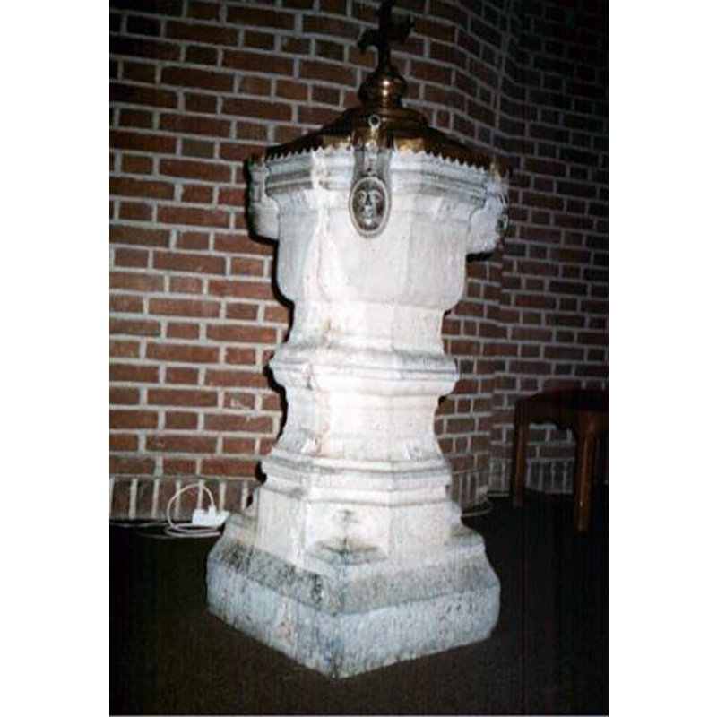
Image copyright © [in the public domain]
Assumed PD
Results: 6 records
view of font and cover
Copyright Statement: Image copyright © [in the public domain]
Image Source: digital image provided by Pol Herman
Copyright Instructions: Assumed PD
human figure - head - 4
Scene Description: set at 90-degree angles of the upper basin sides
Copyright Statement: Image copyright © [in the public domain]
Image Source: digital image provided by Pol Herman
Copyright Instructions: Assumed PD
design element - motifs - moulding
Copyright Statement: Image copyright © [in the public domain]
Image Source: digital image provided by Pol Herman
Copyright Instructions: Assumed PD
view of church exterior in context - southwest view
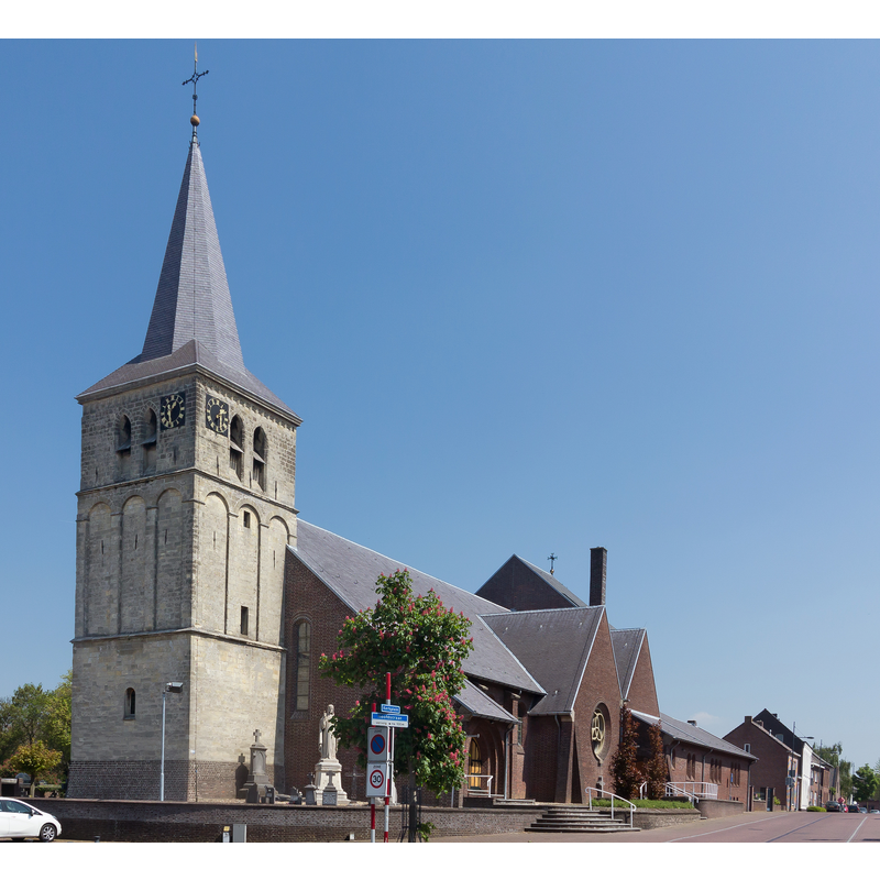
Scene Description: Source caption: Maasbracht, de Sint-Gertrudiskerk:"
Copyright Statement: Image copyright © Michielverbeek, 2017
Image Source: digital photograph 10 May 2017 by Michielverbeek [https://commons.wikimedia.org/wiki/File:Maasbracht,_de_Sint-Gertrudiskerk_RM26519_foto7_2017-05-10_13.26.jpg] [accessed 27 December 2021]
Copyright Instructions: CC-BY-SA-4.0
design element - motifs - moulding
Copyright Statement: Image copyright © [in the public domain]
Image Source: digital image provided by Pol Herman
Copyright Instructions: Assumed PD
design element - motifs - stop - 4
Scene Description: transitioning the lower base to square
Copyright Statement: Image copyright © [in the public domain]
Image Source: digital image provided by Pol Herman
Copyright Instructions: Assumed PD
INFORMATION
Font ID: 23633NAA
Object Type: Baptismal Font1
Font Date: ca. 1500?
Font Century and Period/Style: 15th - 16th century, Late Gothic
Workshop/Group/Artisan: Namur font?
Church / Chapel Name: Sint Gertrudiskerk
Font Location in Church: Inside the church
Church Patron Saint(s): St. Gertrude the Great [aka Gertrud die Große von Helfta, Gertrude of Helfta, Gertrudis]
Church Notes: church documented here 1265; the tower probably added later; church enlarged 1695; damaged bt Brtish bombing in 1944; restored 1950-1951 -- listed church [Rijksmonument no. 26519]
Church Address: Kerkplein 1, 6051 DT Maasbracht, Netherlands
Site Location: Limburg, Netherlands, Europe
Directions to Site: Located off (W) the A2/E25, N of the A73, about 8 km SW of Roemond
Additional Comments: disappeared font (the one from the earlier medieval church here)
Font Notes:
Click to view
The entry for this church in Reliwiki [https://reliwiki.nl/index.php/Maasbracht,_Kerkplein_1_-_Gertrudis] [accessed 27 December 2021] reports a late-Gothic baptismal font made of stone early 16th century with a metal cover. In a communication to BSI (e-mail of 13 December 2021) Pol herman informs: "As early as 1265 mention was made of a church in Maasbracht. The tower is 14th century, although some believe it was built in the 13th century. The church was eccentrically located in the village, on the floodplains of the Meuse. Due to its location, there was a high risk of flooding. The question arises as to why the church was built on that site. Probably with a view to the skippers who sailed the river. The church locations of Linne, Maastricht and Stevensweert are similar. The church was an appendix church of Echt. No images of this oldest church building have survived. Around 1500, the church acquired the baptismal font still present today, hewn from Namur stone. In 1695 the church was enlarged. Another extension took place in 1785 and a porch was added in 1867. In 1890 a new church was built. This church was badly damaged by British artillery fire at the end of 1944. In 1948-1949 a new church was built preserving the old tower. Bluestone, sixteenth century, brass lid of nineteenth century. Square base, eight-sided column with profiles and constrictions, on the lower square rosettes, with a curve merging into eight-sided basin. Four heads. Brass domed and profiled lid with serrated edge. Crowned with a flat lily cross."
Credit and Acknowledgements: We are grateful to Pol Herman for bringing this font to our attention and for his help in documenting it
COORDINATES
UTM: 31U 701944 5670439
Latitude & Longitude (Decimal): 51.149722, 5.8875
Latitude & Longitude (DMS): 51° 8′ 59″ N, 5° 53′ 15″ E
MEDIUM AND MEASUREMENTS
Material: stone, limestone (Namur)
Font Shape: octagonal, mounted
Basin Interior Shape: round
Basin Exterior Shape: octagonal
LID INFORMATION
Material: 19th century?, metal
Apparatus: brass?